Home » Adventures » Santa Monica Mountains » Hammered By the Weather
Route I Hiked This Day
Rain fell gently throughout the entire night, but conveniently stopped at about the same time the sun decided to rise. My food survived its night in the tree, managing even to remain dry. I dedicated about an hour that morning trying to dry and clean my gear so I could be comfortable sleeping that night (as it turned out, this effort would be in vain). Overall, it would have been easier for me just to sleep on the bathroom floor along with my pack, but at least I got to enjoy the outdoors sleeping in the tent.
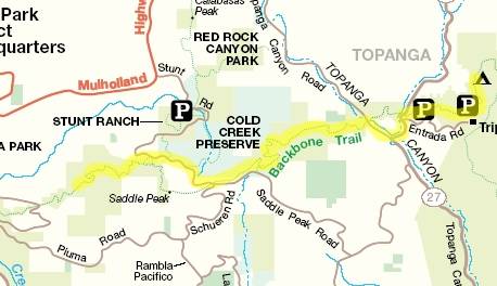
After fairly successfully drying my gear, I began this day’s hike following the trail towards Dead Horse parking lot. A detailed map displayed outside Musch Camp’s bathroom allowed me to discover the correct route to follow, but I was forced to recall the directions from memory since I still only possessed a map which was not fit for precise navigation. As I arrived at Dead House parking lot (after only about a mile) a friendly park ranger stopped me, inquiring as to my intents. I informed him I was backpacking the Backbone Trail towards Point Mugu. I must have been believable or pathetic because he accepted my explanation, and told me he mainly had to verify I was not setting up residence in the park or causing environmental damage. With my credentials clear I asked the ranger where the trail continued, since its route was not obvious past the parking lot and my map sure was not going to help. After radioing a buddy to retrieve the requested information, he offered to drive me to the next trailhead, since I would have to follow roads anyway to reach it. Although cheating a little, I consented (fairly sure he was a genuine park ranger and I would not end up dead in the side of a ditch), especially since I started a little late that morning. After dropping me off about a mile down and around on Old Topanga Canyon Rd. he wished me luck, and I once again commenced hiking.
From here, the trail climbed rapidly towards Saddle Peak. It presented a seemingly unending series of switch backs on its route over the pass. Although they allowed for a relatively gentle ascent, the miles of trails and over 1500 ft climb took their toll on my stamina throughout the morning. Vegetation in this area was also different than the previous day in Topanga State Park. Low, prickly brush desperate to find any water in the surrounding soil gave way to larger, leafy plants, tall enough to enclose the trail. The weather was not as cooperative as I would have liked either. The clouds formed a thick barrier allowing only a dull-gray sky to hang over me. In the Midwest I am used to these grey skies which might block the sun for weeks throughout winter, but I did not travel all the way to fabled sunny California to encounter them. How impolite. It was also cool, but the effort I exerted covering the Backbone Trail kept me warm and sweaty. At least it was not snowing here like it had been at home. Independent of the weather, progress was slow along the trail. Climbing naturally takes more effort than not, and the switch backs made my “as the crow flies” distance accumulate excruciatingly slow. Nevertheless, after giving my legs a nice workout for a couple of hours I was finally able to reach the zenith.
After finally reaching the summit, the trail dropped me at the intersection of Schueren, Saddle Peak, and Stunt Rd. near Saddle Peak. The roads allowed for a clear view towards and ocean and inland into valleys below. The clearing also provided a conduit for a strong ocean wind to assault me. Only a constant hand on my hat kept the wind from repossessing it, and the air current made reading my map more difficult than usual. Speaking of my map, which I remind you was not intended for navigation, it told me the Backbone Trail continued just on the other side of the junction, but looking up from the pavement I saw no such continuation. I wandered around for at least half an hour trying to discover where to pickup the trail. I must have fought the wind half a dozen times checking my map trying to verify my bearings. There was one strong lead with a short trail leading near a water tower, but my hope was extinguished as it shortly ended at a semi-private driveway. Becoming desperate and annoyed at being stuck at this intersection for so long I noticed on my map, which had already disappointed me a couple times, a tiny side entrance existed to the Backbone Trail about a mile down Stunt Rd. If I missed that entrance or it did not exist in real life, I would be pretty screwed since Stunt Rd. did not lead anywhere useful to a backpackers. It did, however have an abrupt 180 degree turn just past the trail entrance (or so my map insinuated) so I convinced myself I could tell if I traveled too far. Growing frustration with my lack of progress and knowing that I was still a great distance from my planned campsite, I was running out of options so I gave it the old college try and started down Stunt Rd.
As I walked along the hard pavement of Stunt Rd. I was constantly scanning the brush, looking for any break which might be the trail. I was contemplating trail blazing through the thick brush if the trail eluded me for too long, but getting shot at for trespassing sounded like an even worse predicament than my current one. Guns would not be needed to solve this dilemma though because my cartographical skills (luck) proved themselves, and the alternative entrance to the Backbone Trail was actually found where the map indicated. It would have been easy to miss blasting by in a car, but at my lethargic pace I was able to spot it.
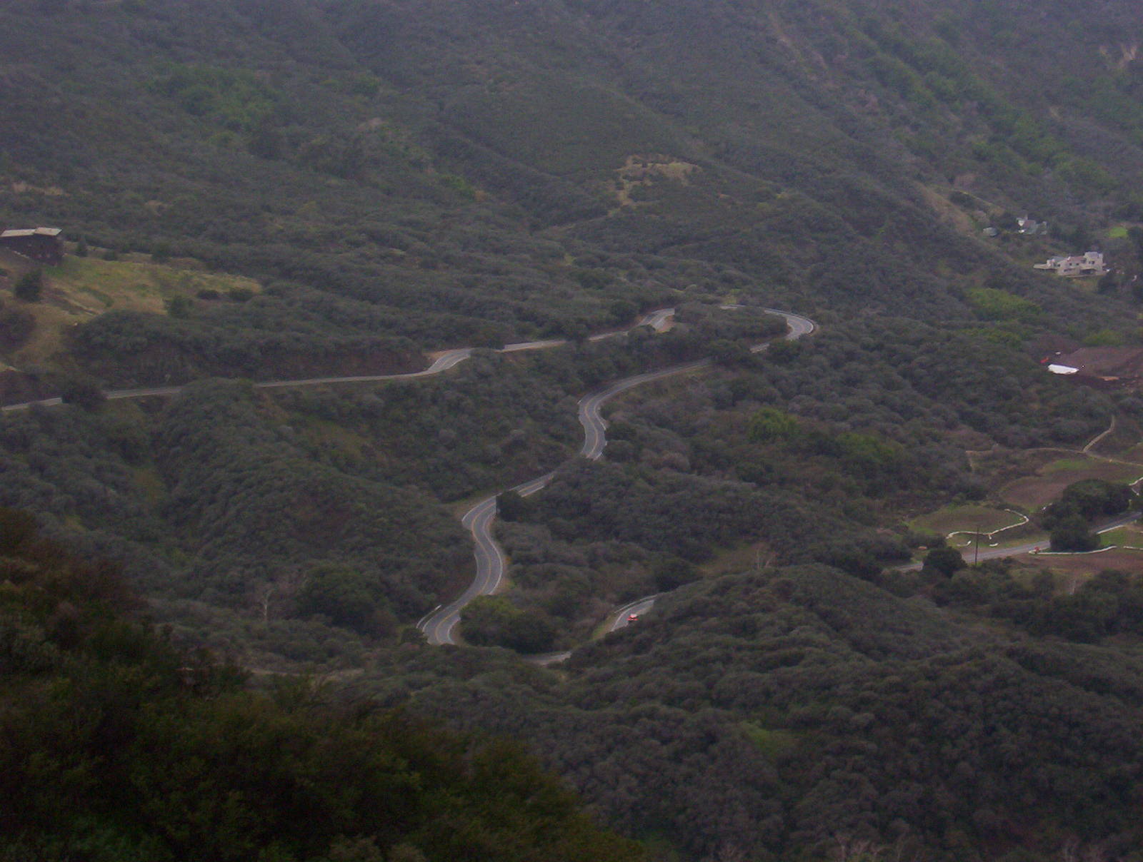
Twisty Piuma Road
After winning my gamble on finding the trail, I hurried along it. With my delays and other slow progress this day it did not seem possible for me to make Malibu Creek State Park before sunset, and I was ill equipped to travel in the dark. Plus the sky looked threatening, and I did not want to setup camp nor hike in the rain. I made the executive decision to push as far as possible before I ran out of daylight and just camp on the side of the trail whenever that happened, although I believe camping in a non-designated area was technically against the rules. But since no one else was around, I would be practicing leave no trace behind, and that fact that I could not physically get to a camping area seemed like pretty good justifications for being rebellious one night.
The threatening sky started to drizzle and after toying with me for a while, rained hard enough to where I sought refuge under some tall brushes. I turned off my GPS since it seemed I would be stuck there a while. (As it turns out, this would be about the last data point I would acquire the entire trip). After only about 10 minutes though, the rain let up enough to keep hiking. I did not turn my GPS back on because I was not sure how much further I would be able to progress, plus the rain and my own fatigue had made me pretty apathetic to recording where I was.
During this last leg of the day I actually encountered another person hiking along the trail, the first hiker I had seen since near Eagle Rock way back in Topanga State Park. She was out for a nice late afternoon stroll before dark. She had also actually seen me while I was wondering around aimlessly looking from the trail near Saddle Peak and had graciously pointed from her car where the trail continued. She did not honk or slow down though, so I had not seen this helpful gesture. I told her I was from Iowa which seemed to totally amaze her, and I believe that marked the first time I told someone I was an Iowan (since I had only lived in that state a couple of months). After divulging some of my plans, she informed me that Malibu Creek was only about an hour away, but I was leery of her estimate. It was at least four miles away (also keeping in mind that I have a strong tendency to underestimate distance), which if I pushed myself I could do just hiking, but there would be no way I could travel that fast after two full days of packing.
After parting our ways, I continued hurrying looking for a place to stop for the night. The brush formed a thick wall on each side of the trail, preventing me from erecting my tent along most of it. There were not even many places open enough to stick my tent smack dab in the middle of the Backbone Trail (which I wanted to avoid if possible). Ideally, I would have also liked a water source and somewhere to hang my food, which constrained my options even further. I passed a couple of clearings which may have worked, but none seemed ideal. As sunset crept closer, I became less selective and more desperate for a campsite before dark and the approaching rain. It seemed as if there were no openings in the vegetation to setup camp. Finally though, the apex of a switch back offered a very small clearing where, after moving some rocks I could barely fit my tent. There was even a semi-decent tree nearby to hang my food. There was not, however, a water source. I was not all that thirsty though and did not too much care, elated at merely finding a site for my tent. As I would be harshly taught later though, this was far from an ideal location.
It had begun lightly raining again, accompanied by short gusts of wind. I quickly and carefully setup my tent and hung my food between the drops and bursts. I had no doubt that both rain and darkness were on the doorstep, and I did not want to get caught outside when they started knocking. So I secured myself as best I could in my trusty tent and got ready for bed. My GPS later told me that I traveled about 13 miles this day (guestimation — subtracting hitching a ride from the ranger and adding after I turned off the GPS), much of it climbing over a mountain pass. Not too bad for my second day, although my next day’s planned route was much further, and I was pretty sure I would not be able to make it all the way to Circle X Ranch. As it would turn out this predication was extremely accurate — although for all the wrong reasons.
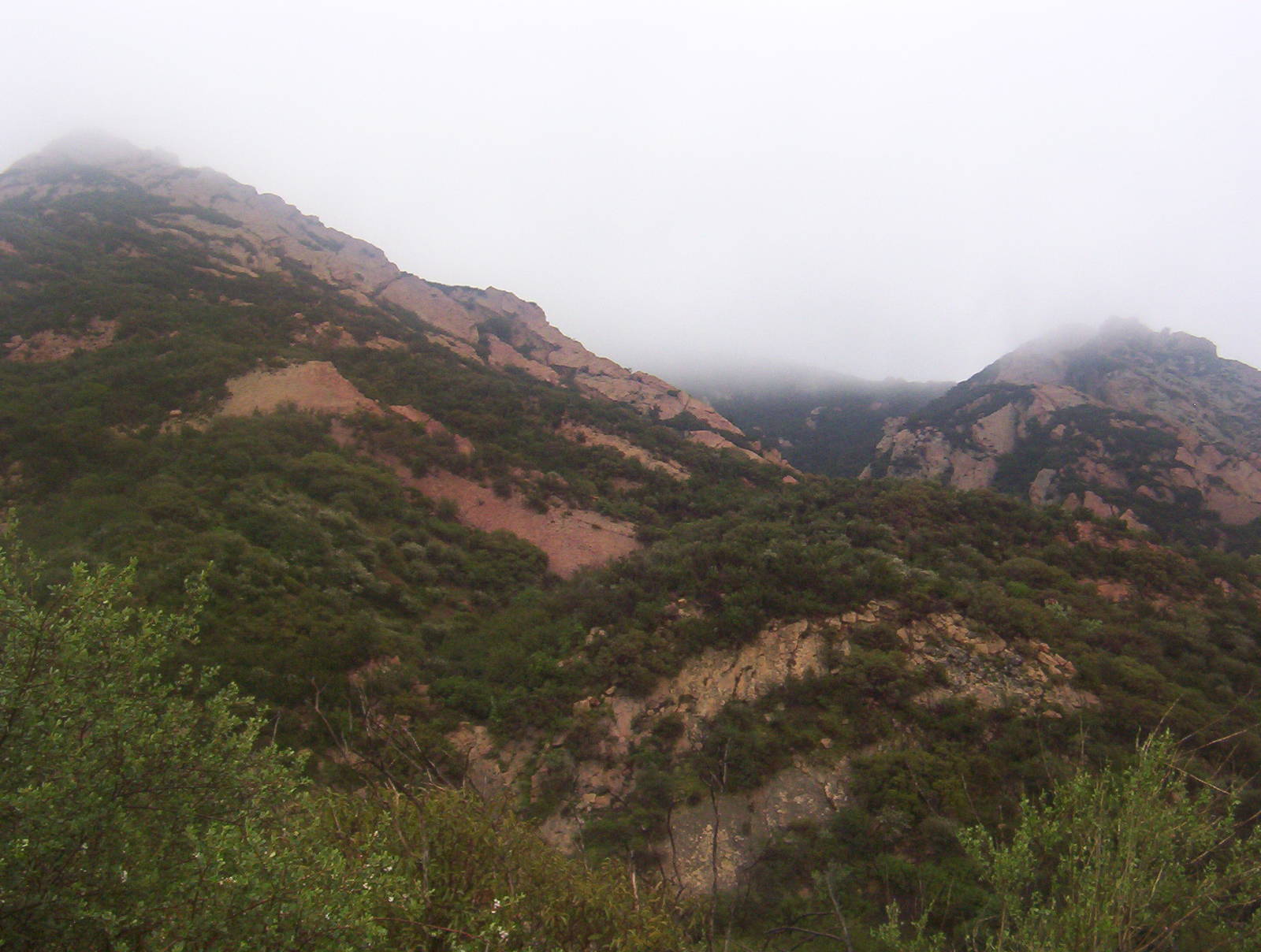
Fog covered peaks
Shelter inside my tent though, did not result in sleep. The intermittent rain and wind which had taunted me came now with a vengeance. Poseidon exhaled mightily and threw a storm to remember at the coast. The wind howled through the mountains, and rain fell in droves. Being inside my small, fabric tent only magnified the storm’s effects. Sheet after sheet of rain assaulted my tiny shelter and the wind blowing in from the ocean shook and twisted it almost to its breaking point. Jesus did not command the wind and rain to obey Him because they continued without much abatement throughout that night.
The pitfalls of my selected campsite became more and more evident as the night’s storm progressed. There was not much vegetation at the tip of this switch back which left me exposed to the elements. Every gust of wind or sheet of rain attacked my tent with its full furry. Many times throughout this very long night the wind blew with enough force to flex my tent to its limit. The wind would distort my shelter such that the sides would bend down far enough to hit me as I lay on my back. I wondered at what point my tent could no longer take the abuse and collapse. Trying to brace the sides with my hands seemed only to cause the fabric to stretch more. I had no choice but to wait out the unrelenting storm and hope that my tent would remain standing, which I strongly doubted several times through the night. Besides testing the extreme limits of my tent, the wind also blew a cold chill through it. The blustery weather traveled under the rain fly and chilled me to the bones, with no regard for the sleeping bag which was supposed to be keeping me warm. Not much worse for camping than to be damp, cold, and in the dark. I wanted nothing more than this night to end. Unfortunately, the night was still young.
In addition to the downpour and wind, lightning flashed sporadically throughout the night. Being exposed on the edge of a mountains, made me concerned about the height of my tent relative to its surroundings. I did not exactly want to be zapped on this already miserable night. Judging by the gaps between flashes and their reports though, it seemed pretty far off. Plus it was occurring infrequently so I tried my best to push it from my mind, using the ostrich approach to safety.
Since the deluge kept me in the confines of my tent and prevented me from sleep, I did not have much to do but wonder if my tent would hold and try to make deals with God to end the torrent (even though I knew this is theologically horribly incorrect.) These being the only two things for my brain to ponder made time pass extremely slow. I dreaded checking my watch because of the discontinuity between the amount of I perceived as elapsing and what my unbiased watch reported. My internal clock was running at least ten times faster than reality. Every once in a while my masochistic side would prevail, and I looked, only to be reassured that this night would indeed never end.
There seems to be a limit as to how long I can stay apprehensive about a situation, because as the night crawled on I got accustomed to the sheeting rain and gusting wind shaking my tent. Either I made peace with the fact that worrying accomplished nothing or my sleep deprived state made me ignorant of the dangers surrounding me. As the weather continued to beat my tent I just lay there more bored and annoyed that I could not sleep than afraid of its consequences.
That night was absolutely horrible, getting only a few hours of sleep and having my nerves on edge most of the night. I laid there for over twelve hours trying unsuccessfully to stay warm and dry with the only thing to stare at being my tent whipping back at the wind’s mercy. The long night was interrupted only occasionally by sleep. If I never have to experience a night like this again, I will be very happy.