Home » Adventures » Australia » Western Arthur Traverse
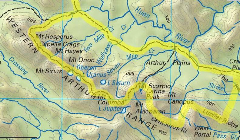
Route I Walked
74 km
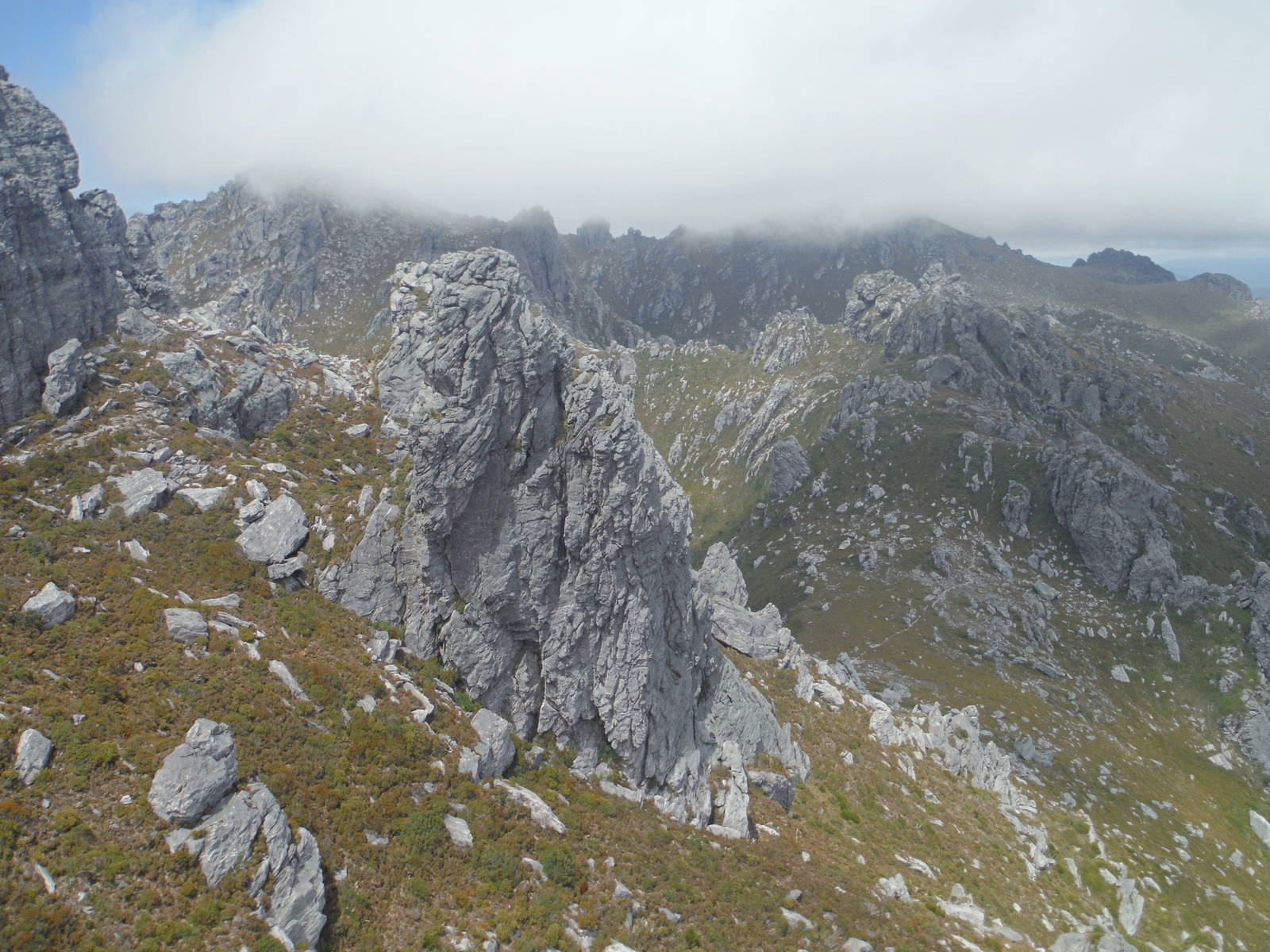
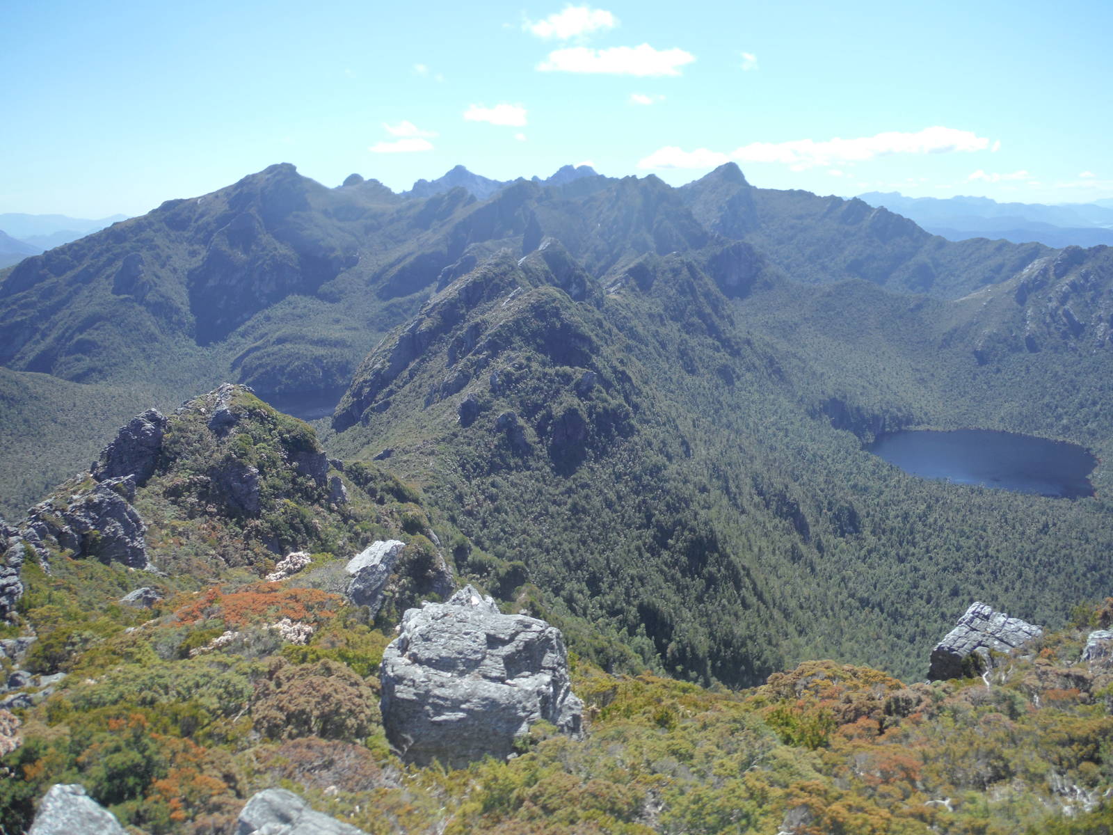
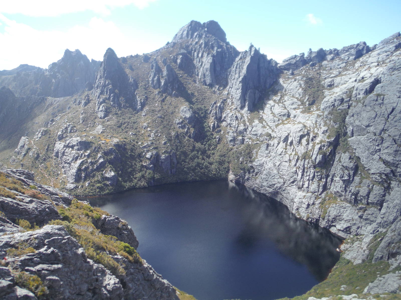
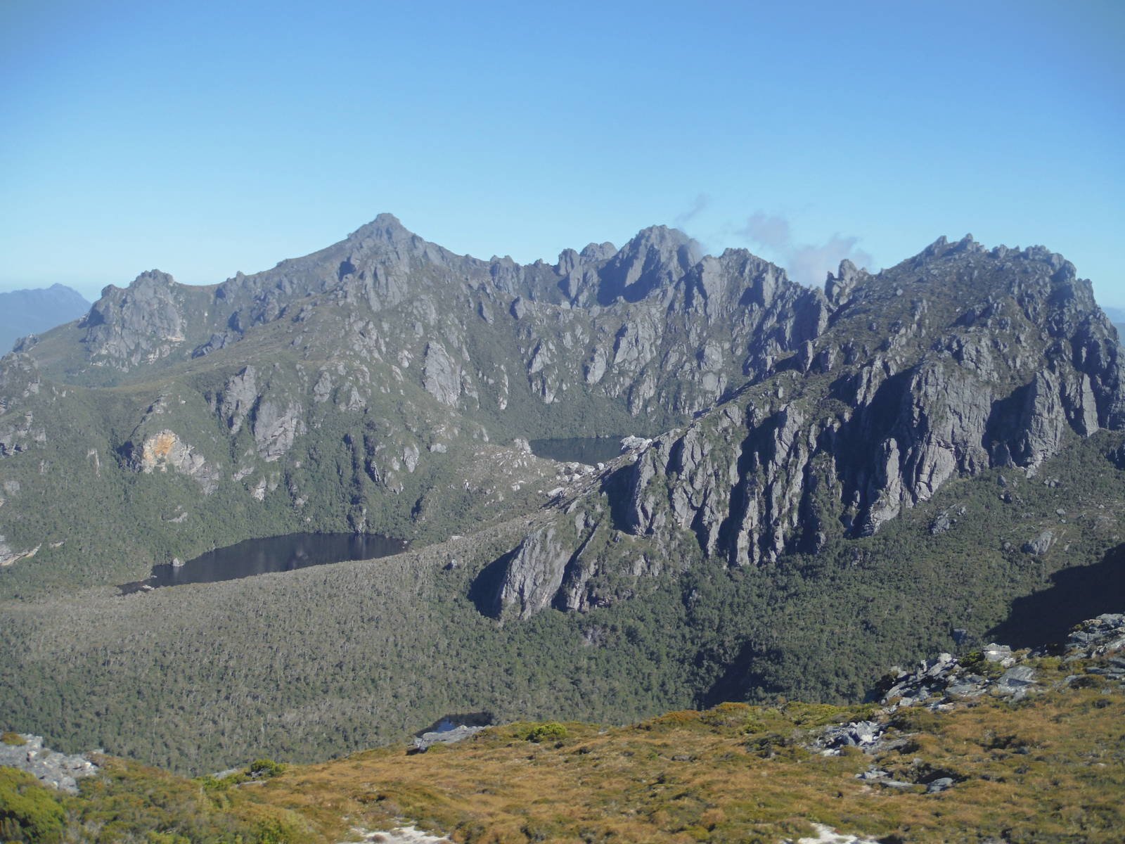
Less than twenty-four hours after finishing the Southwest Track, I headed back in along the Port Davey Track, this time to tackle the Western Arthur Traverse — “the most spectacular walk in South-West Tasmania.” The track lived up to the hype, but was also quite demanding. After climbing up from the plains an undulating ridgeline walk crossed the tops. The views were spectacular, with rocky ridge tops, mountain lakes, and jagged peaks. The mountains had a different feel than others in which I have hiked — these being relatively low, growing starkly from the plains, and almost completely covered with vegetation. I had clear weather most of the way (not a common occurrence), and could enjoy the mountains and surrounding country side at my leisure.
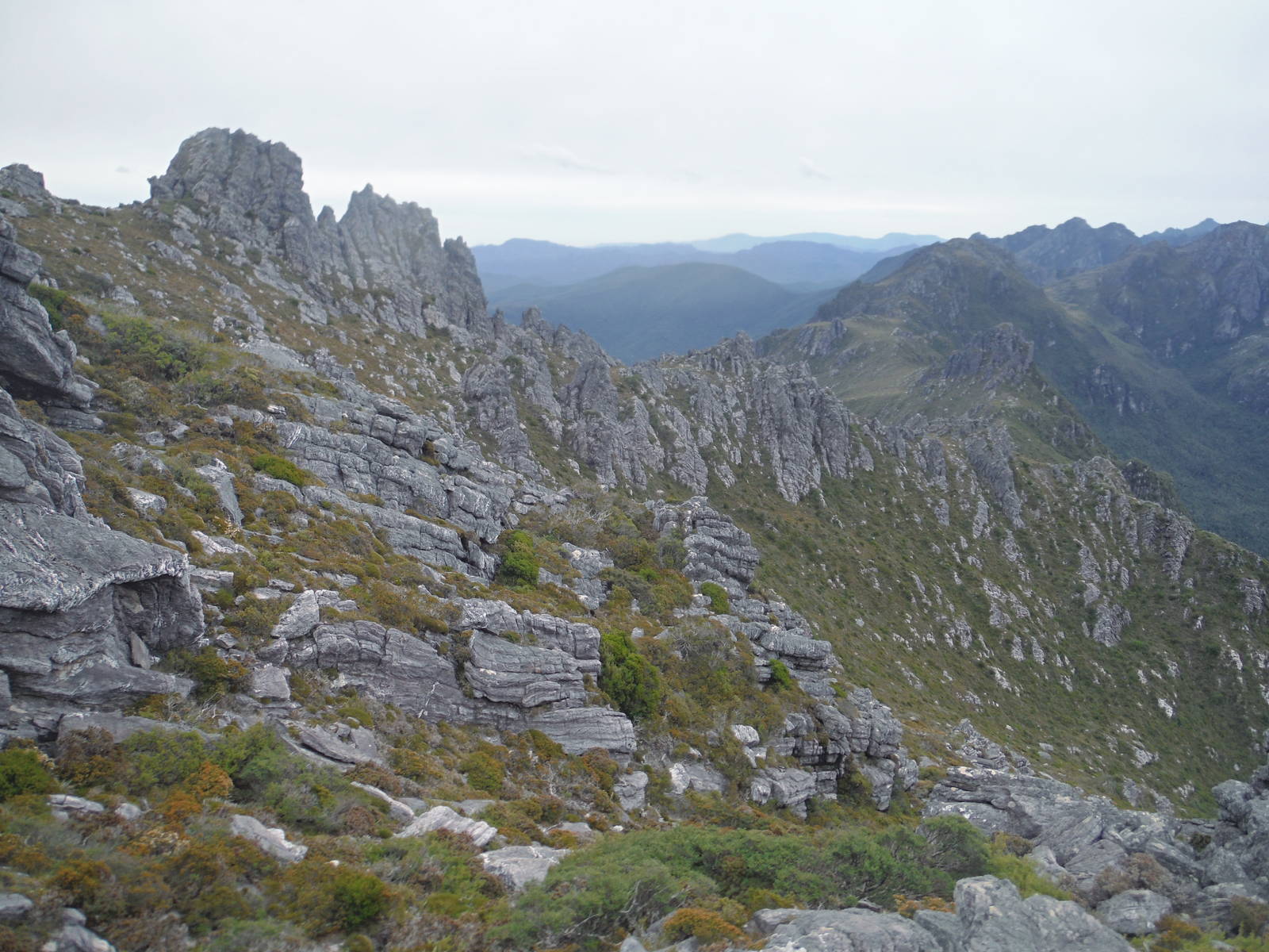
The track was definitely difficult though, with many tricky ups and downs — including class 4 scrambling necessitating three points of contact. The handholds were mostly excellent, and only a few times did I wish for better grips. All the available holds were adequate though, and I never had to lower my pack. In addition I crawled through (not just over) boulder fields and snaked through gaps in those rocks. Other spots descended very steep chutes where roots were the only handholds. The Beggary Bumps were particular memorable, where for a couple hours the track elaborately twisted among the peaks, and I root and rock hopped almost the entire time, barely ever walking upright. Unfortunately being solo I could not capture any decent pictures showcasing these obstacles.
The track was at least mostly easy to follow navigationally, and only west of Promontory Lake was a bit of minor route finding required. The final walk along the boulder filled Centaurus Ridge and the Crags of Andromeda provided more great views and interesting mountains, before the track finally fell off the ridge and passed through some thicker scrub towards Lake Rosanne.
To complete the circuit back to Scotts Peak Dam I death marched the McKays Tracks in a single day — mostly because my iffy campsite at Lake Rosanne did in fact turn into its own small lake in a rain storm, as I feared it might. After waking up in a puddle at 2 a.m. I relocated to slightly higher ground with only an underpowered headlamp for guidance. By morning almost all my gear was soaked, so spending another night in the backcountry was less than appealing. If the temperature dropped it would have been outright dangerous too. So I had a very long day of slogging through the continuing rain to finally reach the dryness and relative comforts of my station wagon at the carpark. With the low visibility and single mindedness of my walk, I could not appreciate anything the McKays Track offered and just focused on reaching my car. I did though, meet many of the leeches which inhabit the wet wilderness, most crawling on my clothing but some already attached to my skin.