Home » Adventures » Australia » South Coast and West Cape Track

Route I Walked
190 km
After leaving my car at Scotts Peak Dam, I hitched to Hobart and then caught a bus down to Cockle Creek for a very ambitious introductory walk to South-West Tasmania — linking the South Coast, South West Cape, and Port Davey Tracks. I did not take any side trips however, making this long trek even possible without a resupply midway.
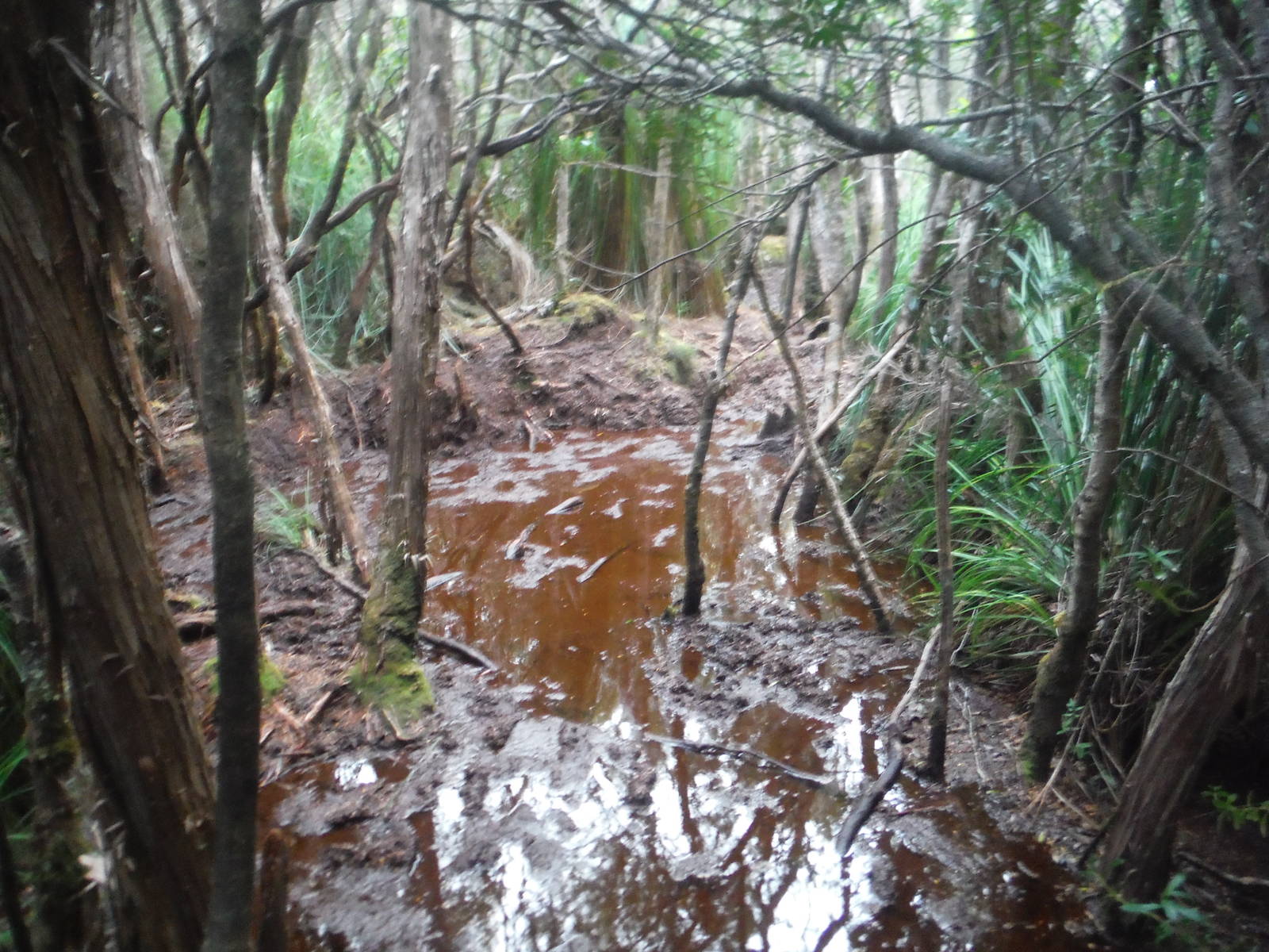
The South Coast Track was beautiful, exploring wild, remote coastlines, mountain ranges, and forests. The way was rarely easy though, and reaching each rewarding spot was a challenge. Long stretches of mud regularly tried to steal my shoes. Normally the quagmires would not exceed ankle deep, but occasionally an unexpected hole would swallow me up to my knee. Plants were also reclaiming their forest, with overgrown vegetation crowding the right of way and scratching any exposed skin as I bashed through. The track went over many roots and rocks as well, making progress very difficult and slow. Add in some creek crossings, a row boat, and climbs necessitating a rope to conquer the steep slope, made for a very tough track. I will never again scoff at track notes that estimate 5-7 hours for a 9km stretch, wondering to myself how anyone can possibly walk that slow. I learned my lesson 6 hours later, arriving at camp by headlamp after dark. I was still too pampered from the PCT, assuming a marked track meant I could average 4kph all day without a problem.
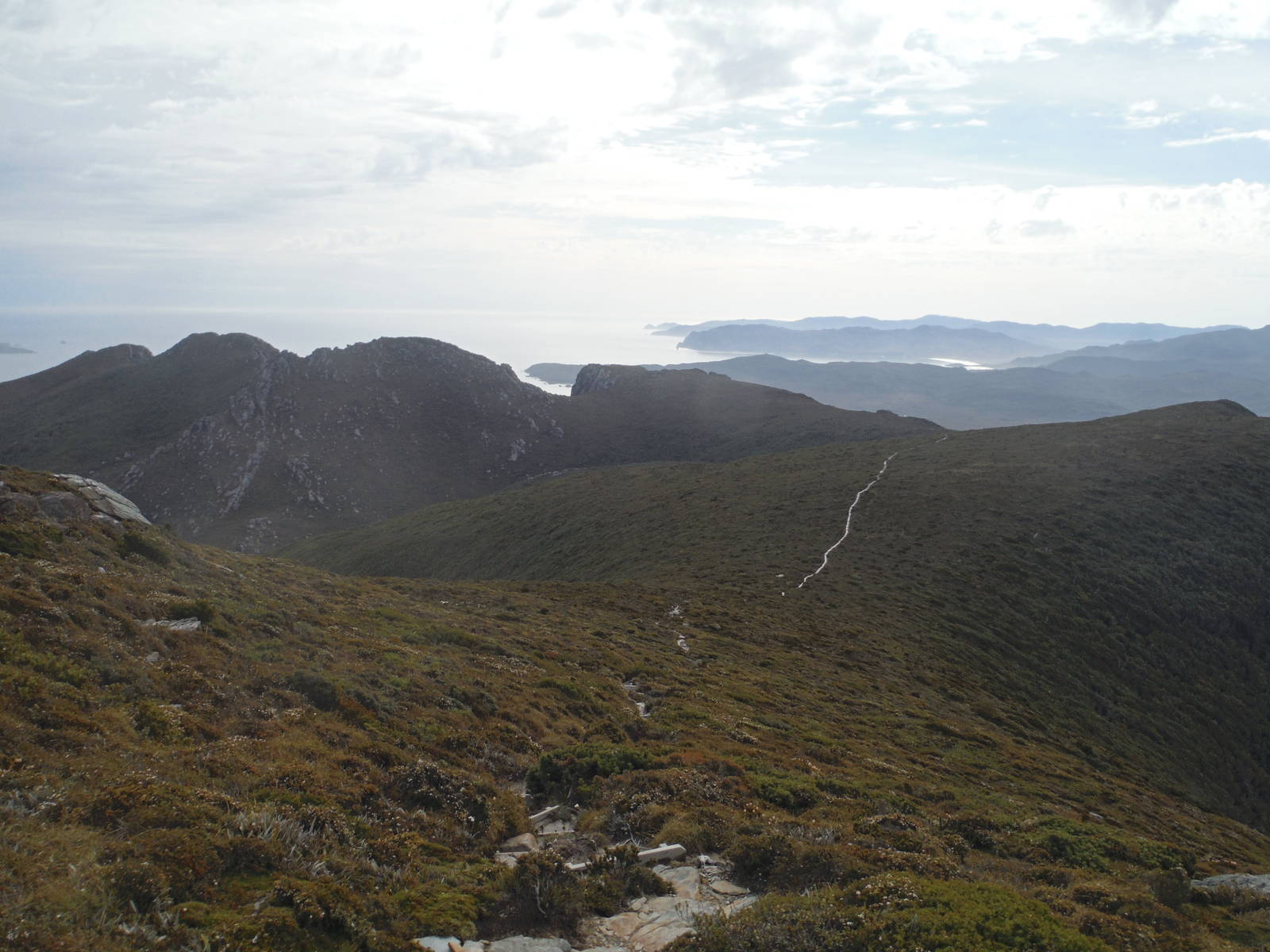
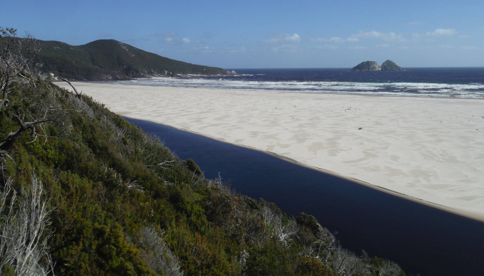
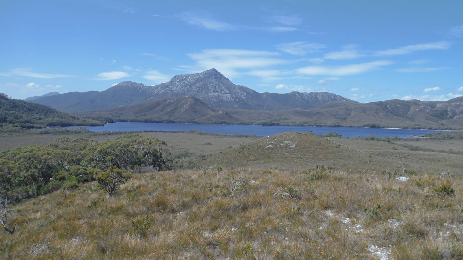
The highlight of the South Coast Track was the beaches. Some were long ribbons of sand and dunes, while others had a rocky cliff backdrop and stones underfoot. Multiple times I walked several kilometers barefoot, enjoying the sand and water through my toes. The roar and rhythm of the endless waves was musical. The Ironbound Range was the best inland section of track, with commanding views of the ocean as well as the interior mountains of Tasmania from on top. West of these the tree cover also lessened, providing grand views of the landscape.
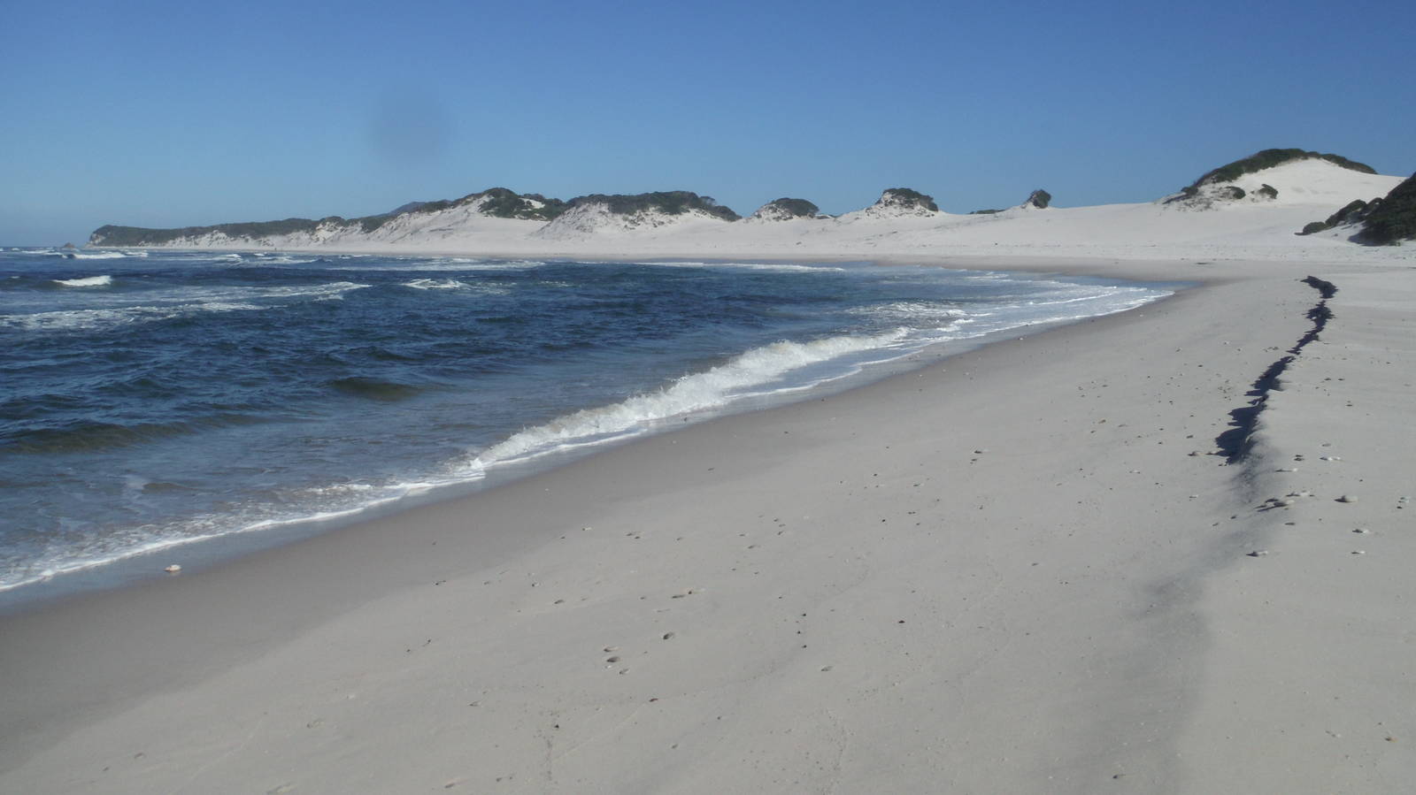
Despite not having detailed maps, barely having enough food and fuel, and unable to make my phone use the Australian GPS grid format, I tacked on a mostly unplanned trip along the South West Cape Track to the end of my South Coast Track walk. This part of the coast was much less frequented, rougher, and had long stretches of off track navigation. Despite its difficulties, this area was a great continuation to the South Coast Track. The scenery of wild beaches and grand mountains was very similar, but this untamed wilderness that few walkers reach was even more raw and rugged. The beaches were almost entirely untouched and the mountains gave spectacular views of only unspoiled wilderness — especially along the Southwest Cape and Pasco Ranges. Still, the track made you pay for its beauty in sweat and blood to reach such amazing spots.
Navigation was fairly straight forward, with a rough foot-pad along most of the stretches without official track. A compass and map reading ability were still required though. The foot-pad was very easy to loose and more than once I had to bush bash for an hour before finally locating the track again. I had outstanding weather however, and in poor visibility finding the correct route through many of the high sections would have been nearly impossible. Signage was nonexistent in this section of the park, although very rarely flagging or repurposed ocean trash marked the correct way.
Overall the track was less muddy than the South Coast Track, but had many more scrubby plants. I learned firsthand why Aussies wear their ridiculously tall gaiters, as in just long plants my legs were scratched up by the day’s end. Still, their gaiters would not have protected against the branches that often smacked me in the face. I also worried about a swim across a river in Horseshoe Bay Inlet described in my guide, but that spot was merely a knee deep ford when I went through.
Although I was often at least several days walk from anything resembling civilization, I never felt that remote in South-West Tasmania. I did see other people everyday, but moreover I am becoming used to being in the wilderness on my own. True, I do not have any survival skills — without carrying in all my food and gear I would be in as much trouble as most other people — but with proper supplies I feel comfortable in the middle of nowhere. When I hiked the CDT that entire experience seemed so isolated and that I was on my own, but I now question whether it really was extreme, or just felt so because that was my first big expedition alone in the bush.


I walked the Port Davey Track back to Scotts Peaks Dam after the South Coast and South West Cape Tracks, mainly to avoid flying out of Melaleuca. The track was not the smooth highway I hoped for to get back to civilization quickly, but was much easier than the South West Cape Track. It still had its own rough spots though, with corresponding slow travel. Spiders also loved the areas which had recently burned, and I carried a stick most of the time to knock the endless series of spider webs out of my way. A rowboat was provided to cross Bathurst Harbour, and after manhandling the heavy boats by myself, the paddle across provided a nice change from constantly walking . The Port Davey Track was not as scenic as the other tracks I tackled on this expedition — mostly following a valley — but still had some nice views of the hills. Chiefly though, it provided semi-convenient access to more interesting tracks without having to buy a plane ticket.
I death marched the entire Port Davey Track in two days — mainly because I was running low on food — but talking longer would have been much more pleasant. My only real spell of bad weather occurred on this track, which was quite fortunate considering I spent over a week in South-West Tasmania. A steady rain that fell almost the entire day left me damp and cold. In typical Tassie fashion, the entire prior day to this deluge was sunny without a cloud in the sky, and I felt the warmth of a day in the sun on my skin as I went to bed. At least this happened on my last day in the bush so I could dry out in my car instead of spending a damp, miserable night in a tent.