Home » Adventures » Patagonia » Sierra Valdivieso Circuit
Before catching my ride to the start of the Sierra Valdivieso Circuit, I politely endured the advice and abject horror from my hostel’s staff about undertaking this trek solo. My own level of concern was quite low though, and I patiently listened through all their suggestions, which I have heard before. My philosophy was that if a Lonely Planet book covers the hike, it probably is not too difficult for me.
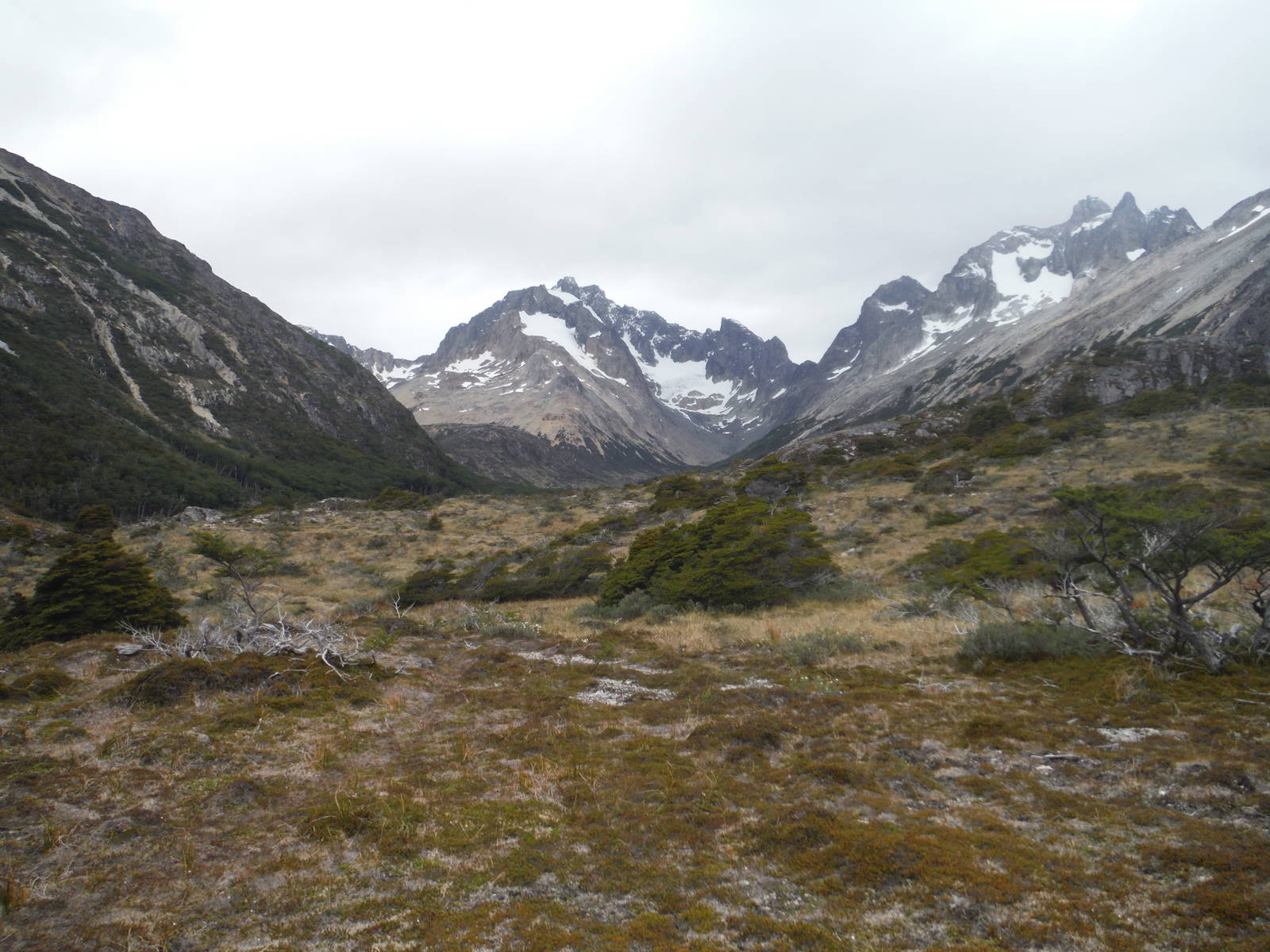
I did not get to the trailhead on the side of the road till 2 p.m. but at least my ride was cheap. The route began by following an old 4WD track through forests. A couple open boggy areas provided excellent views of the surrounding snow capped mountains. The route narrowed to single track and within short order I arrived at a refugio — a simple backcountry hut. It was basic, but at least solid and dry. The afternoon was still young though, and I had more ambitious plans, so I continued on.
The trek went through a beautiful mountain valley, and I was really enjoying truly being out hiking again for the first time in a while. The tread became faint in places, but I could usually at least scout footprints, and the correct way to go was generally fairly obvious anyway.
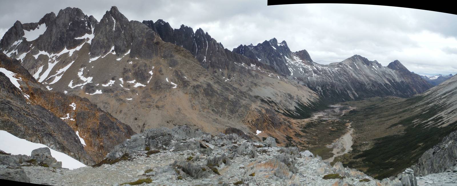
Paso Beban Este
The recommended map —Trekking Ushuaia— was all but useless except for the coarsest navigation, with its large and inaccurate contour lines. I gleaned almost as much information from the low-res satellite background image as from the topographic data. As a result I mostly navigated by the text description in my guidebook. My mind works better with maps though, so using mostly prose was a challenge. The book’s write-up was detailed though, and I rarely had an issue on where to go. A few specific GPS coordinates listed in the book helped as well.
A very steep climb led over Paso Beban Este, followed by a small traverse and another climb to Paso Beban Oste. The views along this stretch were spectacular. I then descended into a valley and went past a lot of beaver activity along the river before ending in a nice clearing for the night. Daylight lasted long into the evening this time of year, so at least I did not have to rush to beat darkness with my late start.
A chilly and drizzling morning, combined with my own laziness made staying late inside my tent a big temptation. I kept snoozing, but the rain eventually stopped and the sun even peaked through so I finally crawled outside. The weather constantly changed as I made my way though the valley — sunny, windy, cloudy, raining, hailing — nothing seeming to last longer than thirty minutes. At least I could tough out any bad spells though, assuming it would be over quickly.
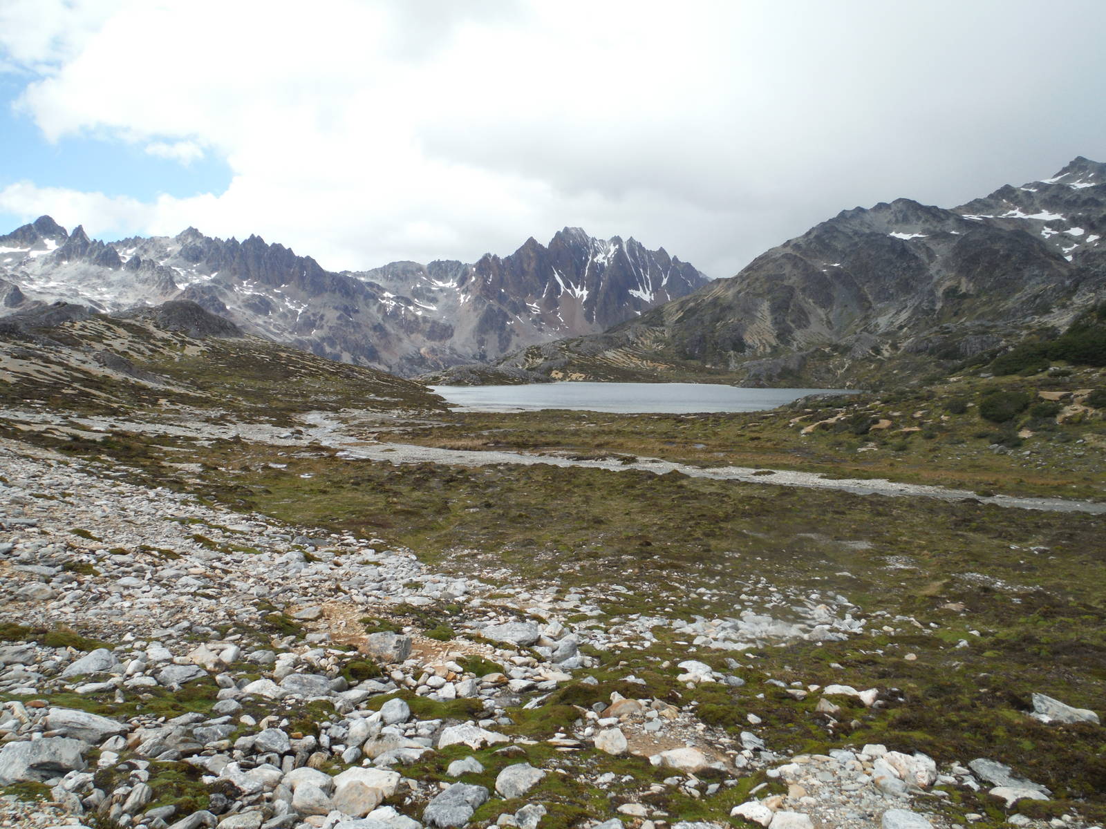
Laguna Azul
The climb to Laguna Azul went basically straight up the side of the valley, with very few footprints and a vague description not providing much help as exactly where to go. I scrambled and searched around a bit, finally finding the beautiful mountain lake. From there the route was at least marked with cairns as it climbed across a bare rocky plain that had occasional snow patches. Paso Mariposa was very windy with snow flurries even falling. A steep scree slide down the other side of the pass brought me to more mountain lakes and nice views.
I finally descended to the Rio Olivia Valley. Although it was getting late, I continued downstream for another hour since I had such a delayed departure that morning. I did not encounter good campsites “continually” as my guidebook predicted but still found a fine one across a swampy moor. A fox visited as I cooked dinner, wanting a helping for itself. Yelling did not scare away the animal, and I had to stand up and wave my arms to finally shoo it away.
No rain fell in the morning, but I was still very lazy and did not want to get out of my sleeping bag. I eventually emerged though and the remainder of the hike was a wet slog through boggy moorland. The trail continually disappeared in this quagmire, and the spongy surface made walking very difficult as well. My feet were soaked as drudged through this marsh. Beaver dams would occasionally flood the entire trail, and I had to make long detours to cross a small, water filled gap.
I finally got sick of the spongy terrain and forded the river to reach woodland with more stable footing. By coincidence and luck I crossed at exactly the spot of Laguna Arco Iris, which I almost completely missed. A slug through more plant life and a thigh deep ford of a calm Rio Olivia led to an actual (although muddy) trail through the rest of the woods and out to the road.
Although I finished the Sierra Valdivieso Circuit, I was not done hiking as I went straight to walking along the highway for a couple hours to the start of Pase de la Oveja. I did not feel comfortable trying to hitch this stretch, since I did not speak any Spanish.