Home » Adventures » Patagonia » Baños de Caulle
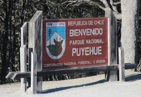
I took a bus from Osorno most of the way to Parque Nacional Puyehue, but still road walked a couple hours (I really hate hitching when I do not speak the language) to finally reach Anticura. I got a bit of a surprise at the entrance gate though as the infrastructure was not a good as my guidebook indicated. Apparently an eruption had occurred two years prior, after my book was printed. This change completely blindsided me as I had not done any updated research on current conditions.
I was lucky though because despite being in remote Chile the person there spoke English and could actually explain the situation. As it was some of the trails had been completely wiped out, in two days the weather was supposed to turn bad, and no maps were for sale. I was able to take a picture of the map at the desk, which was far from ideal, and now added a working camera to my mandatory safety gear list. This, combined with my lost/stolen gear from earlier spelt disaster. Despite the omens I headed into the park, walking only about an hour up a farm track through cow pastures to camp amongst the bovines.
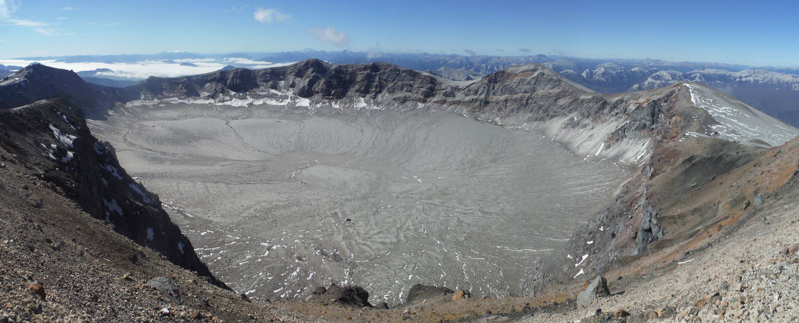
Volcán Puyehue
Dew and condensation soaked my tent in the morning, and I spent a while trying to dry it before hitting the trail midmorning for the rest of the long climb to Refugio El Caulle. The walk through the forest was pleasant, but the grade was relentless. After a lot of work I finally reached tree line and the refugio — the first one I used in Patagonia. It was similar to old huts I used in New Zealand. I took lunch there, despite the creek being dry. After eating, climbing another 800m with a full pack to the rim of Volcán Puyehue did not sound fun, so I instead elected to leave most of my gear and food in the refugio, climb to the summit, and then return to spend the night here. With this plan I would not get as far along the trail as originally planned, but the climb would be much easier and I would at least be under a solid roof if the predicted bad weather materialized.
With my light load I started up the dormant volcano. The route was straight forward — follow the occasional cairn and footprint more or less directly up the steep mountain. The footing was loose in a lot of places, but after a couple hour slog I reached the crater’s rim, which had gorgeous views of the surrounding mountains as well as the crater itself. The crater was massive — I cannot even try to comprehend the eruption that created it. Nothing was inside the crater now though, just barren mud.
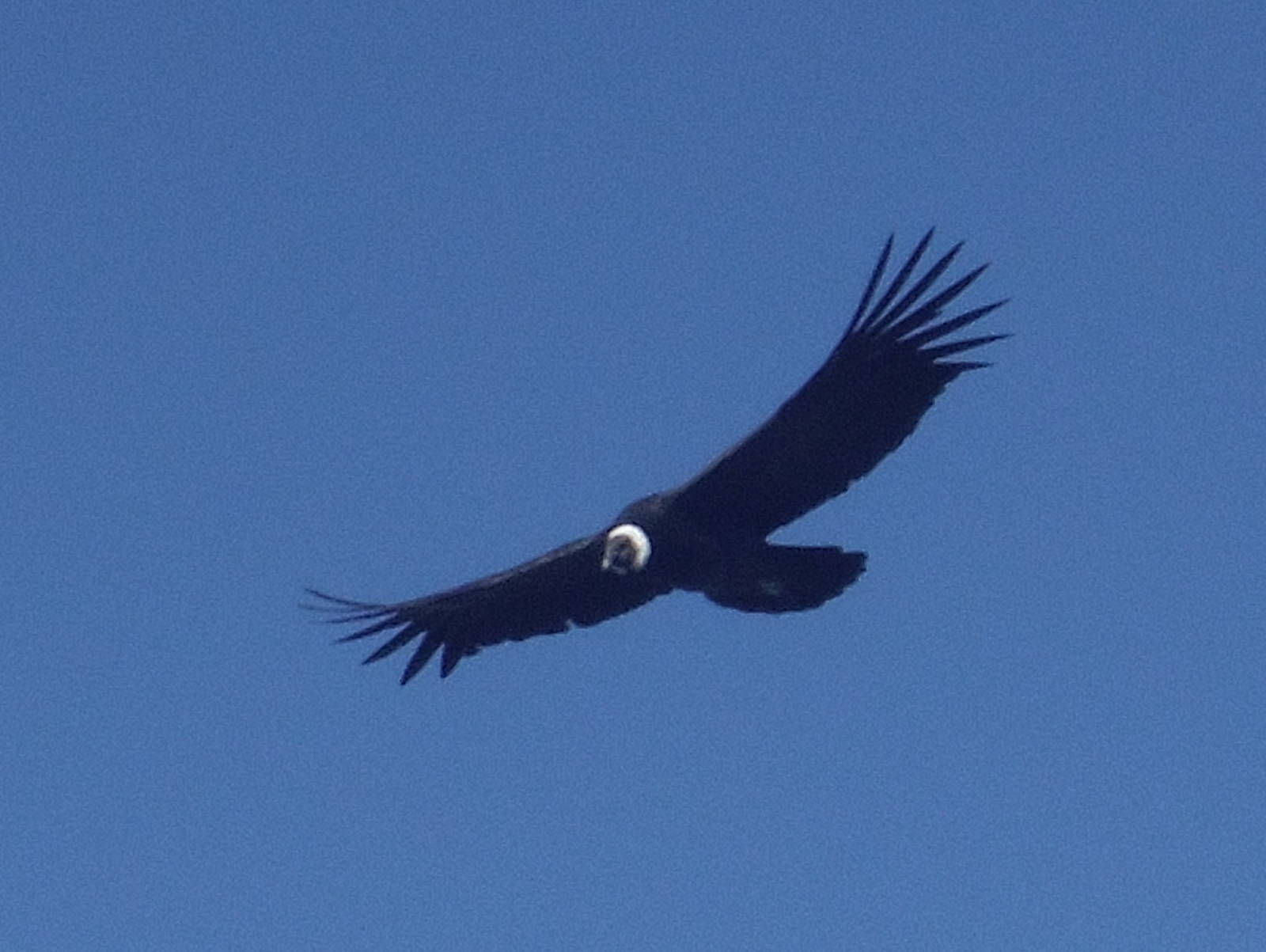
I had perfect weather atop the volcano, with most of the clouds in the valleys having burned off, and a clear blue sky with no wind above me. I relaxed on the edge a long time — enjoying the view from on top of the world (at least for the immediate area, much taller peaks loomed in the distance). A large bird of prey soared around the area, occasionally dipping below me, and I could gaze down upon the masters of the sky. At one point several avian friends joined and four large birds circled high above me.
Eventually my time on top was over, and I slid back down the side of the volcano — which surprisingly was not too hard on my knees. Back at the refugio I ate dinner and afterwards sat outside watching a magnificent performance by the night stars, including several of the shooting variety.
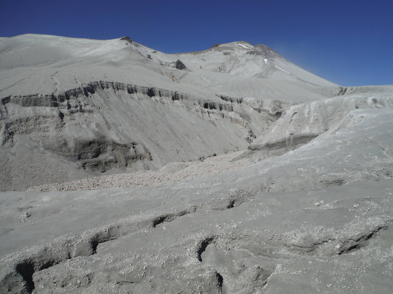
I awoke to a beautiful morning and started traversing around the base of Volcán Puyehue, crossing many eroded crevasses and canyons in the loose soil. Some were quite small and I could just leap over them, while others required a sketchy climb up and down the unstable ground. Some of the gullies were deep with steep sides and reminded me of scenery from America’s Southwest, although these were cut through shaky earth instead of solid rock.
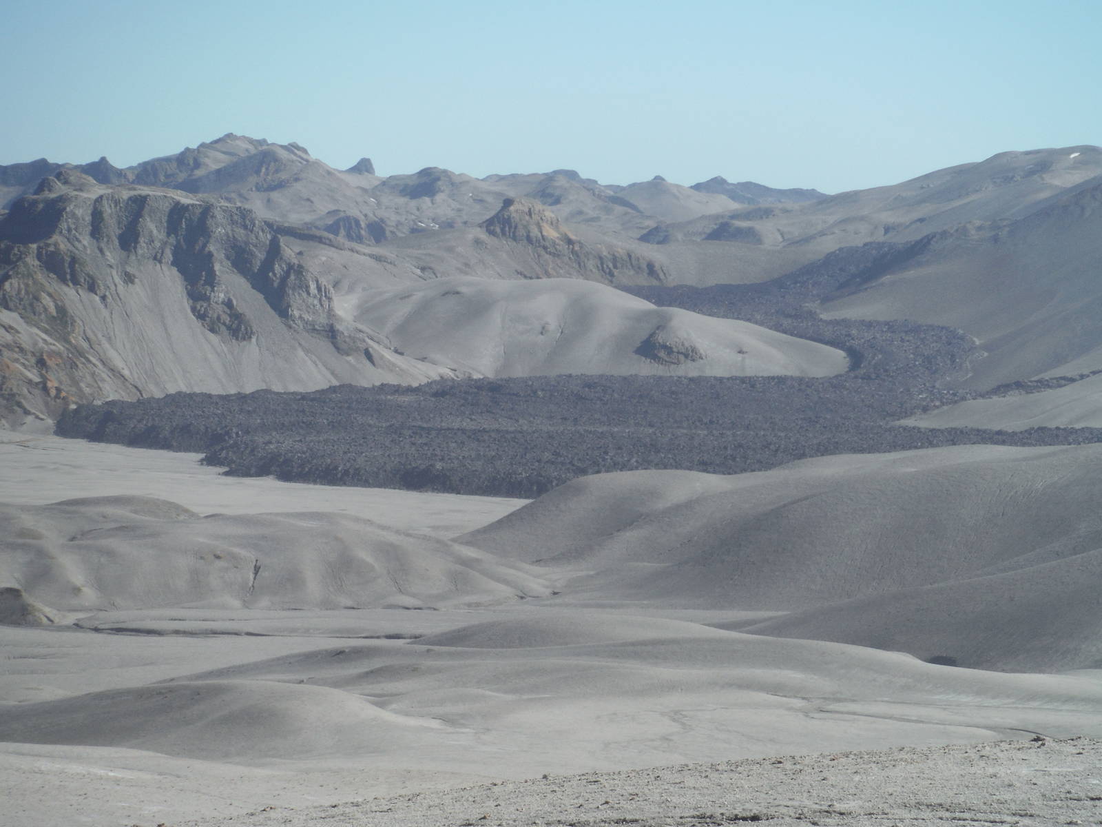
As I continued the tread became rarer as I crossed even more barren landscape, before the trail completely disappeared. I was not sure if the landscape was new pyroclastic flows from the recent eruption or if this area was usually lifeless. Either way it resembled large sand dunes in a massive desert, although instead of sand the ground was made from rocks and soil. At least my guidebook contained specific GPS coordinates in its route description, which kept me on track.
According to my GPS I arrived at the turnoff to Ruta Los Americanos, but no post marker was there (buried under the eruption?) nor sign of any other trail. So I eliminated that route as a possible return path, as I originally mused.
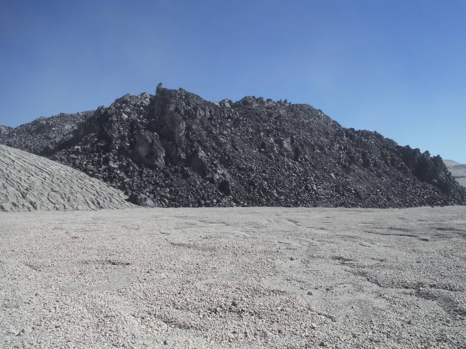
I continued towards where the trail to the geysers should be and eventually came across the face of the dried lava flow from the recent eruption. The new cliff was at least 100 feet high and made of many craggy and sharp rocks. The trail, river, and campsites were all seemingly buried underneath the new rock, so I continued along its edge. The lava flow covered almost the entire river valley, but at least as I traversed along its perimeter I was generally going in the direction I wanted.
Rio de Lava
After a while I located a spot sheltered from the wind (which was blowing strong all day), although it might have turned into a creek bed during heavy rains. I left most of my gear there on the assumption I could hike the rest of the way to the geysers with my light pack and return here for the night. I did a dicey, if not outright dangerous, scramble up nearby rocks to avoid a section where the lava flow blocked my path. At the top of this climb I finally got a complete view of my surroundings. The area was massive, covered in yellow minerals and others steaming fissures. I also realized reaching the geysers and getting back to camp before dark would be impossible. I could not tell for sure, but it appeared the geysers may have even been buried under lava anyway. So I just sat up there for a while admiring the large lava field before returning to camp, following a route that avoided the foolhardy scramble taken earlier.
I had assumed that while going to the geysers yesterday I would stumble across water and be able to tank up. Having turned back early though (and possibly even if I had not) I was bone dry and started hiking in the morning without anything to drink. I may have been able to do a full day return trek to the geysers, but with them possibly underneath new rock, an unclear water situation, and having figured out I could squeeze in a trek to Parque Nacional Nahuel Huapi, I started out of Parque Nacional Puyehue. I made GPS breadcrumbs yesterday incase the weather turned — navigating on this moonscape would have been near impossible — but with today’s clear skies I opted for a shortcut across the route I had taken in. Nothing much existed to get in my way except the large “sand dunes,” and semi-surprisingly my shortcut back was actually faster. I also miraculously crossed a small stream in this arid wasteland, which was some much appreciated liquid to quench my thirst.
The remainder of the day was backtracking over the same trail I came in, once again climbing up and down gullies. After a break at the refugio I started the long descent through the woods. I camped near the entrance to El Caulle, and the next morning I arose with sunrise, hitched back west towards Osorno, where I immediately caught a bus back east past El Caulle again and over the border into Argentina.