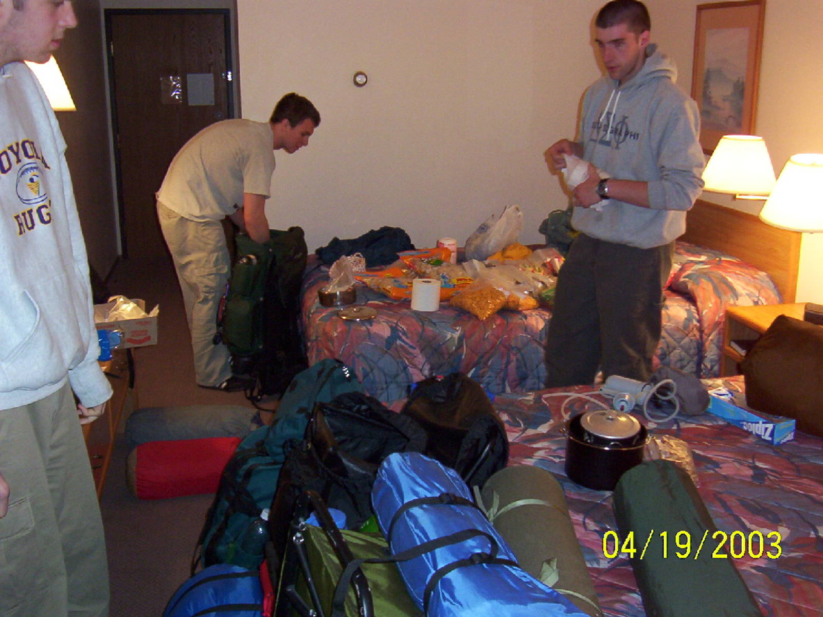
Getting all our stuff together for the trail the next day
Home » Adventures » North Shore Trail » Driving North
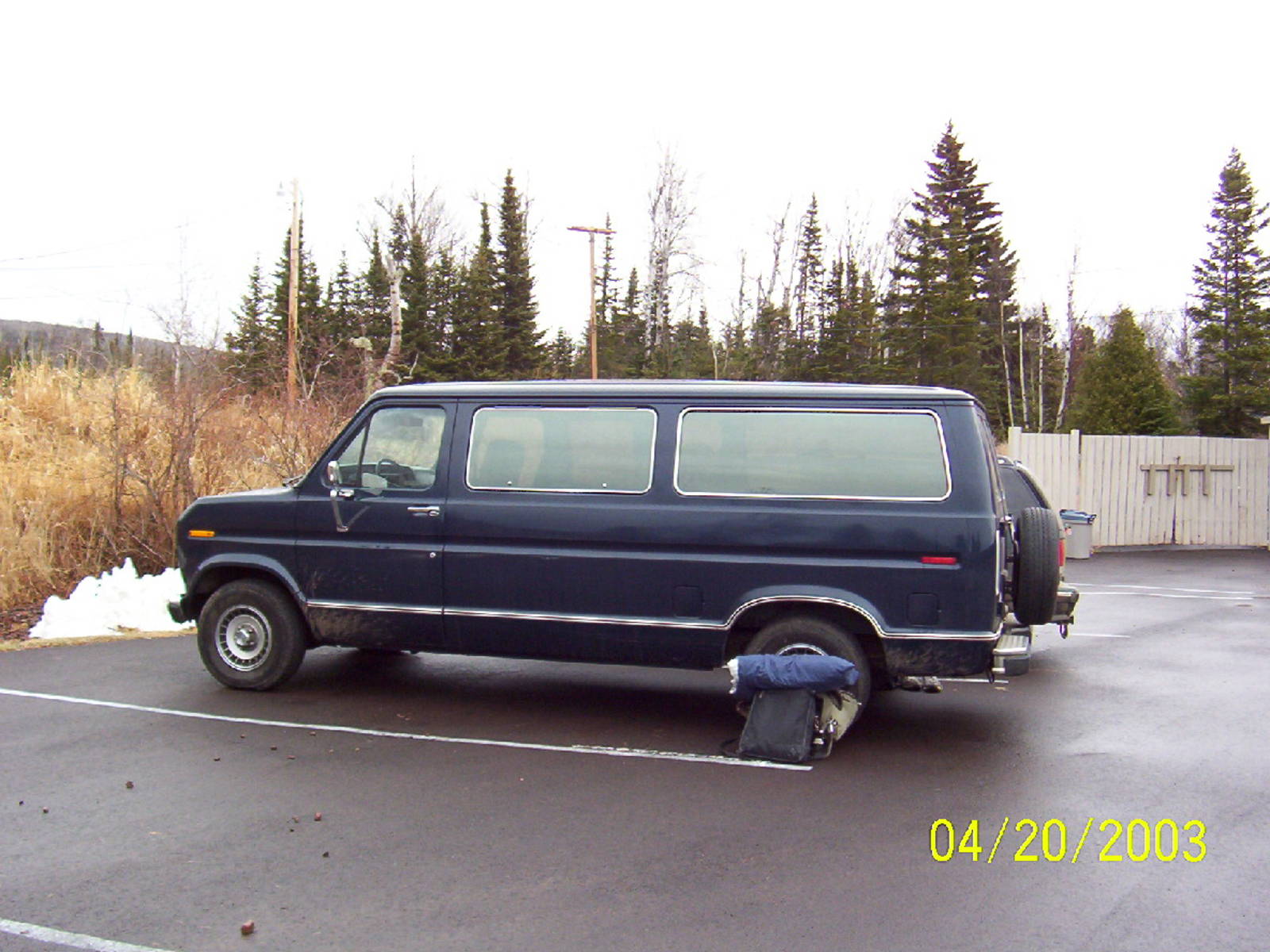
Our smooth oil-burning ride to MN
I woke up nice and early on my first day of Spring Break. We left before 8 a.m. (our scheduled departure time), which is usually a good omen. The directions to get to our trail in Northern Minnesota were actually pretty decent. We did not just have some MapQuest crap 1, but actually had the nice AAA directions that members could get. We were taking a big van that one of the guys had (OVC was paying for gas though). It definitely was not the newest van, but it had lots of room and seemed to run okay. It burned oil pretty well though so hopefully no one would pass out from their fumes during the trip.
Unfortunately, my hope to leave my tool-dom behind was not quite as total as I hoped it to be. The only electronic devices I brought were a camera (actually three), a flashlight, and my digital watch — not too bad. After all, one person brought his laptop and watched movies the whole way. Back to my tool-dom though, I did bring books about Java to read so I would know them really well for my job that summer. Not too bad though, I guess I could not leave all of my past behind while going into the woods.
The driving went by pretty quickly. Between reading and sleeping the trip was not too bad. It only took us thirteen or fourteen hours to get there, including stops. During my time driving, however, we went through some pretty thick fog. That is never fun to drive through, but we made it through without any problems. And now for my random gripes about Wisconsin and Minnesota. First off, they “number” the highways up there by letter. So instead of Highway 31, you have Highway T. I am sorry, but that was just goofy. Also, I swear that every highway off the the interstate was called Highway Q. I would hate giving directions to that. Also, instead of rest areas like normal states have, they called them “waysides.” They served the exact same purpose, but just have stupid names. I guess that is what you get from a state where they play “Duck Duck Grey Duck” instead of “Duck Duck Goose.” One positive side of things up there though was the sheer number of trails they had for snowmobiling. There were miles of them that ran along the side of the interstate. I had never been snowmobiling before, but I thought that they would be awesome just for biking or running along when it is warm (which is not too often up there). They were actually dirt/gravel, and not the paved crap that they are installing everywhere now with the rails to trails program2.
We altered our plans a bit and decided to drive past Duluth because there was still about ninety miles between there and our trailhead. Duluth actually seemed like a semi-interesting town (at least to drive though). It was one of the farthest points west in the great lakes so it has ports there for ships to unload. Also, their downtown had a nice combination of casinos and adult bookstores. A nice quaint town. Another ominous aspect of going through Duluth was the fact that there was still snow on the ground. Lake Superior was also choked full of ice along the shoreline. Not a good sign for a group that was going to spend a week in the woods. We passed through it as I said though, and drove to Grand Marais, where we planned to pickup the trail. We stayed in a Super 8 Motel over night (really ruffing it), packed our gear and food, and got ready to hit the trail the next day.
In the Hotel Room

The hotel we stayed in had a “guide to Grand Marais” which included a church directory. I was thinking it may have been possible to go to a sunrise Easter service before we hit the trail, but I did not have any information on any such services and also we started too early anyway.