Home » Adventures » New Zealand Extended Holiday » Tongariro NP
Route I Walked
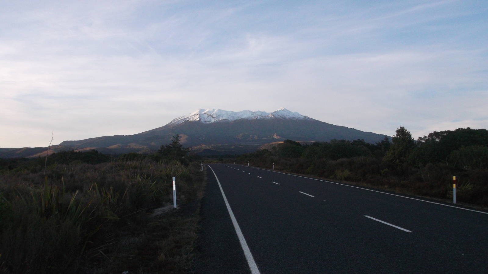
With a spell of good weather, before starting the Round the Mountain Circuit I headed up Mt. Ruapehu for Crater Lake. Unfortunately new snow had already fallen on the peaks, but I naively assumed it would be no worse than my climb up Mt. Taranaki. The walk up the ski fields under the chair lifts passed easily, and I inadvertently found myself headed up Knoll Ridge. Since this route was more commonly used with snow present, I was happy with my fortune and continued on. I hit snow line but could still easily plod through, staying on exposed rocks for traction. As I gained elevation though, the snow became harder, rocks less frequent, and the slope steeper. I started kicking toe holds in the icy snow and soon found myself in a dodgy spot — mainly since I did not have proper equipment such as an ice ax, helmet, or crampons. The mountain side was steep and slick, but I had also gone too far to easily descend.
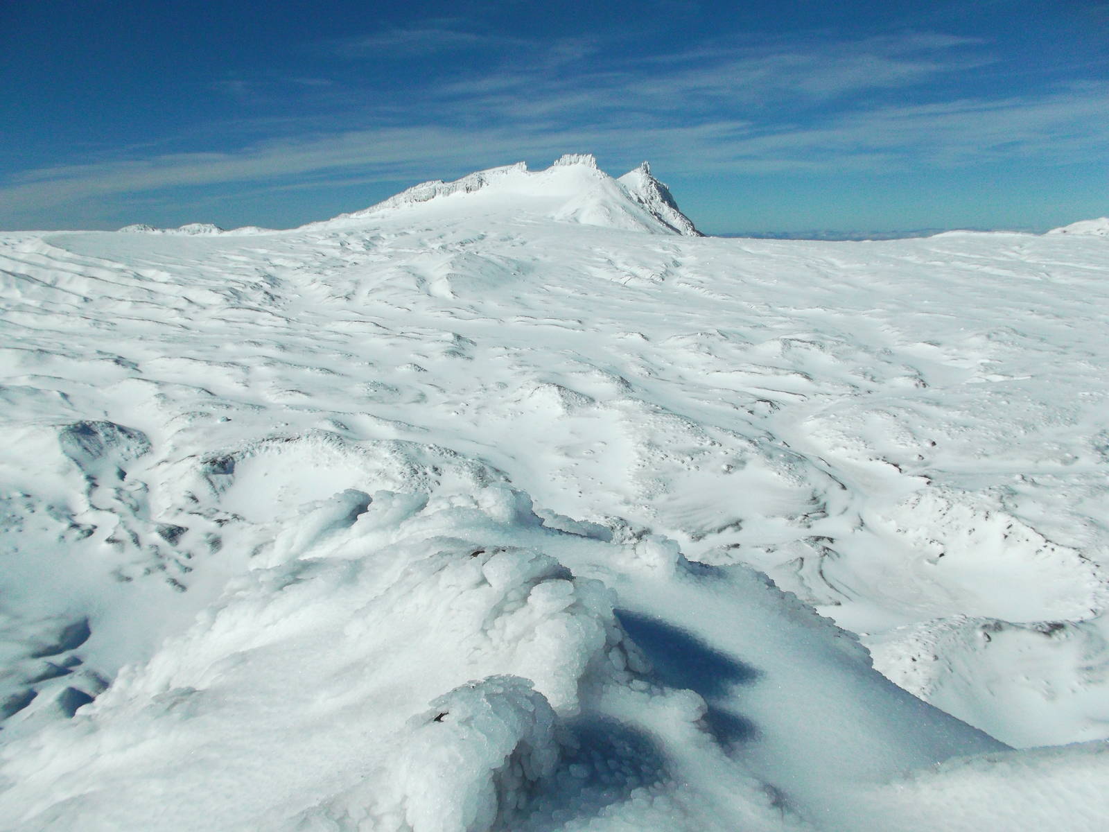
The terrain appeared to remain at about the same difficulty, so I elected to keep climbing, and afterwards come down the other route on Restful Ridge across the gully, which looked easier from my vantage point. My course of action was decided for me though, as on the icy slope I gradually lost grip and started sliding uncontrolled downhill! I did not have time to panic as adrenaline took over. I instinctively spread eagle and fruitlessly dug my hands into the ice (bruising my fingers) to try and slow down. I still gained speed alarmingly fast though. A couple large rocks lay in my path, which was actually fortunate. I hit the first one, absorbing the impact with my legs which slowed me, but I bounded around the side and kept on the express train downhill. The second rock was a more direct hit, and I was blessedly able to self arrest on it, where I found myself breathing very quickly and heart racing. I scratched up my stomach on the slide but was still in one piece and at least not moving anymore. I probably only slid for a couple of seconds, but it seemed like a very long time. This situation could have turned out much worse, as many people have been seriously injured or killed from uncontrolled slides on ice.
This disastrous incident instantly and completely convinced me to finally turn back (which I should have done earlier), but I still had to carefully make my way down a few remaining difficult stretches. To add to the danger, small pieces of ice and snow occasionally crashed down the mountainside. One even struck my in the back while I rested. I did not hurt, but had it been a foot higher and stuck my head, once again the situation could have been much worse.
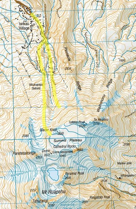
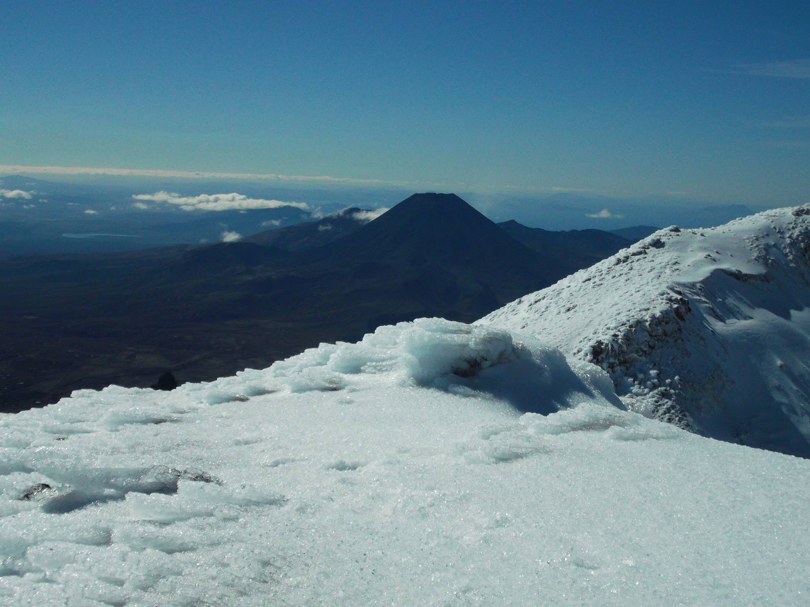
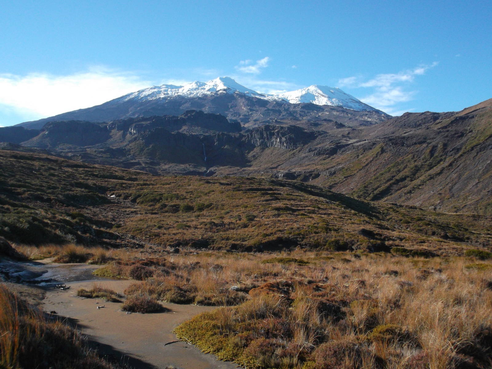
Although I had just used up one my nine hiking lives, when I reached a point where I could cross the valley, I somehow decided to try the other route to Crater Lake up Restful Ridge. Thankfully this side was much easier — less steep and softer snow. A short section near the top was icy, but I made it up to Summit Plateau between Glacier Knob and Dome Ridge. I still could not see Crater Lake but called it quits anyway. The snow became icy again, and I had cheated death once already. Plus, I wanted to back with enough daylight to starting walking around Mt. Ruapehu and not just up it. The views into Summit Plateau and back down the mountain were great anyway. The nearby volcanoes of Mt. Ngauruhoe and Tongariro rose high, and off in the distance Mt. Taranaki rose above the clouds. My way down went smoothly, although my knees were ready for a rest by the time I reached the bottom.

Route I Walked
70 km
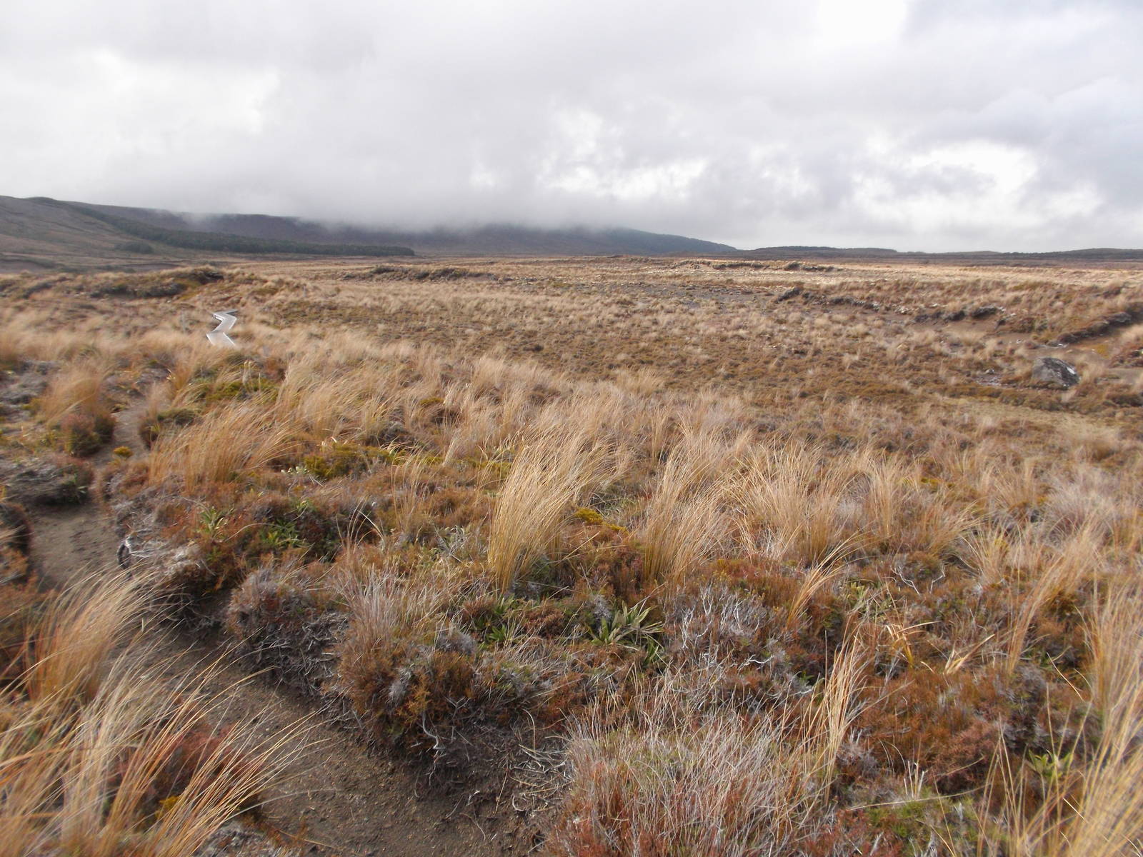
After nearly dying climbing Mount Ruapehu to Crater Lake, later that day I still started the Round the Mountain Track from Whakapapa, still bruised from my fall. The west side of the circuit was fairly muddy, and I slipped and slid as the track continually climbed up and down the gullies eroded into the lower reaches of Mount Ruapehu. In some spots though, large stretches of boardwalk had been built, making progress much easier. I had great views of the mountain most of the way. A clear sky and fresh snow on the faraway tops made for a gorgeous backdrop.
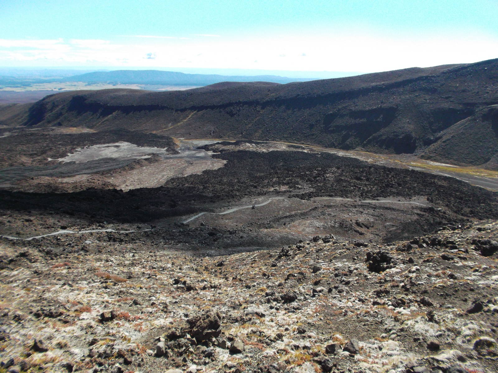
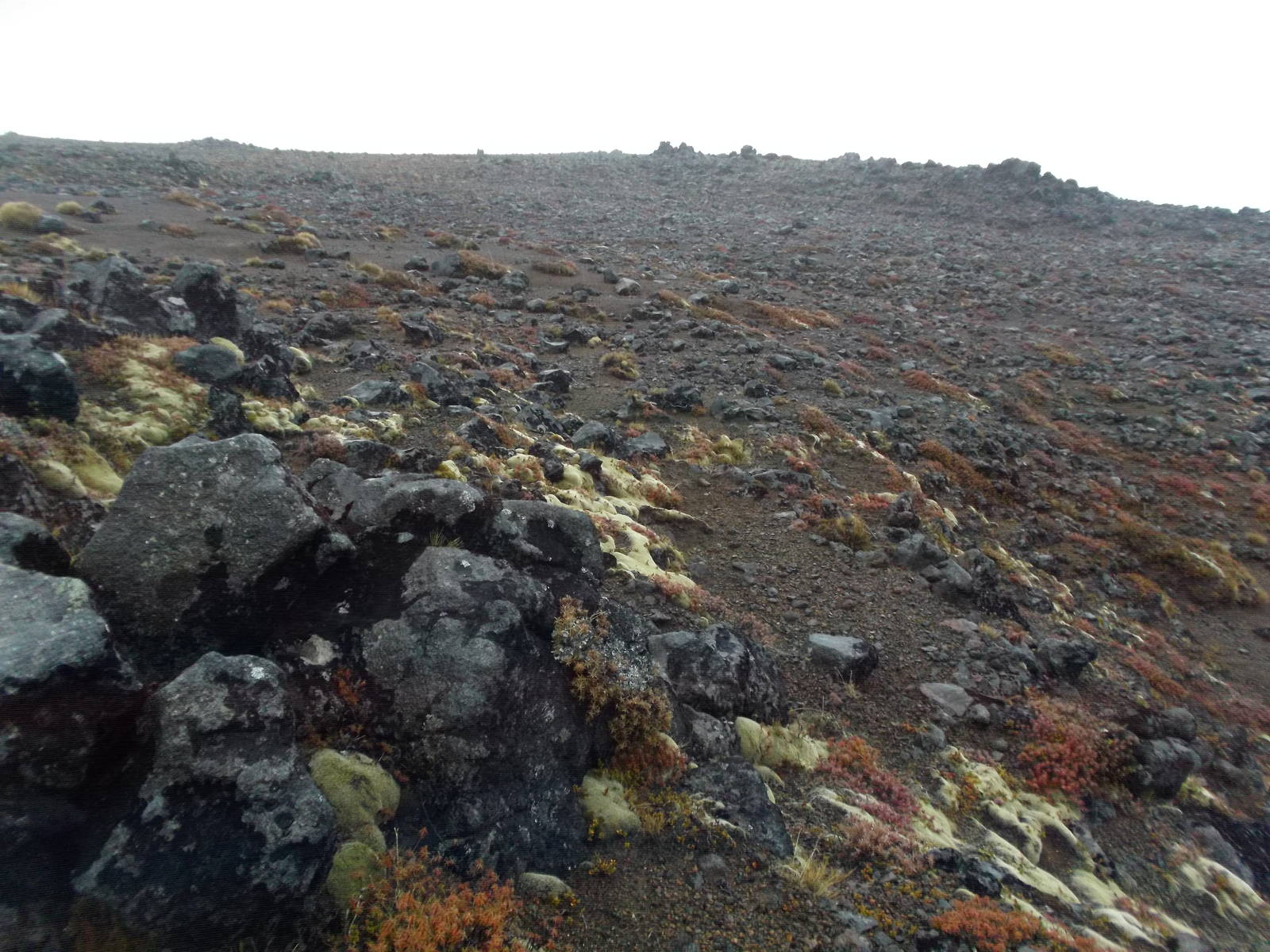
On the north side of the mountain the track led through the bush before emerging into the “desert” east side. This area was mostly void of vegetation, with only the scattered rocks from past volcanic eruptions covering the ground. This lunar landscape was neat to walk through, although it rained most of my time in the “desert.” Despite having done the crossing several weeks prior in good weather, I extended the Round the Mountain track into the Northern Circuit, hoping for an opportunity to climb Mount Ngauruhoe. The fact that it was now the off season, and I could stay in the Great Walks huts for “free” with my hut pass also helped me to pick that route. The weather did not cooperate though, with a cloudy and windy day convincing me not to do any more climbing, and instead backtrack out the normal route out between Mount Ruapehu and Ngauruhoe.
I barely snuck in this tramp before winter set in as well. Only a couple days after I left snow was predicted down to track level. I was not equipped, or had the desire, to do such a walk through snow.

Route I Walked
18 km
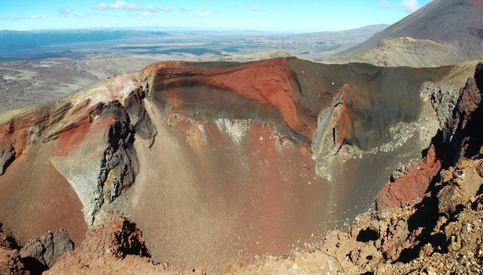
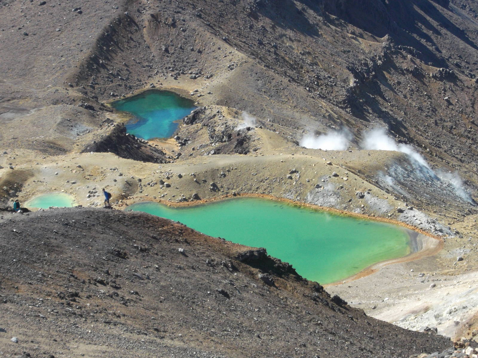
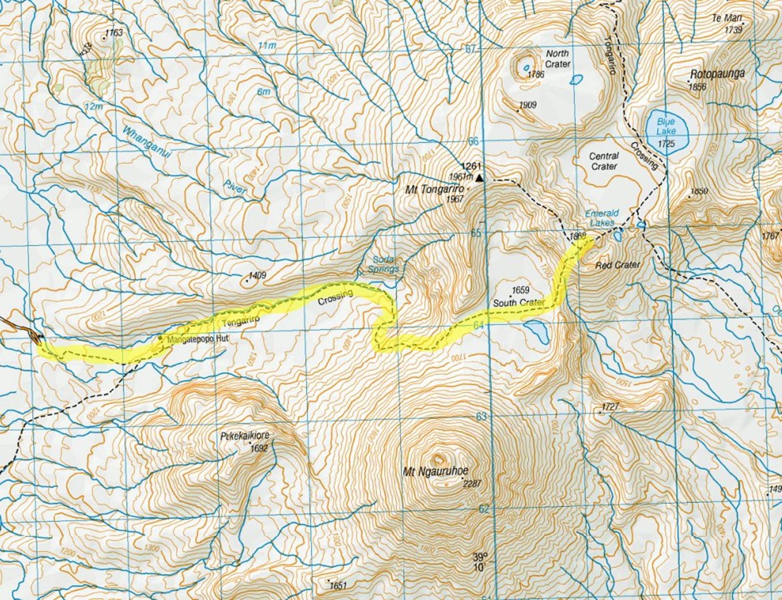
Undertaking one of the most popular day walks in New Zealand, I headed into the volcanic region of the Tongariro Crossing. Even on a chilly weekday this walk was busy, but the barren volcanic landscapes still made it worthwhile. The second half of the track after Blue Lake was closed due to potentially dangerous ongoing subterranean thermal activity. Still, the most interesting part of the track was available, and I walked through the large lava fields, across the cold, windy ridgeline, and in the shadow of the impressive Mount Ngauruhoe. Steam rose from many areas of the ground and puffs of smoke emerged from the recently erupted volcano. The minerals from the volcanic activity left impressively varied and vivid colors among the mountainside.