Home » Adventures » Patagonia » Dientes Circuit
Route Map
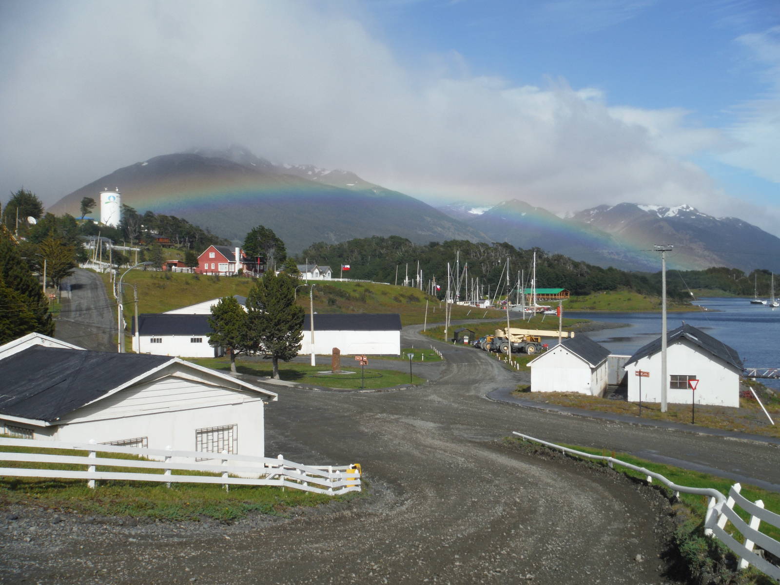
I took an invigorating early morning Zodiac ride across the clam Beagle Channel from Ushuaia, Argentina to Puerto Navarino, Chile, a collection of several small buildings. I waited around this remote outpost for several hours as I cleared customs, another boat run across the Beagle Channel occurred, and then for the bus to finally show up. The fifty kilometer drive to Puerto Williams was pleasant (if not bumpy), with views of the channel and towering mountains. When I finally alighted the bus in Puerto Williams I did not stay long in town — only buying a few supplies that could not be brought across the international boundary — before walking to the start of the Dientes Circuit. Since the crossing from Argentina had taken most of the day I just camped near the trailhead.
In the morning I began with a steep climb up Flag Mountain (Cerro Bandera). When I finally reached the top clouds engulfed the area, but after a short wait the fickle Patagonia weather changed, parting the fog and providing gorgeous views of the Beagle Channel.
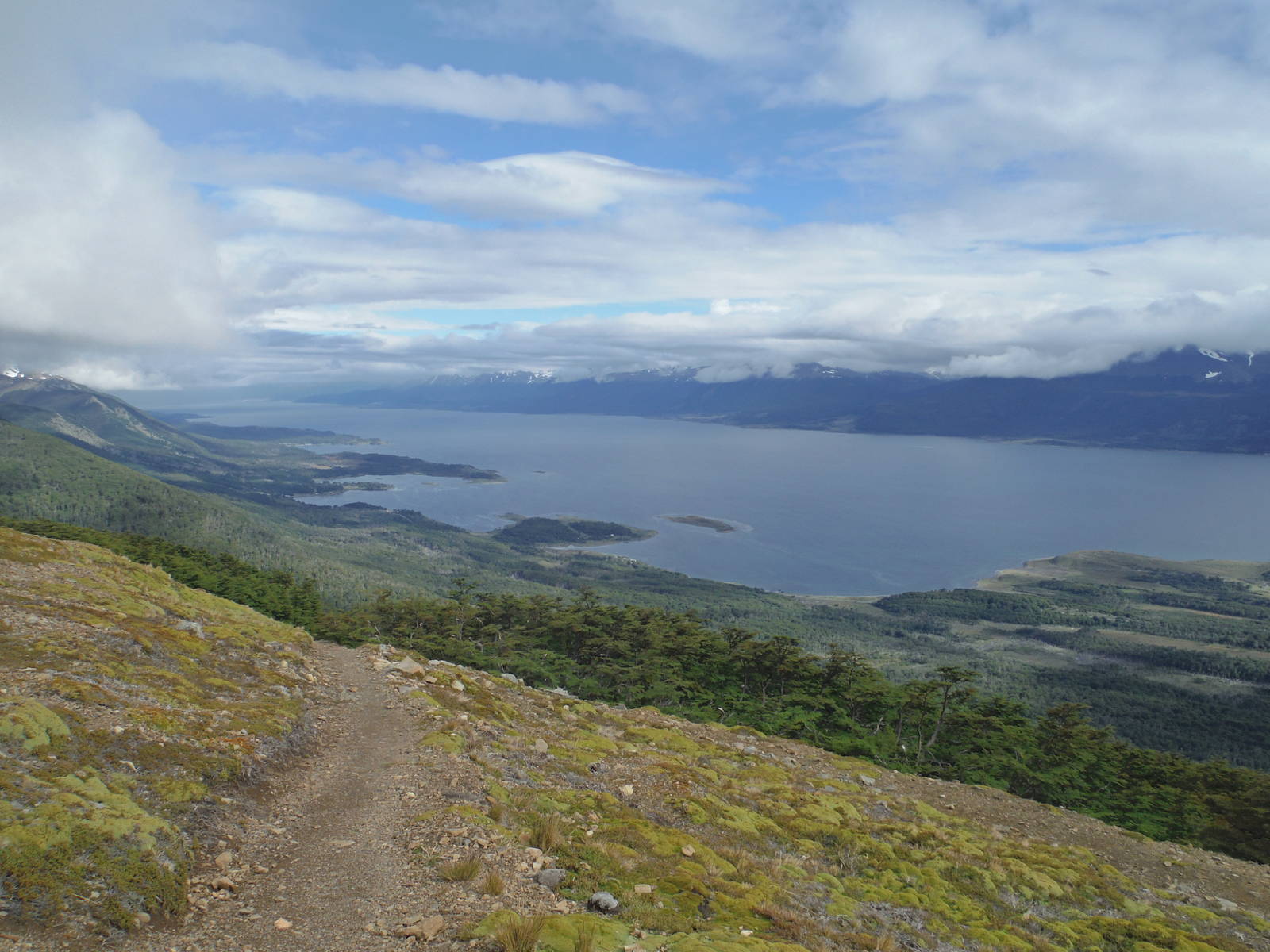
Flag Mountain
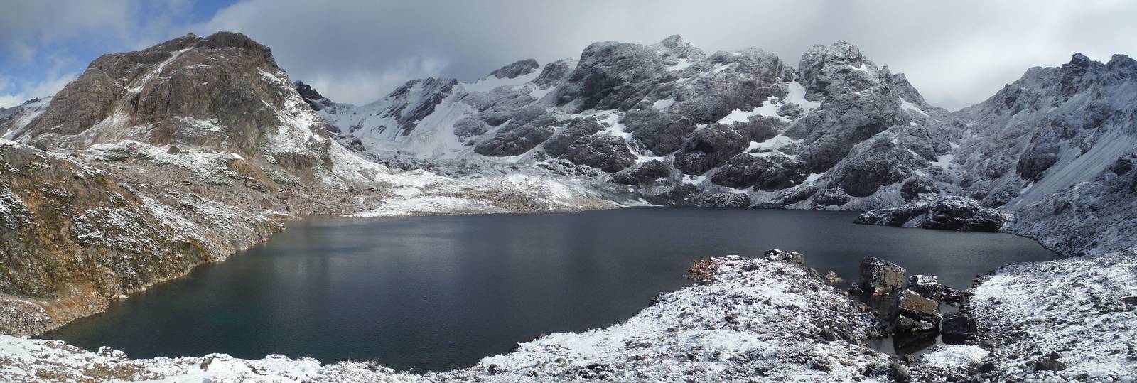
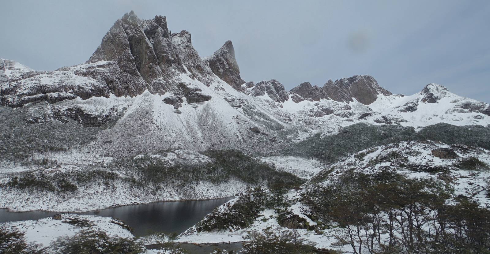
I then traveled up Valle Róbalo, traversing the steep walls high above the valley floor. The tread was mostly solid, but a few spots were truly dicey, with iffy footing in spots where slipping would have major consequences. The worst parts were usually only a couple steps, but I was very uncomfortable several times. All it would take was one wrong step. At least the head of the valley contained the spectacular “teeth” of the Dientes.
I slipped, but did not hurt myself on a descent on talus down to Laguna del Salto. A steep climb from that lake led into the heart of Dientes de Navarino, and a wonderful trek among the barren mountaintops capped with patches of snow. I traversed a small snow field around Laguna del Paso, but thankfully it was not very steep and slushy enough to not present much of a sliding danger.
The terrain changed to mostly talus and loose rock, which my trail runners did not handle overly well, but I survived. Unfortunately the mountains around Laguna Escondida were covered in clouds, so most of their beauty was obscured. After a lot of searching I found a passable spot to camp, meaning it at least did not have standing water in it. Rain had come and gone all day but a dry spell allowed me to setup camp and cook dinner, and I crawled inside right before some stronger rain came through.
Laguna Escondida
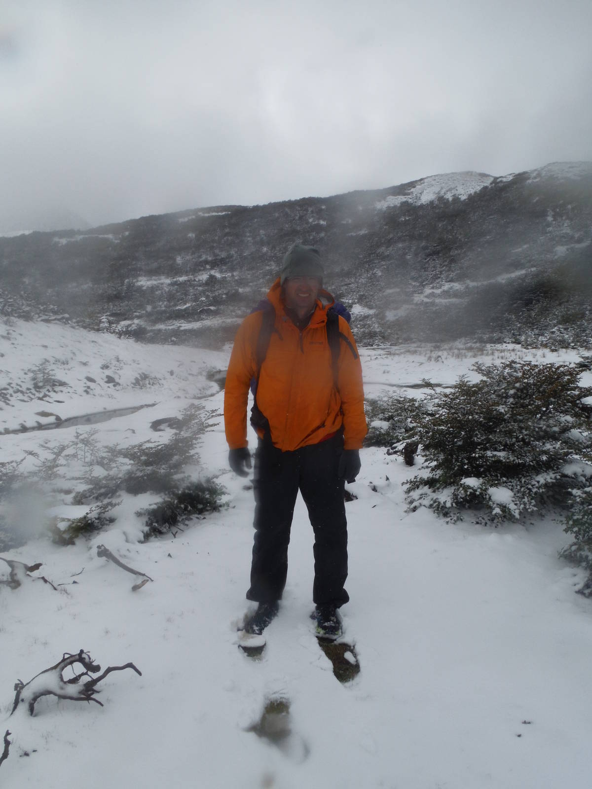
The air cooled overnight and the rain changed to snow. The precipitation was wet and slushy, and I had to clear it off my tent several times before it became too heavy. My Tarptent was a lightweight 3-season tent at best, but it held up to the snow. Only a couple inches fell in total, although this was the first snow of any accumulation I had encountered while backpacking. The weather was at least clear in the morning, which made breaking camp much easier and provided excellent views of Laguna Escondida (now doused with snow) that had eluded me the prior day. I naively expected the day to warm and most of the snow to melt off by lunch, but this was not the case. In fact it probably got colder throughout the day.
As I climbed over Paso Ventarrón a strong wind hit me as snow began to fall. Visibility was low, and the trail after the pass was hard to follow with much of it being covered with new snow. I was able to follow the cairns though to the relative safety of lower ground. For some reason the snow did not scare me like on the CDT. Perhaps I thought this summer storm would not drop significant enough snow to trap me (although I did not know if this was true); did not feel as isolated on this fifty kilometer trip — even if I perhaps was more so; have gained confidence; or was just blissfully ignorant.
For navigation I had been following the light tread and occasional marker — barely using my map or book — but that strategy was less than ideal with the new snow cover. But trying to look at a map or book in snow and a strong wind was also difficult. Still, I somehow only got turned around once (and was actually on the right path anyway). My GPS also came in very hand when it cooperated. Another couple was hiking the trail and having them nearby was reassuring as we bumped into each other or hiked together occasionally. The snow fell steadily throughout the day (although accumulation was slow) and the wind persisted.
After some scrambling and bushwhacking I called it an early day along Laguna Martillo, as I was drained from trudging through the snow and starting to get cold. The ground was completely covered in a couple inches of snow, and this would be my first camping on it. I found a spot snuggled in the trees, cleared away most of the snow with my foot, and pitched my tent as normal.
Melting snow with an alcohol stove proved harder than anticipated so I used a lot of fuel to produce little liquid water. My lighter had also gotten wet and I had not replaced my matches which were stolen in Parque Nacional Tierra del Fuego, so I could not relight my stove for dinner. A warm meal would have been nice, but I had enough dry food to get by. For the rest of the evening I stayed huddled in my sleeping bag for warmth and read.
Another nice morning allowed me to break camp easily and provided amazing views of the surrounding mountains and lakes. The air finally did start to warm up and some of the ground cover melted. I made my way through the wet, muddy valley before a climb straight up a muddy wall on the way to Paso Virginia. Above tree line the incline lessened, but the climb along the mountain was still long. A cold, strong headwind assaulted me on a final large plateau that led to Paso Virginia and some amazing snow cornices on nearby ridges.
Montes Lindenmayer
The way down from Paso Virginia to Laguna Guanacos was dicey, with the new snow making me uncomfortable on the traverse high above the lake. After safely navigating that, an incredibly steep slide down loose dirt and rocks finally led to the lake’s edge.
After an easy walk along the lake, the final descent from the mountains was a horrible slog through mud and fallen trees. I slipped several times on the steep muddy slopes and cursed the trail. The numerous downed trees also made for arduous progress. I followed a track, but may have fallen off the guidebook description as I never passed the abandoned fish processing factory, but I instead begrudgingly made my way across a pasture before finally reaching the road. I got lucky as just after I joined the road a car passed and offered my a ride, saving me a couple hour road walk. I was doubly grateful since today took a lot longer than expected (especially the last part after Laguna Guanacos), and I was hungry.
Before this trek, my attitude was that a trek was listed in a Lonely Planet book — even one called extremely arduous along with many other warning labels — would not be too difficult or dangerous for me. After the Dientes Circuit though, I had to reconsider this position just a bit, even if I made it through this trek unscathed.
After my hike, leaving Puerto Williams proved as much of a challenge as the Dientes Circuit itself. I planned on taking the boat back to Ushuaia, but between bad weather, mechanical difficulties, and an intervening Sunday, I got marooned in town for four days, without much to do. I eventually flew out the one day a week a large jet flies into town. The plane ticket cost about as much as the Zodiac and skipped a twelve hour bus ride after returning to Argentina, so I was happy. I was not used to flying being a cost effective option, especially at the last minute, but it was this time.