Home » Adventures » Great Superior Adventure » Superior Hiking Trail
Returning to the site of my first ever backpacking expedition I endeavored to complete a NOBO thru hike of the Superior Hiking Trail, which runs along the north shore of Lake Superior from Jay Cooke State Park near Duluth, Minnesota to the Canadian border. For added fun at the end I tacked on the Border Route Trail, which cuts across half of the Boundary Waters. In grand total that made about 375 miles of hiking goodness. For nitty-gritty detailed information that might help a future hiker see the logistics page.
Although this was already stop #3 on my Great Superior Adventure, as I had already hiked around Isle Royale and canoed in the BWCAW during my fall in northern Minnesota.
A picture is worth a thousand words, so rather than spend a lot of time reading words on this page, you can instead look at all the pretty pictures from my hike on the SHT and BRT.

SHT Overview Map
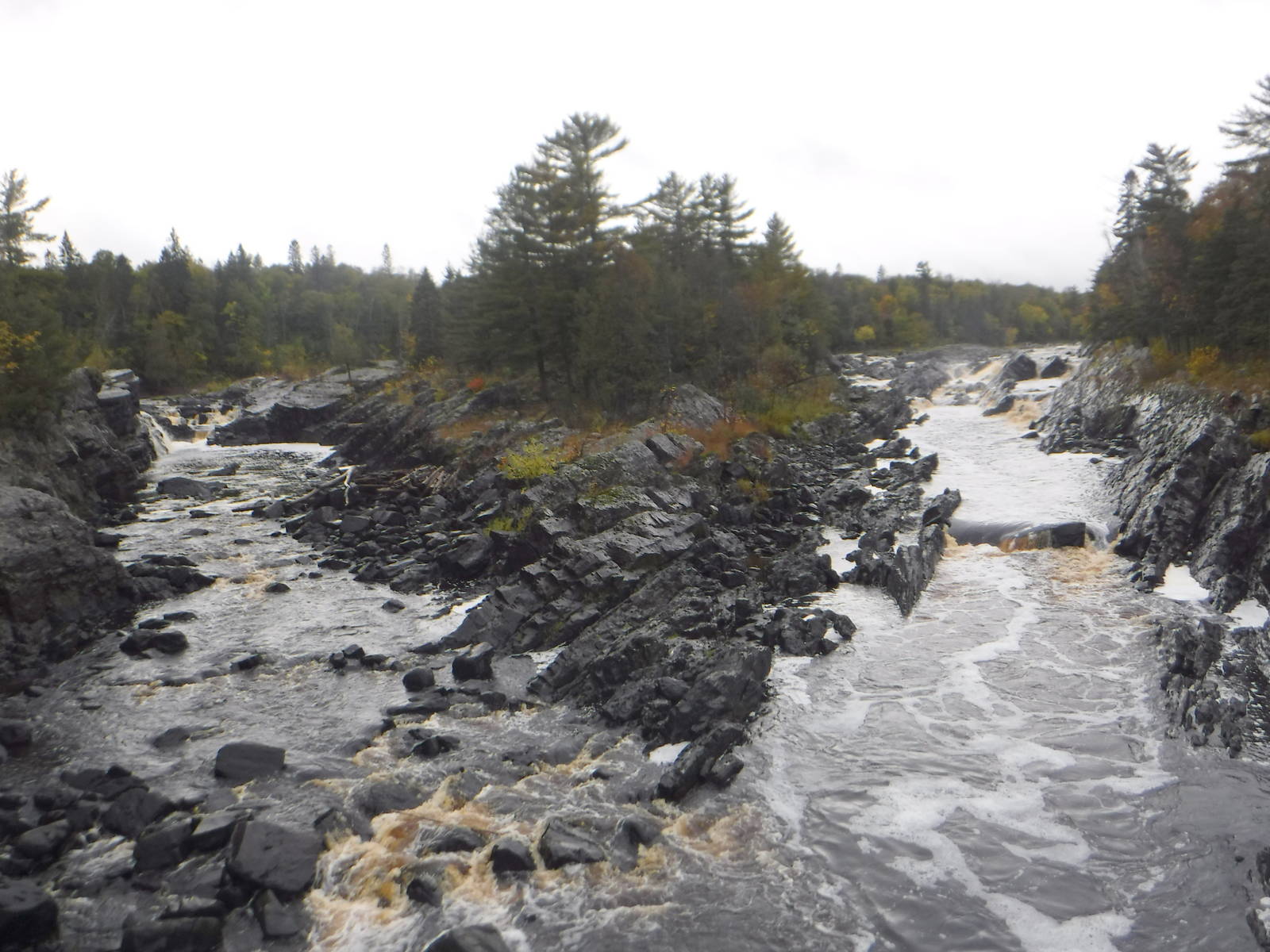
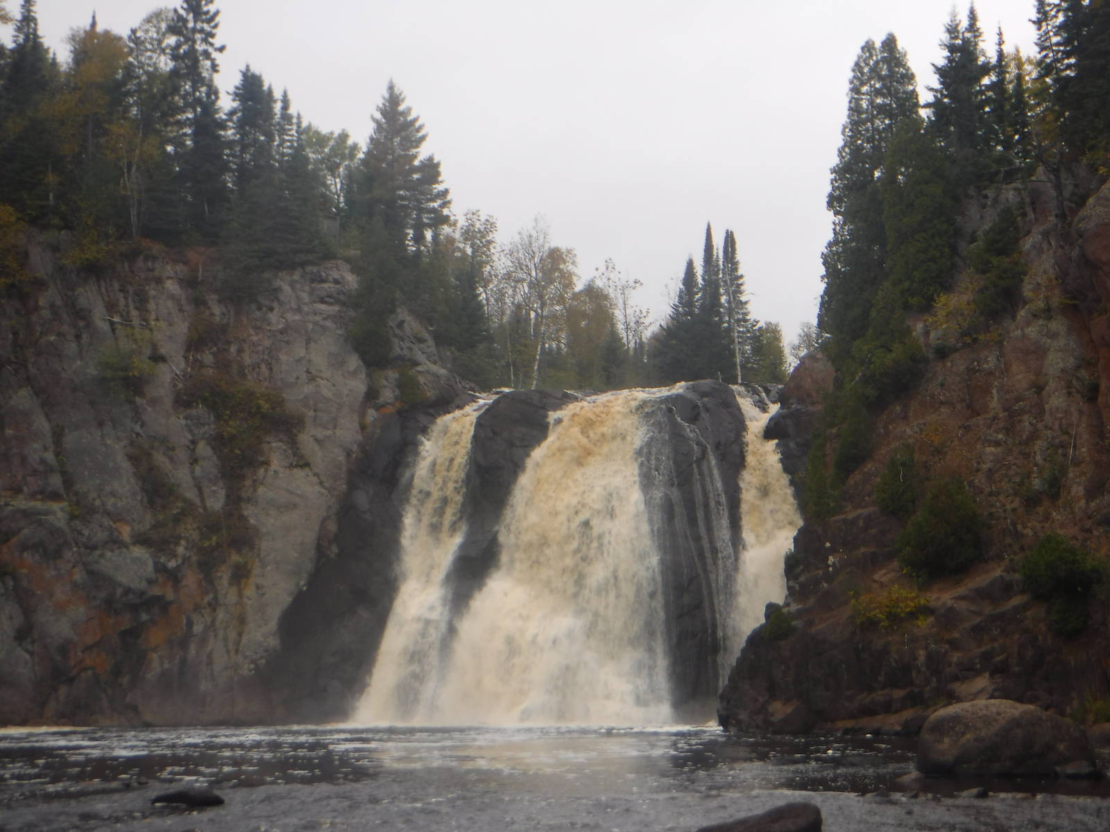
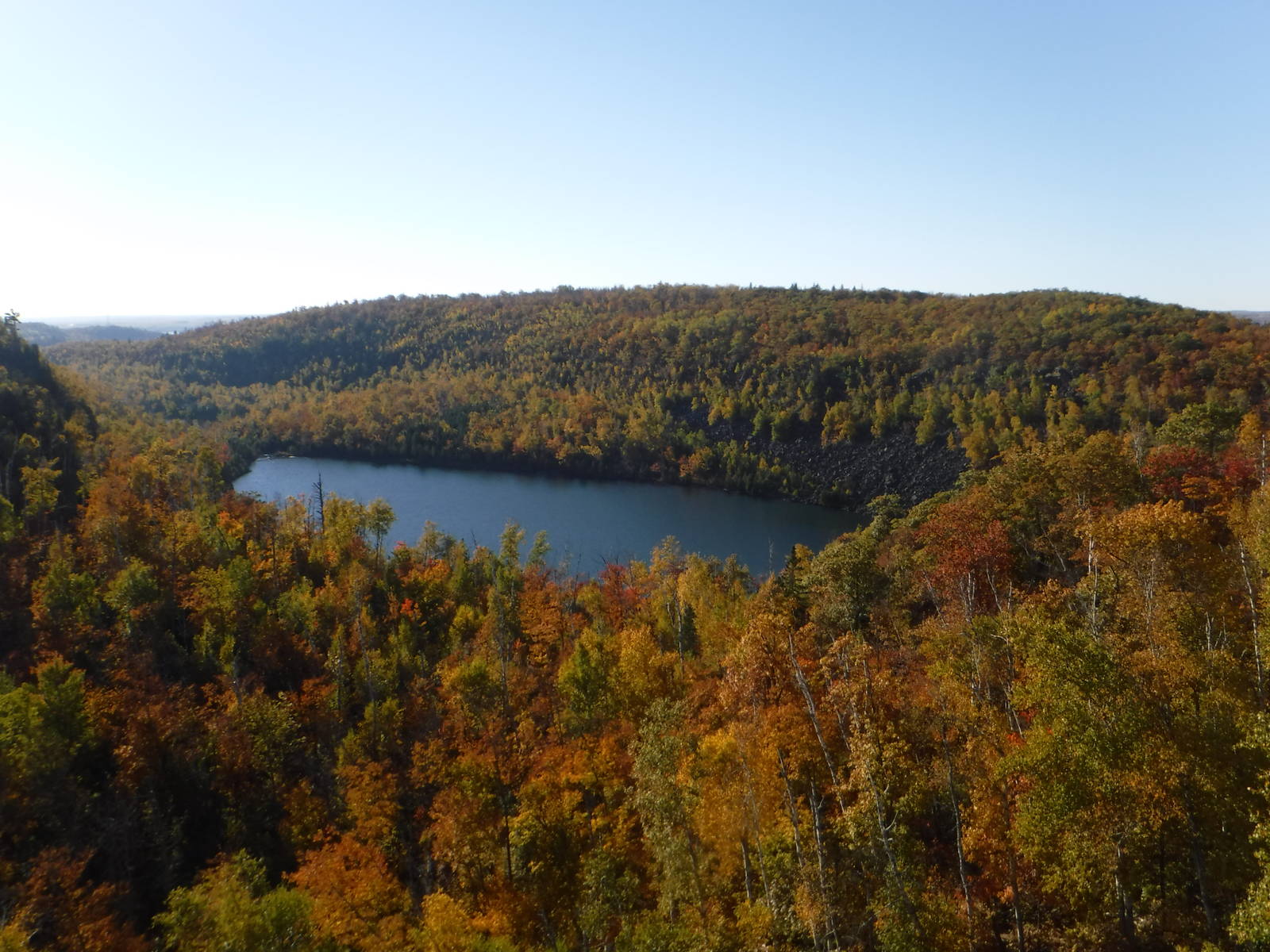
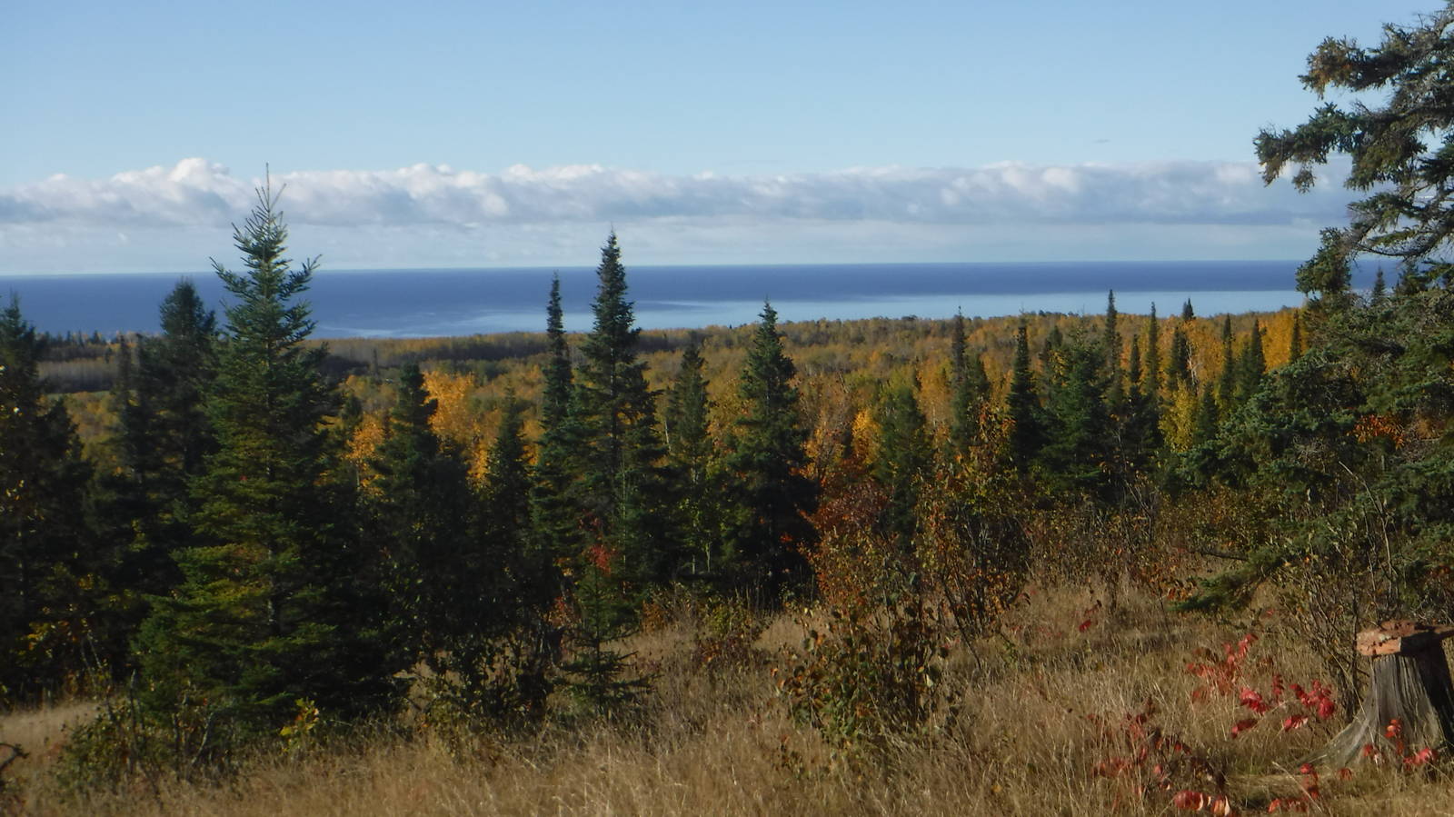
Overall the SHT was an enjoyable hike. It was different than many of the other long trails I have completed — which mostly traverse mountains (with one big exception) — but the forests and lakeshore of northern Minnesota were still a lovely destination. The trail crossed numerous picturesque rivers, many of which had great waterfalls and rapids. Through the Duluth area especially, the number of cascading streams full of bubbling water was surprising. Many beautiful views of Lake Superior were also to be had, including two walks along the waterline.
Sometimes though, I felt trapped in a forest that looked a whole lot like the other forest, and did not offer anything new. Not that a day in the woods is a bad thing, but it could feel like endless wandering through trees without getting anywhere. I usually need a bit more of a distraction or destination in mind, rather than just similar looking woods. And although the trail contained great Lake Superior overlooks, the route mainly stayed in the hills paralleling the shoreline and days could pass without seeing the lake.
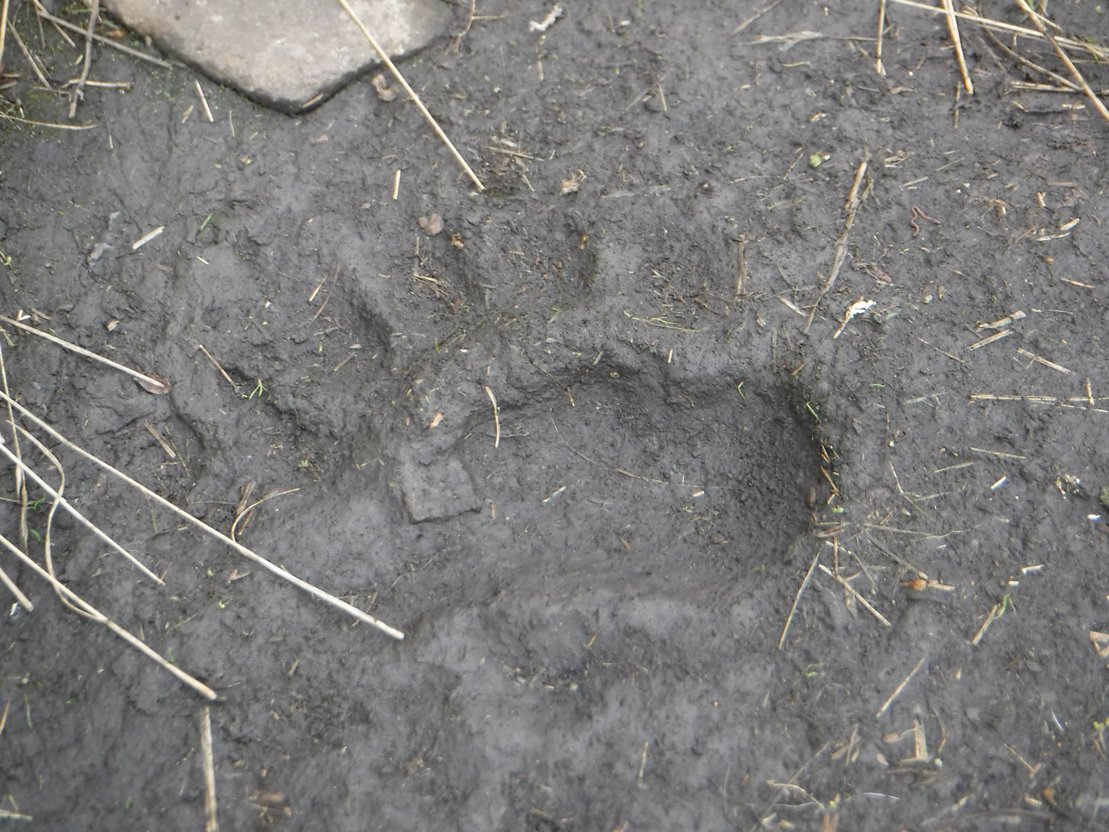
My hike went smoothly and was free of any major (or really even minor) problems. I could “relax” and just enjoy a couple weeks hiking. A bear might have wandered through camp one night, but a panicked call from another person sharing that campsite brought out the police, and I never had any issues (despite having cooked dinner next to my tent that night).
In my typical fashion I turned this hike into a bit of a death march. It was “only” 300 miles after all, and having done much longer trails, I perhaps became a bit complacent with the SHT. A few rest days would have been nice, but I could not let myself slow down with so many other adventures planned in the area. My miles per day was about my average, but with less available daylight in the fall I was always pressed to keep hiking as long as the sun shone. I would constantly watch the clock in order to make my miles and could not allow myself many breaks throughout the day. For the most part as long as the sun was up I needed to be on my feet. I also had to be mindful to crawl from my sleeping bag into the chilly morning air to start as soon as it was light, and could not wait for the sun’s warmth to arrive. I should have allowed a few more days for my hike and not have been such a slave to an arbitrary, self-imposed schedule.
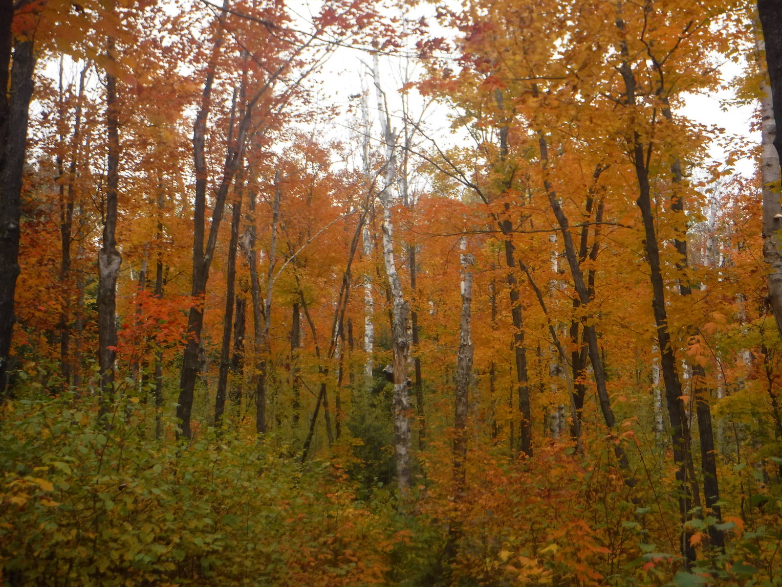
I hiked in the fall and think that would be the best time of the year to go. Although summer is probably more popular due to peoples’ vacations, northern Minnesota can be surprisingly hot and muggy, not to mention overrun with insects. Autumn offered mild temperatures with cool nights, but usually not below freezing. The hoards of summer bugs had almost entirely died off, so you could save your blood to transport oxygen around your body during the next exhausting climb, instead of donating another pint to walnut-sized mosquitoes. Best of all though was color change and trees painted with vivid reds, yellows, and oranges. With proper timing and a little luck, an entire thru hike can be an immersion into a forest of fiery colors. During the summer I also think a “green tunnel” would envelop much of the trail, but falling leaves and changing colors breaks open that canopy.
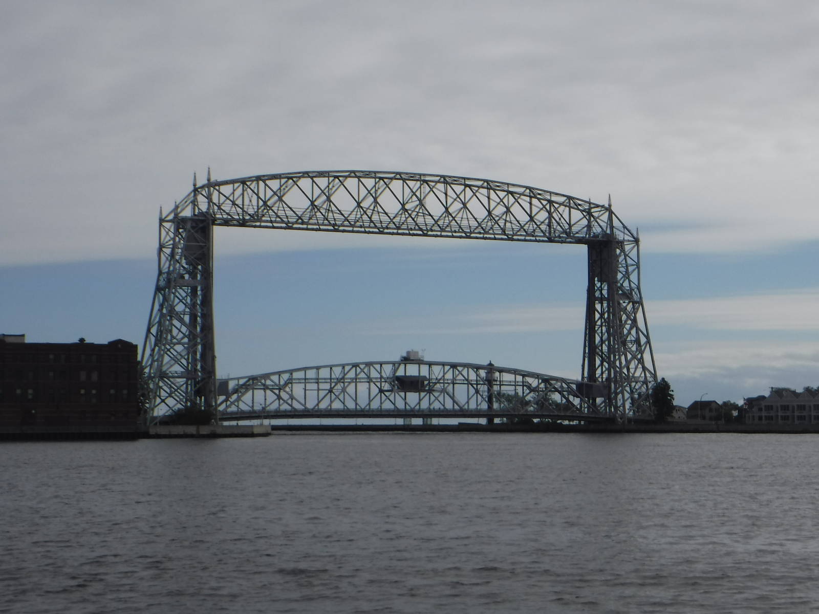
Many people skip the section of the SHT that goes through Duluth and start/end at Martin Road, but I was glad to have included this stretch. True, there was some connecting road walks and creativity was required to sleep on the cheap, but I also enjoyed Jay Cooke State Park, a walk along the shoreline past the lift bridge, numerous creeks crashing through rocky slots, a ski run, and an OCD sense of accomplishment of having hiked the “whole” trail.
Most of the SHT was purposefully built, dedicated hiking trail and offered long stretches of uninterrupted tread. It did occasionally utilize bike paths, dirt roads, and even some pavement (mostly around Duluth), but those were usually short and not much of a nuisance. The SHT coincided with the North Shore Trail in few places, but that route sees almost no motorized use unless snow is on the ground.
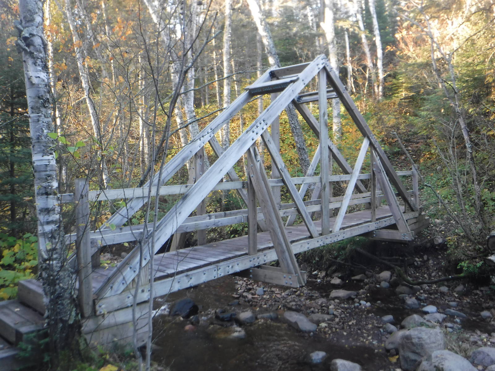
The trail was very well blazed its entire length, and I never had any navigation issues. The route was also well built, with good footing and tread almost the entire way. Miles of boardwalk had been installed in wet sections (although the quantity of planking diminished the further north you went on the trail), and many big, elaborate bridges had been built over creeks. These spans sometimes seemed overkill, and I wondered why so much time and effort had been invested to erect such a formidable structure over such a meager trickle. These overpasses made the crossings effortless though and would keep the trail open even in times of extremely high water, but I wondered if perhaps the money could sometimes have been put to better use elsewhere.
Many times the SHT’s routing seemed to meander around for no obvious, good reason, and I found myself wishing the trail would take a more direct route. I even cheated a few times and stuck to roads when the path made a circuitous loop, although my footsteps still always connected. To add aggravation and also keep hikers honest, a few PUDs were thrown in throughout the trail for good measure as well.
Of course none of the climbs were giant (this is the Midwest after all), but instead they challenged hikers through continual smaller ups and downs, adding to the normal fatigue from hiking. So the trail did demand fitness, but I did not really get my rhythm and hiking legs back till nearly the end. All that effort getting back into shape and ready for thru hiking, just to reach the finish.
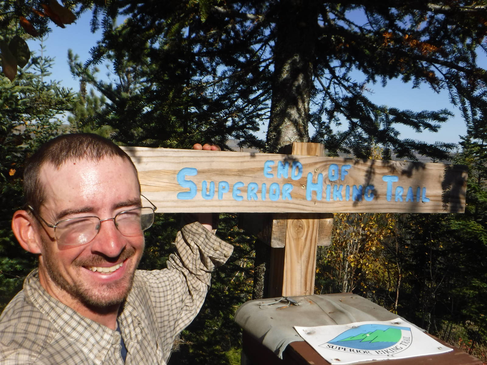
The SHT ended at the Canadian border, which was a substantive finish line to aim for, as well as a beautiful and remote destination. The 270° Overlook highlighted large tracks of undisturbed woods around the tranquil border. A nice place to toast to the end of a great hike (or else keep on walking).
From the SHT’s northern terminus at the 270° Overlook — where Border Patrol agents were securing this remote outpost against possible hoards of invading Canadians — I hiked the 65 mile Border Route Trail across half the Boundary Waters. I had almost no opportunity to plan for this trail, as I decided to hike it only a couple weeks earlier after seeing it on my maps while canoeing around the BWCAW. As such I relied minimally on a GPS track in my phone, a very large scale BWCAW map that depicted only part of the trail, and crossed fingers that the path on the ground would be generally easy to follow.
Fortunately these few resources were sufficient for navigation, mainly because the BRT was fairly straightforward to follow. That was thanks mostly due to a trail crew having recently passed through and done an excellent job clearing blow downs from a summer storm, as well as general overgrowth. They had marked several sections with surveyors tape as well to show the way. If not for their hard work the route would have been a much more difficult and arduous hike, with a lot more bush bashing through obstructed paths.
The BRT was a great addition to the SHT. It ran through a similar environment but was much more remote, basic and primitive. The only roads were near the beginning and end, with uninterrupted wilderness in between. Every other tree was not painted with a blaze and only a few bridges had been built, most of which were no longer very structurally sound.
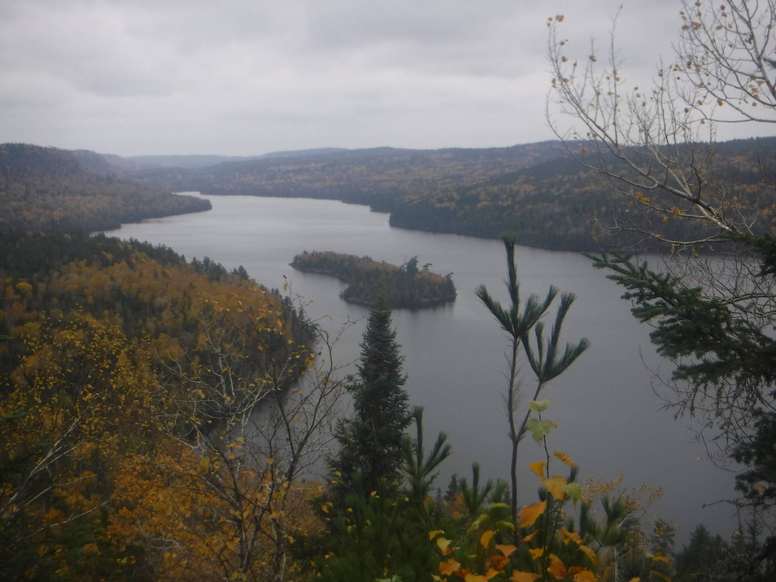
The trail was very scenic as well, wandering amongst the remote lakes of the Boundary Waters. Several times it climbed bluffs high above the water and had expansive views of magnificent wilderness. In other parts the trail ran alongside the Pigeon River or border lakes — the Canadian border in these parts. Fall colors had passed their peak, but some color was still in the trees and the leaves already on the ground made a nice crunching sound underfoot.
I had not allocated food well, and near the end of the BRT I detoured onto South Gunflint Lake Road, hoping to get lucky and find some type of food at one of the resorts. Although a few lodges were already closed for the season, fortunately one still had its lights on, as well as a small store with snacks. It also featured a very tempting restaurant, but for once I had willpower and avoided its warm dining room and a full stomach, for a chilly, damp evening outside instead. The place was also surprisingly welcoming to me, despite looking (and probably smelling) like someone that had been on trail for several weeks.
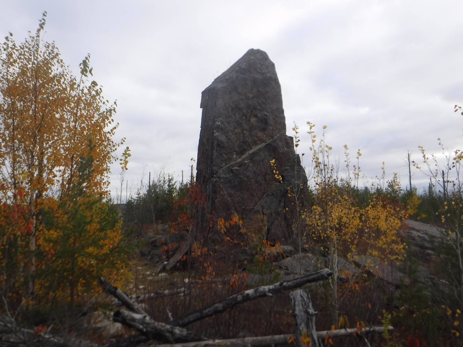
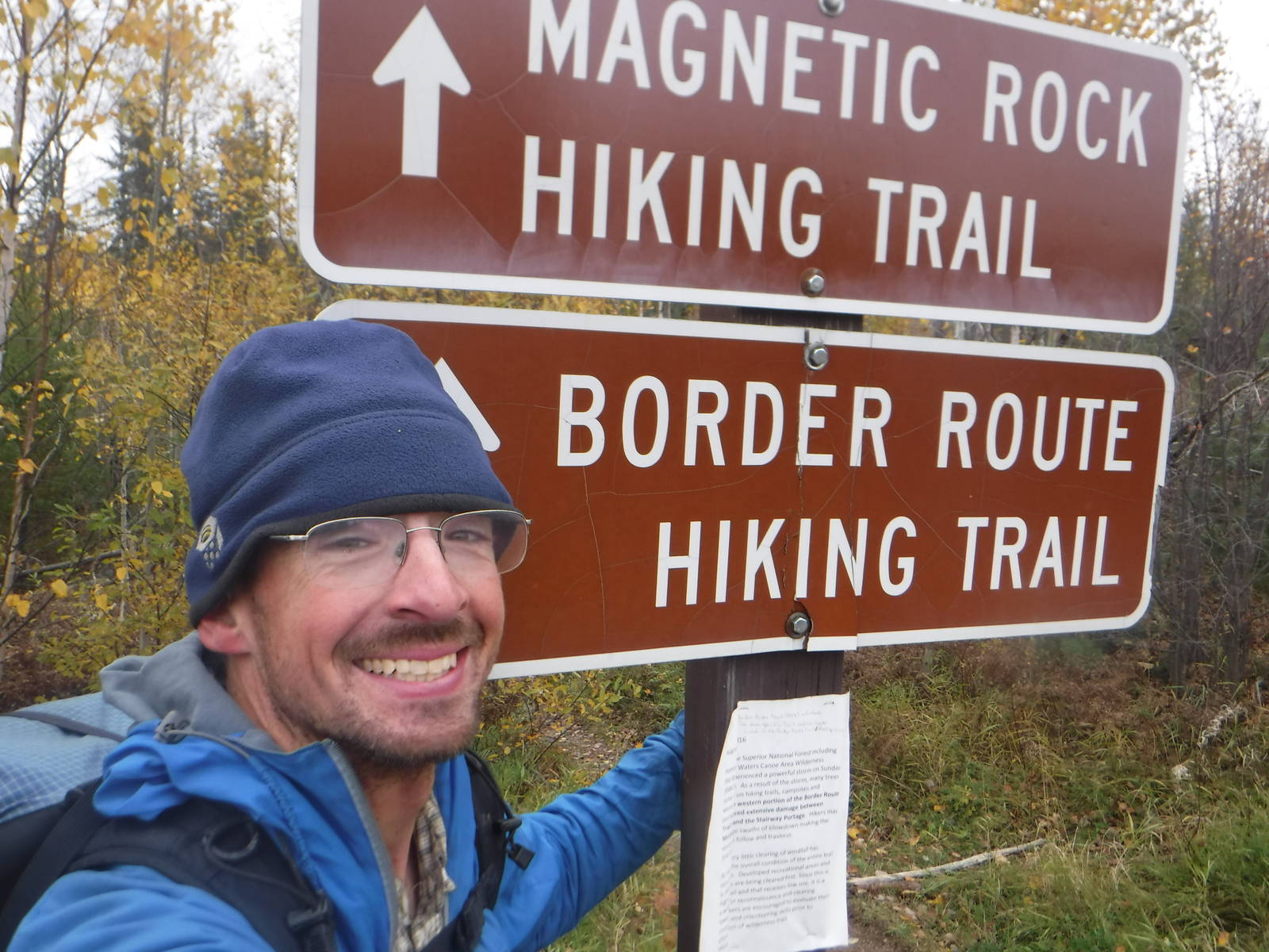
The BRT ended a Magnetic Rock — an obelisk stone emerging from the ground, although I could not tell if it actually deflected my compass. Thankfully my car was still in the nearby parking lot, and I drove into town for some much needed gorging.
I ended my hike at the Gunflint Trail after completing the BRT, but adding on the Kekekabic Trail as well to cross the entire BWCAW would seem a great choice too. (Or you could just continue all the way to North Dakota for that matter.) I had not planned for the Kekekabic Trail (though I had barely planned for the BRT either) and had other places to go anyway. At the trailhead on the Gunflint Trail a sign was posted stating the trail was impassable after a destructive summer storm, so perhaps fortune was on my side in not having enough ambition to undertake the Kekekabic Trail as well. Of course the BRT had a similar warning sign but had been recently cleared, so who knows. At least this way I still have another trail to hike someday.