Home » Adventures » New Zealand » Nelson Lakes » Robert’s Ridge
Route I Hiked this Day
In the morning the clouds seemed to have lifted with Lake Rotoiti visible from Bushline Hut’s front porch. That belief was short lived as I started towards the heart of Nelson Lakes. Circling clouds, wind, and a blasting drizzle appeared climbing towards Robert’s Ridge. Those were not good conditions to follow a ridge line, as my map and the trail’s name indicated. With a mantra of “know your limits” though, I started along the trackroute into the abyss.
The initial parts passed easy, with a bit more wind than desired, but the wide, smooth trail made passage simple. Within a couple kilometers though, conditions changed. The path narrowed as the wind continued to pick up. I unprofessionally estimated it at 50 to 80 k.p.h., mostly as a sustained, incessant gale. The weather forced constant concentration while hiking. I could not allow my mind to wander and blissfully enjoy the trail. I had to be aware of the adverse conditions and ensure they did not facilitate a larger mistake occurring. These were trying conditions, but I did not feel in danger moving forward, with “known your limits” intentionally on constant repeat in my head.
At the moment the most dangerous part of my endeavor was the unknown — if the trail became more exposed or technical further on, and without a weather report. Worse conditions, even just a steady rain, would create a very bad situation, but in my youthful ignorance I pressed forward. The wind’s might often forced me to drop slightly below the trail along the peak and use the mountain as a shield against the assault. My hands were also becoming chilled. I was not close to hypothermia or frostbite, but assembling a Swiss Watch then would have been difficult.

Bad weather on Robert’s Ridge
The worst point on the trail was crossing from the downwind side of a ridge into the full brunt of the weather on the upwind half. The strong gusts knocked me off balance, and I could not move easily into the unobstructed gale. I also could not tell where the trail went after crossing this ridge, preventing me from continuing on the ridge’s leeward side until the route became less exposed to the elements. In this conundrum I had to sit on my butt and hold onto the ground for stability. While huddled on the rocks, the wind, which had been continually flapping my pack cover, grabbed hold of it and stole it from my backpack. It flew twenty-five meters into the air, speeding away quickly, before I could even turn my head to see it leave. Unfortunately for the pristine park and the protection of my gear, it was forever lost to nature. Eventually I was able to gain my wits and wait for a slight lull in the wind to maneuver through this impasse, with one less pack cover than before.
Thankfully after that difficult obstacle the trail continued through areas more protected from the wind. I was especially grateful since the trail’s terrain also became rockier with harsher footing.
The path followed the ridgeline, crossing a few more exposed peaks, but with better weather. My entire time walking along the windy peaks had been in the clouds. Visibility was very low — good enough to always see the next orange blazer marking the trail — , but not much beyond that. This cover hid any great views on this trek. Occasionally the clouds parted and revealed the wonder around me. With the conditions I did not have much time to appreciate the beauty, but in retrospect the clouds may have helped. Although the wind was a pain, the low visibility hid some of the large, vertigo-inducing valleys around me. I do not handle cliffs well, so not seeing the extent of any steep drop offs prevented me from seizing up near those crossing, and I ignorantly traversed them without reserve. I was not in danger of walking off a cliff, but not seeing the nearby steep chasms — which in and of themselves are not dangerous as long as you stay on top — allowed me to walk naturally along the path, rather than concentrate on the precipices along side.
I eventually emerged at Angelus Lake after slogging through the poor weather. I planned to take lunch at the hut nearby but a construction site greeted me instead. Perhaps I would have known this hut was being rebuilt had I stopped at the Visitor Center as the big red caveat on the map recommended: “Warning, when using this map allow for change which may have occurred since publication…including access, tracks, bridges, huts and fees.” Some large signs may have been posted along the tracks near St. Arnaud as well, but I missed them in my haste through dusk coming in the prior night. With that hut out of commission and not wanting to eat exposed while high in the mountains, gaining sustenance would have to wait until I dropped into the valley below, which naturally took longer than expected.
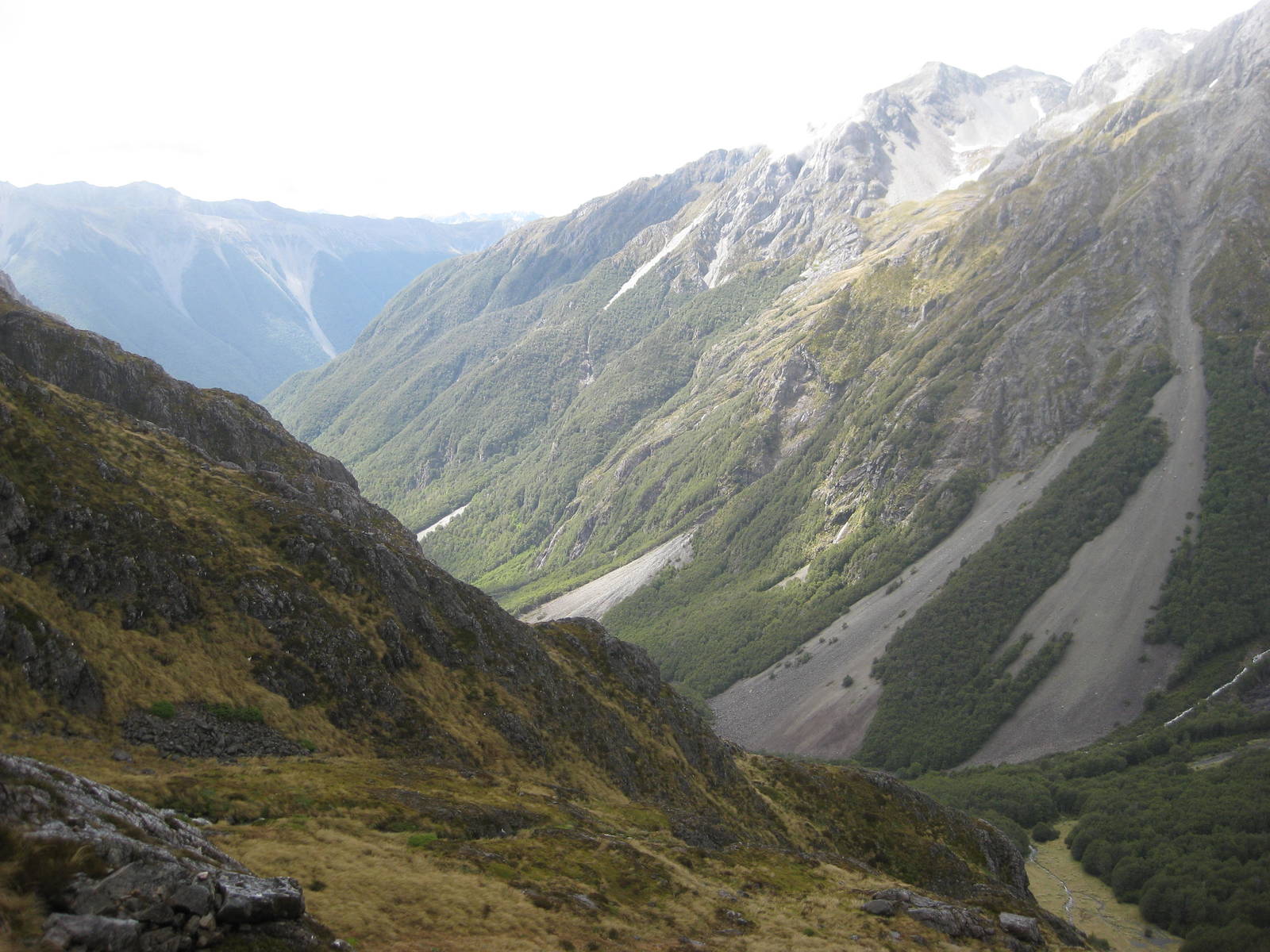
Cascade Track viewed from the top
I followed Cascade Track down from Angelus Lake, which was incredibly steep — even more than my previous worst descent at Cathedrals. The precipitous drop down rain slicked rocks was slow and difficult. I planned and executed each step carefully, but even so ended up on my butt a few times, although thankfully without injury. At least this decline finally brought me below the cloud ceiling, and I could see again. Rain harassed me on and off throughout. I only wanted to reach the relative safety of the bush line, but knew not to rush. Above the vegetation, the Cascade Track went by some amazing waterfalls and rapids, which tumbled down the mountainside.
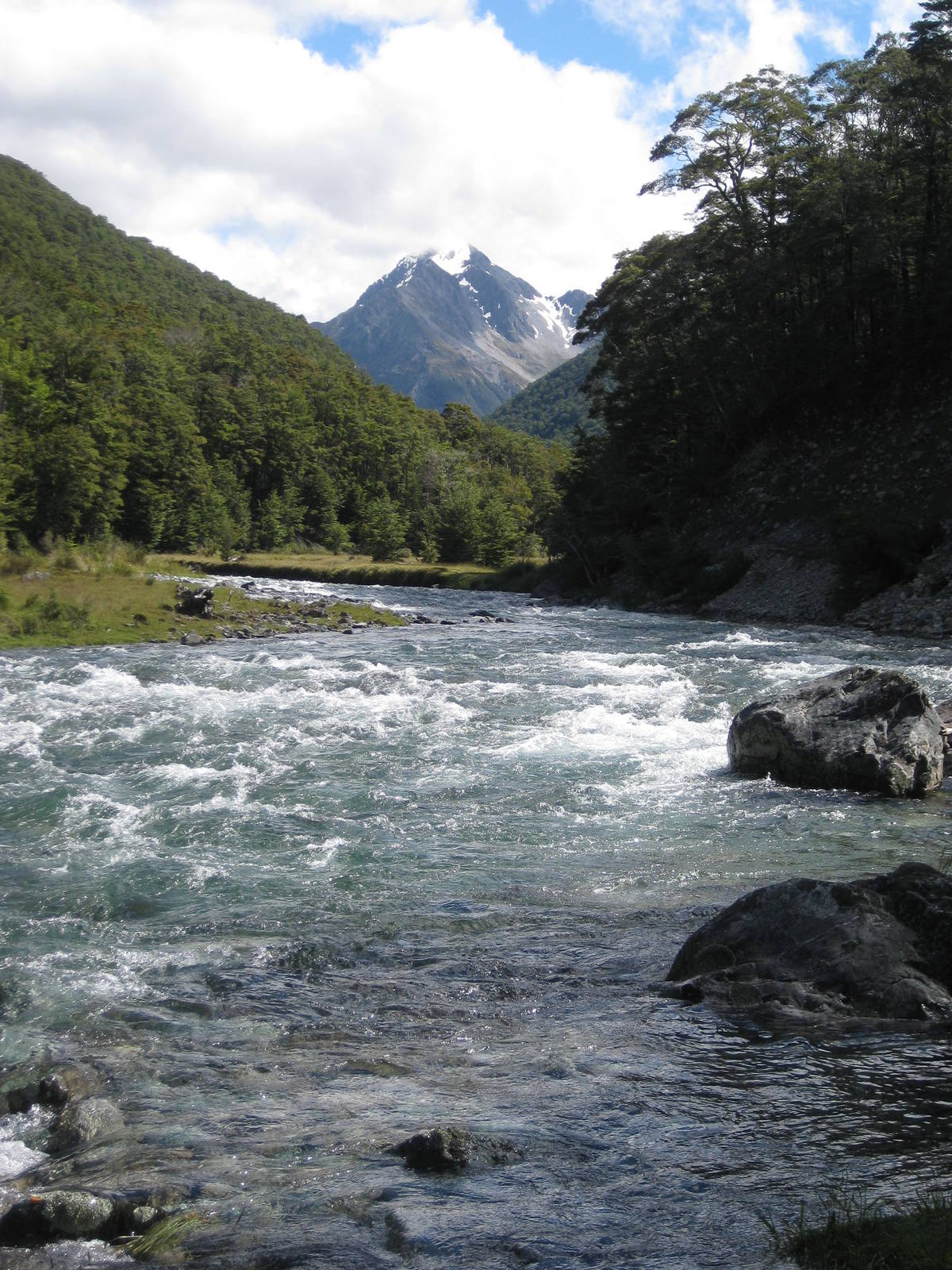
Travers River
The methodical descent and using one closed bridge eventually brought me to the tree line, and my pace quickened slightly as I tore alongside a raging river careening through luscious forest. Many roots and other obstacles still prevented me from going full speed.
This path led me to Travers Track which went up the valley. The nearby river was beautiful, with open meadows and towering mountains around it. By now though my feet and shoulders were aching from the long day, and I looked forward to camp. A little further along the path finally brought me to John Tait Hut, a picturesque structure directly alongside the river and surrounded by mountains. I need to find a house someday with that view. At the moment though, removing my boots from my sore feet was enough, and I grabbed dinner before slipping off to bed.