Home » Adventures » New Zealand Extended Holiday » Mount Aspiring NP
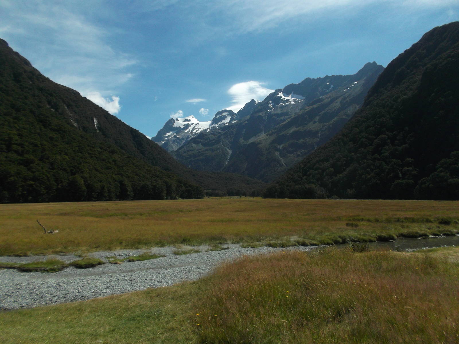
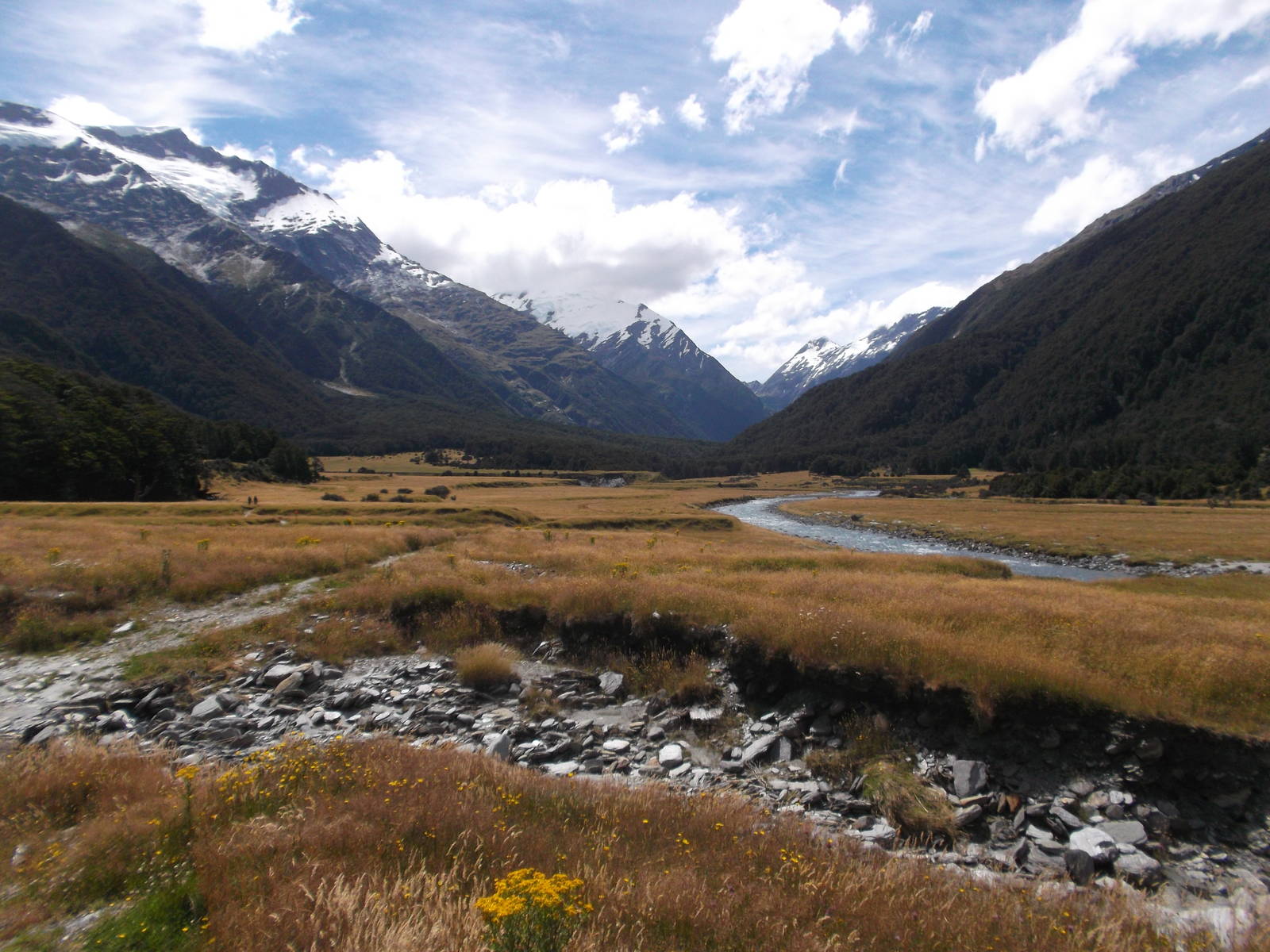
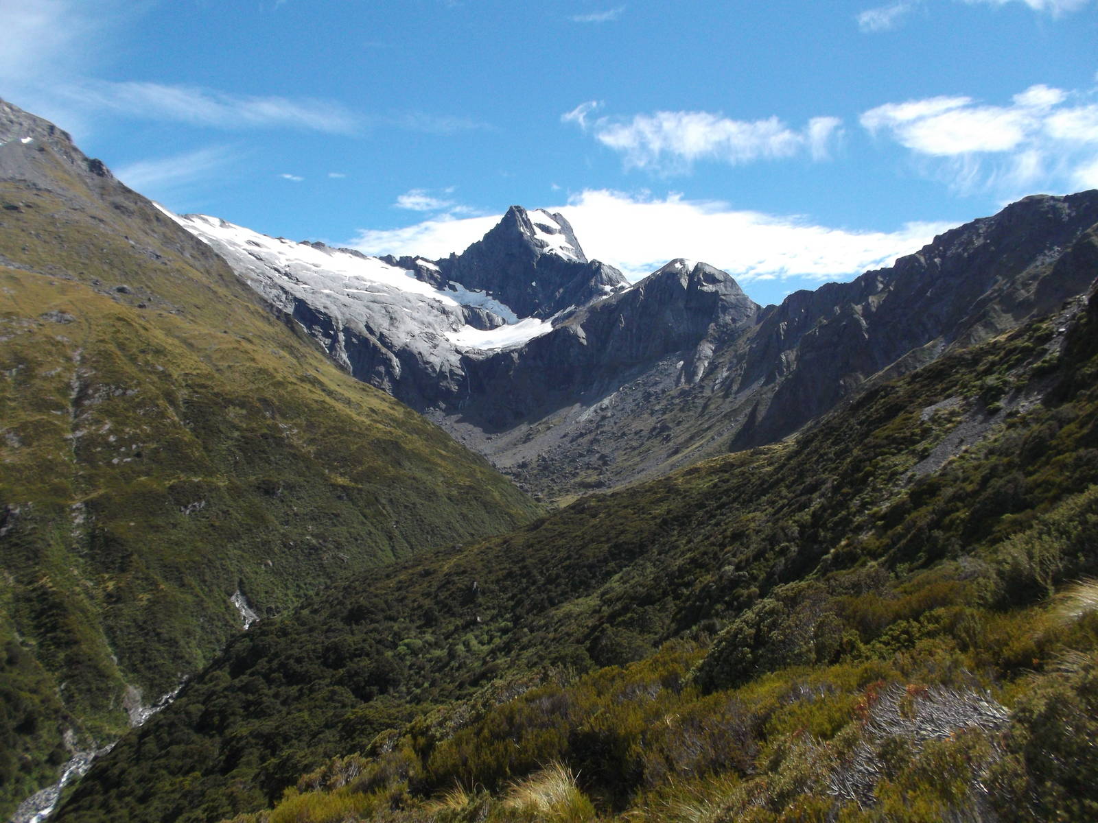
After being stuck in Queenstown for several days during a stretch of beautiful weather, waiting for a pair of overpriced shoes to arrive — which ended up not being available in my size anyway, the weather prediction turned by the time I was able to start the Cascade Saddle Route. This track is one which should definitely not be undertaken in adverse weather, so I had to abort my try at the saddle. I could have waited out the storm system, but had been idling in the Queenstown area for long enough and was itching to move on. I instead only hiked up the Matukituki Valley, visiting Rob Roy Glacier and overnighted at Liverpool Hit. Still, this abbreviated form of the track was still stunning. Rob Roy Glacier was a massive sheet of ice hanging high in the mountains and after an extremely steep climb; Liverpool Hut sat idyllically above the bushline with magnificent views of Mount Aspiring. Too bad I could not make it over Cascade Saddle. Perhaps I will need to return to New Zealand yet again. [Ed. Note: Or just go back a week later.]

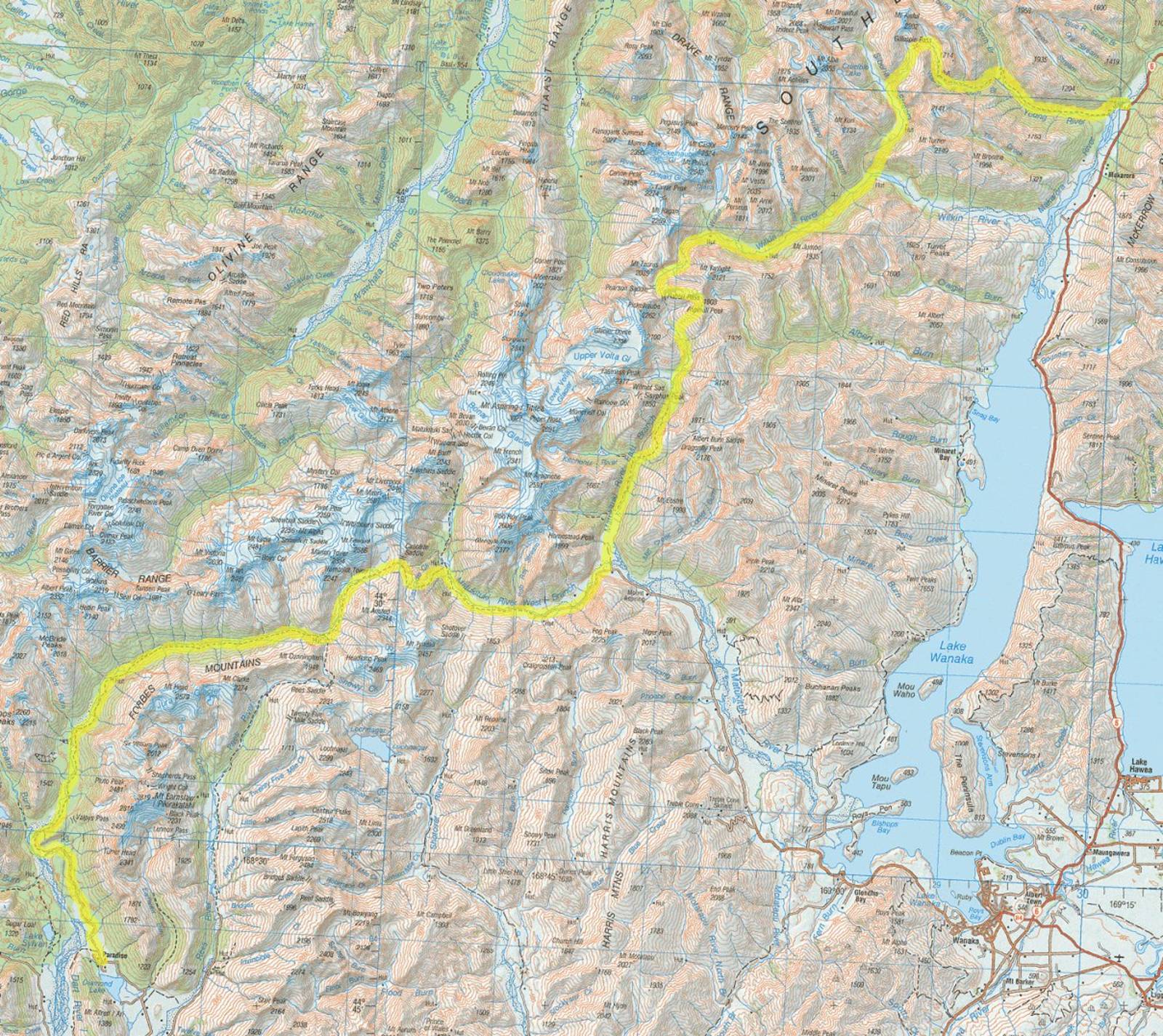
Route I Walked
155 km
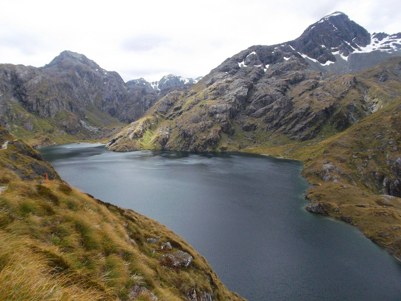
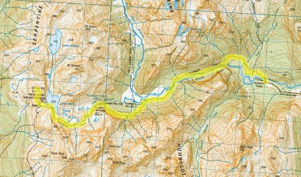
After heading up along the west coast to view some glaciers, with a slightly better weather report I double backed to tackle Cascade Saddle, this time prefixing it with Gillespie and Rabbit Passes. Gillespie Pass was better than expected, providing expansive views of interior mountains of Mount Aspiring National Park. From there I headed up the Wilkin River towards Rabbit Pass, with a side trip to Lucidus Lake for good measure. Rabbit Pass’s waterfall face was a steep climb, but not technically difficult under a clear blue sky. These vistas were even better, with snow capped mountains all around. Unfortunately at Rabbit Pass I still had to climb several hundred more meters in order to reach a “viable” route to the valley floor — which was still an extremely steep descent down loose, crumbly rock.
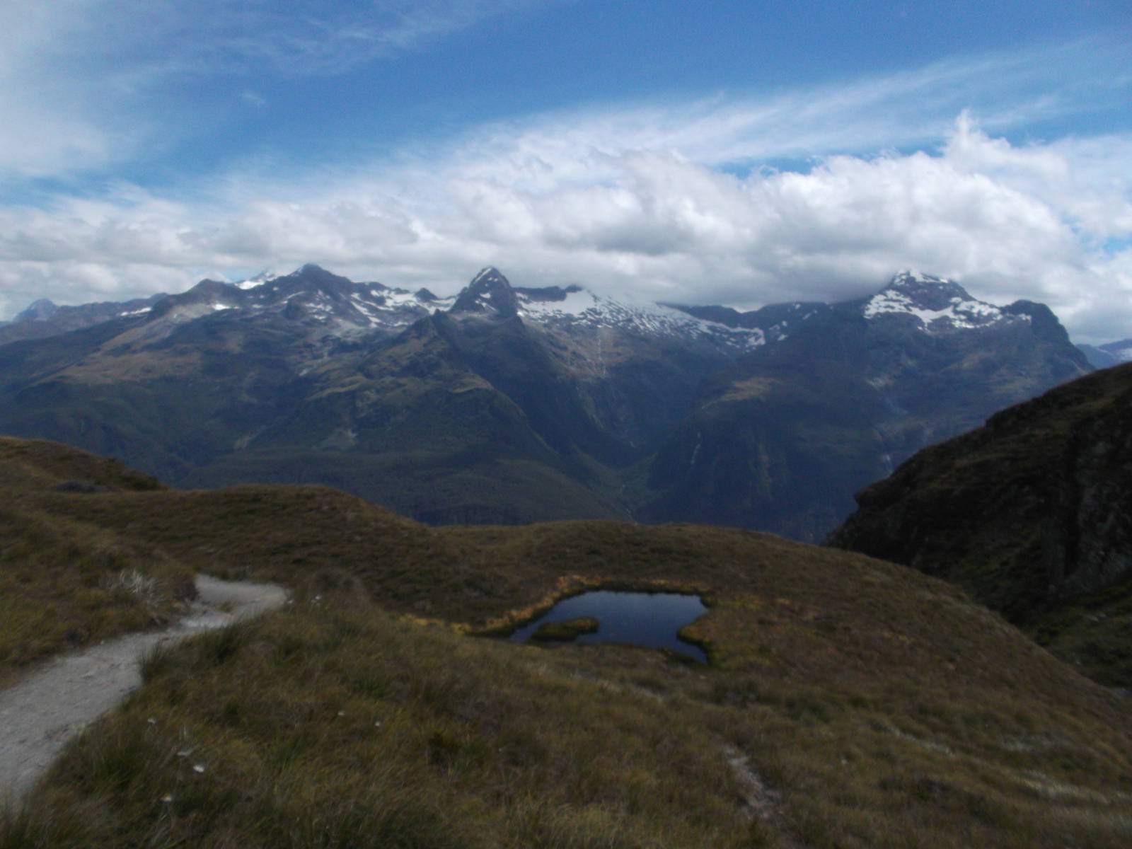
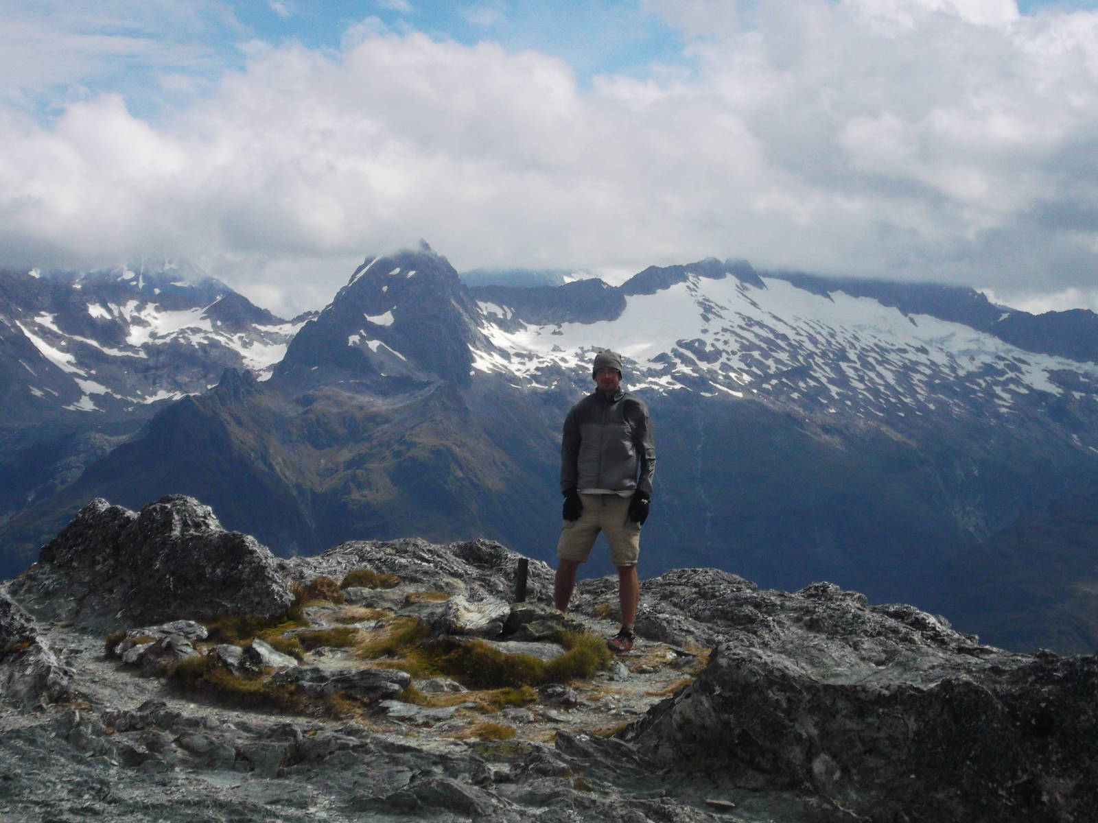
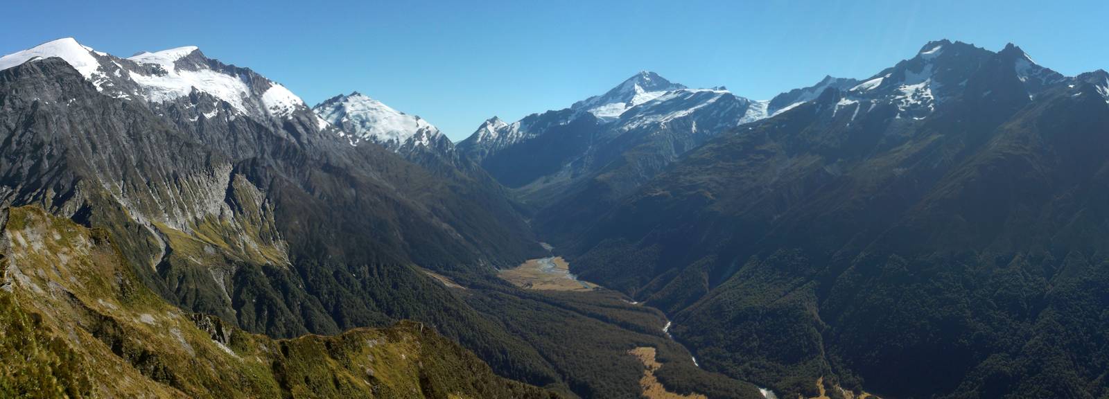
A long, but lovely walk through the East Matukituki River Valley (including another climb above bushline to avoid a gorge) led to my original goal of crossing Cascade Saddle. With my legs feeling the couple prior of days, a laborious climb led to the Pylon, with the best views to date — many mountains peaks and glaciers stretched before me. The rough way down had spectacular views of the Dart Glacier and River. The last day was a mostly flat, but seemingly endless walk through the bush along the aforementioned river. And since I did not know when, or even if, I would reach Chinamans Bluff car park, I had not booked transport, and had to walk over halfway back to Routeburn Road before getting a ride to Queenstown, where I was stuck yet another night. Still, this was my best tramp to date in New Zealand, especially since I did not have to use my rain gear once.


Route I Walked
24 km
After spending as little time as possible in the horrible place known as Queenstown, I was back into the bush, this time on the Routeburn Track. Due to logistics I did not hike the entire track, but from the Glenorchy side tramped to Harris Saddle and back, spending the night at Routeburn Flats. This overnight trip was still spectacular though. The Route Burn valley and surrounding mountains were gorgeous and once the track climbed above bushline past Routeburn Falls Hut, the sub-alpine scenery was breathtaking. Harris Lake, looking back into Fiordland (and the start of the Hollyford Track) from the saddle, and the windy scramble to the outlook atop Conical Hill were all memorable. This relatively short walk covered some exquisite and varied scenery.