Home » Adventures » New Zealand Extended Holiday » Fiordland NP
Gertrude Saddle: A hike up to this saddle on a clear day provided gorgeous views of the surrounding snow-capped mountains, as well as Milford Sound.
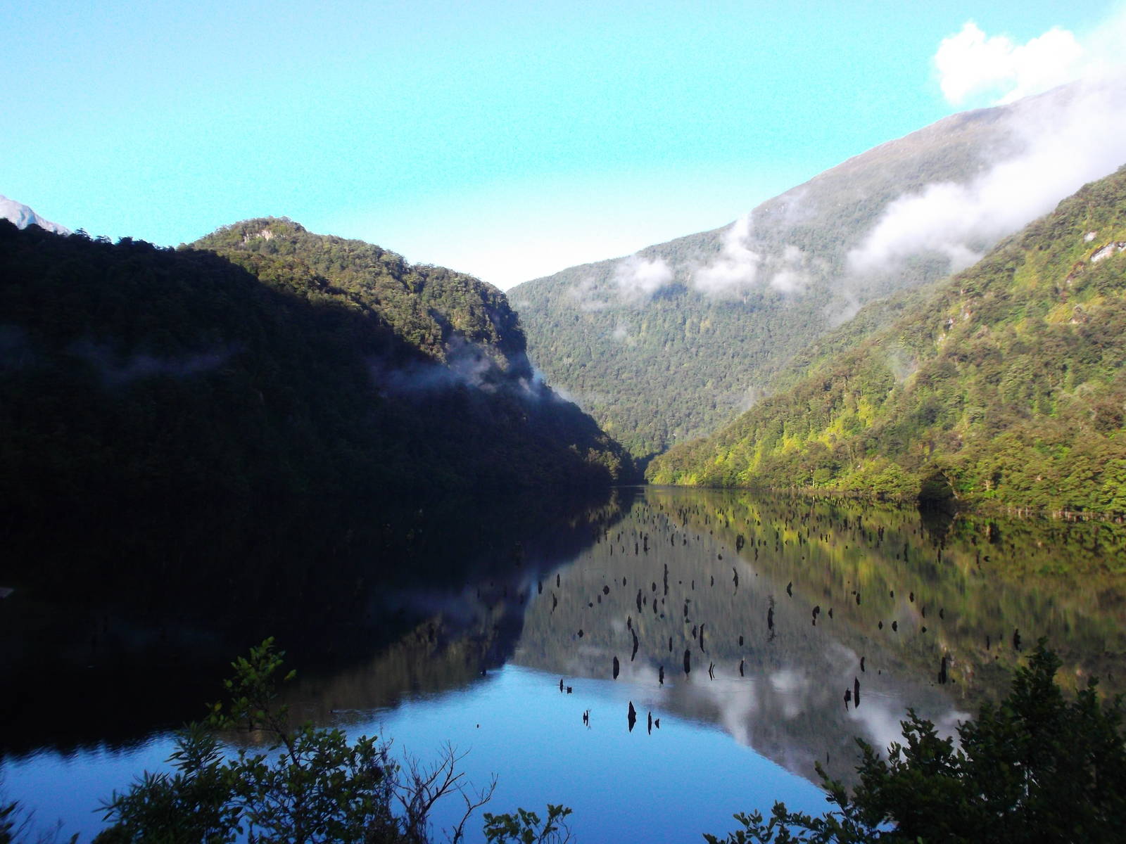
Lake Marian: A beautiful sub-alpine lake, with towering mountains all around. A powerful set of roaring rapids from the lake’s discharge was also along the track to the lake.
Key Stone Summit: An easy track through the bush on the end (or beginning) of the Routeburn Track led to an alpine nature walk, with great views of the surrounding peaks and information about the natural habitat.
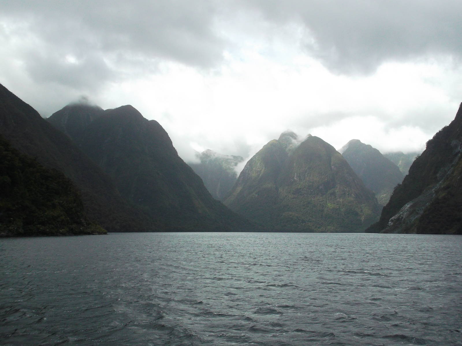
Fiordland is best seen from the water, and to do so I chose a tour of Doubtful Sound. As expected, this cruise had a taste of tourists being processed like cattle through the same scenic views for a couple quick pictures. Still, it was not over the top and I thoroughly enjoyed the cruise. The ride across Lake Manapouri was scenic. The bus ride over Wilmot Pass to Doubtful Sound was encased in clouds, but thankfully Doubtful Sound itself had decent weather. Clouds and occasional rain shared the fiord, but many good views were to be had, and the weather created a mystical feel. The towering rock walls, vegetation, and numerous waterfalls were all sights to behold. On the manmade side of things, the tour of the underground Manapouri Power Station was interesting technically and impressive from the sheer scope of the excavation and undertaking.


Route I Walked
84 km
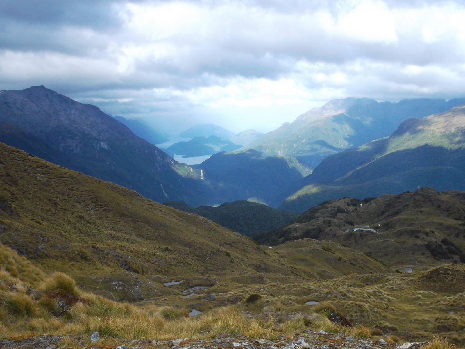
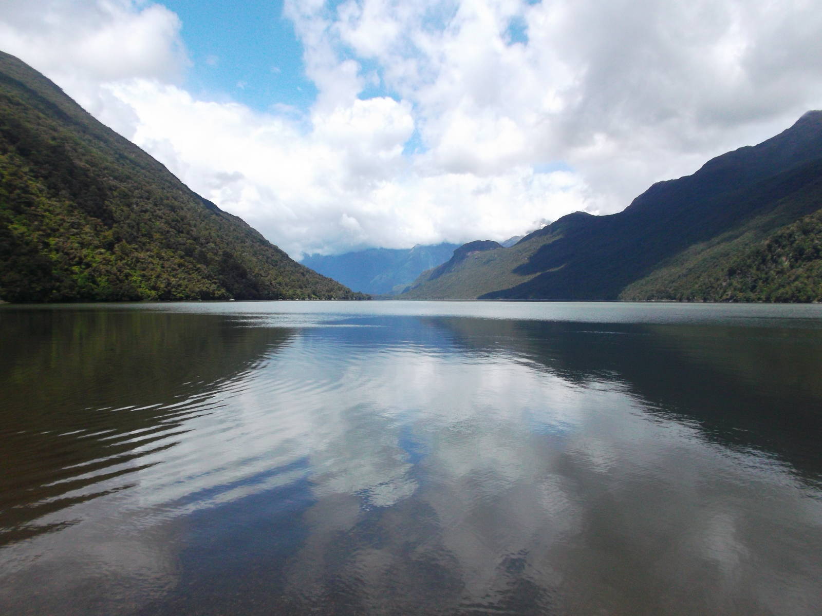
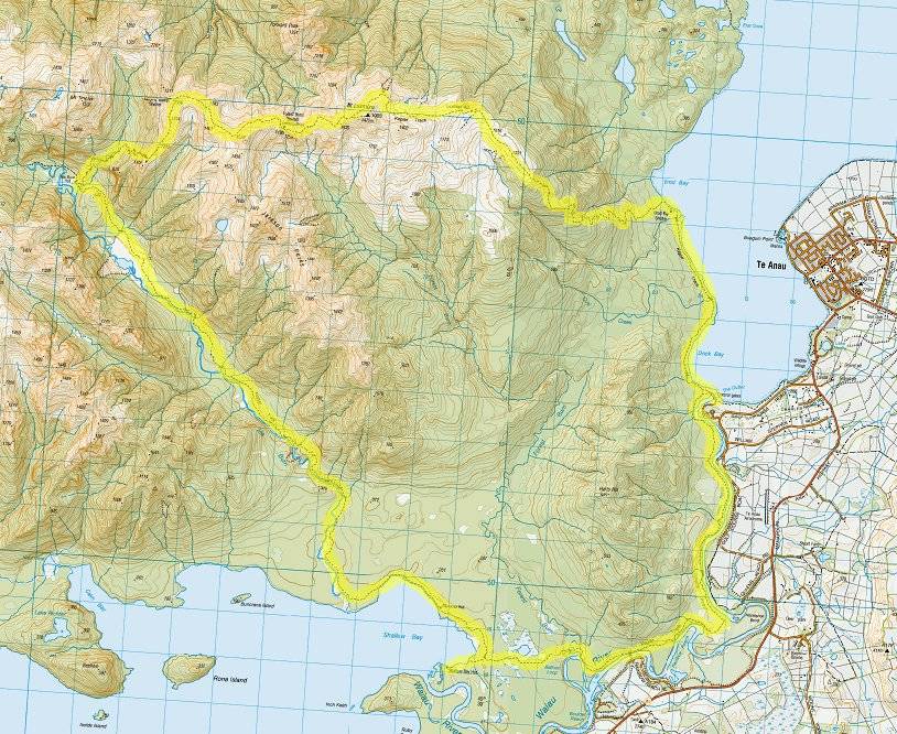
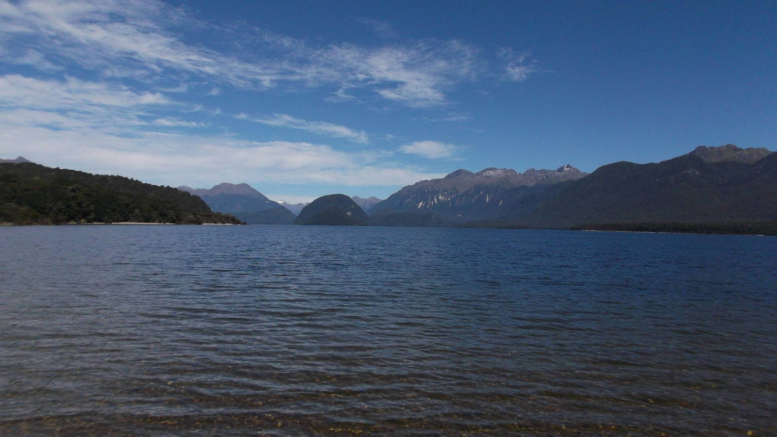
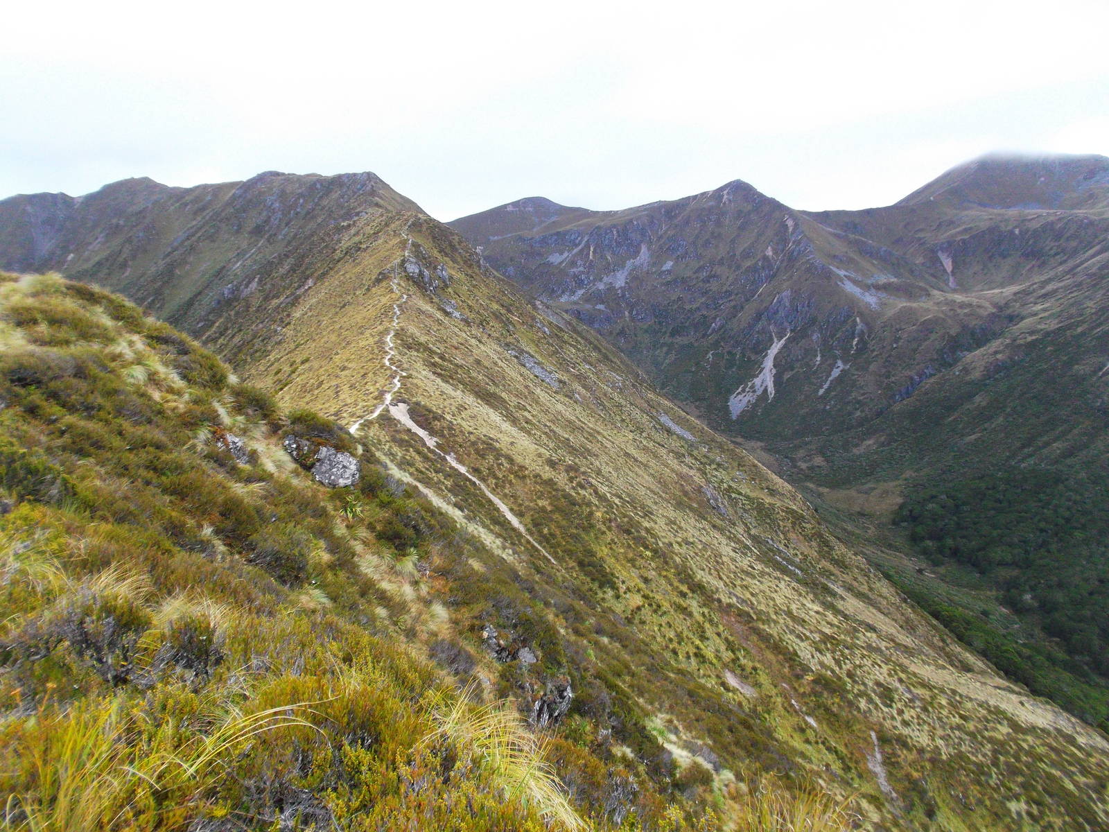
A beautiful and bumpy trip across Lake Hauroko brought me to the start of the infamous Dusky Track. My experience in the bush was very good though, with only half a day of rain (and I had already reached the hut by the time it started). Out of character, I also did not make things artificially hard on myself by skipping huts. I could leisurely leave the hut in the morning but still arrive at the next one by early evening. Still, although in good shape for the Dusky, the track was extremely rough underfoot in spots, absurdly steep in others, and had a few swamp crossings thrown in for good measure. The numerous river crossing gave me no troubles, and I almost got lucky with the tides at Supper Cover, but still found myself wading through chest deep water. For all its difficulty though, the Dusky had some gorgeous stretches — a lovely afternoon lounging by Lake Roe, a windy walk above bushline, and breathtaking views at Centre Pass, that with a little more effort had even better sights atop Mt. Memphis. Although I missed out on some of the classic Dusky experience with my favorable weather, I was not saddened to have covered the track in tamer conditions.

Route I Walked
164 km
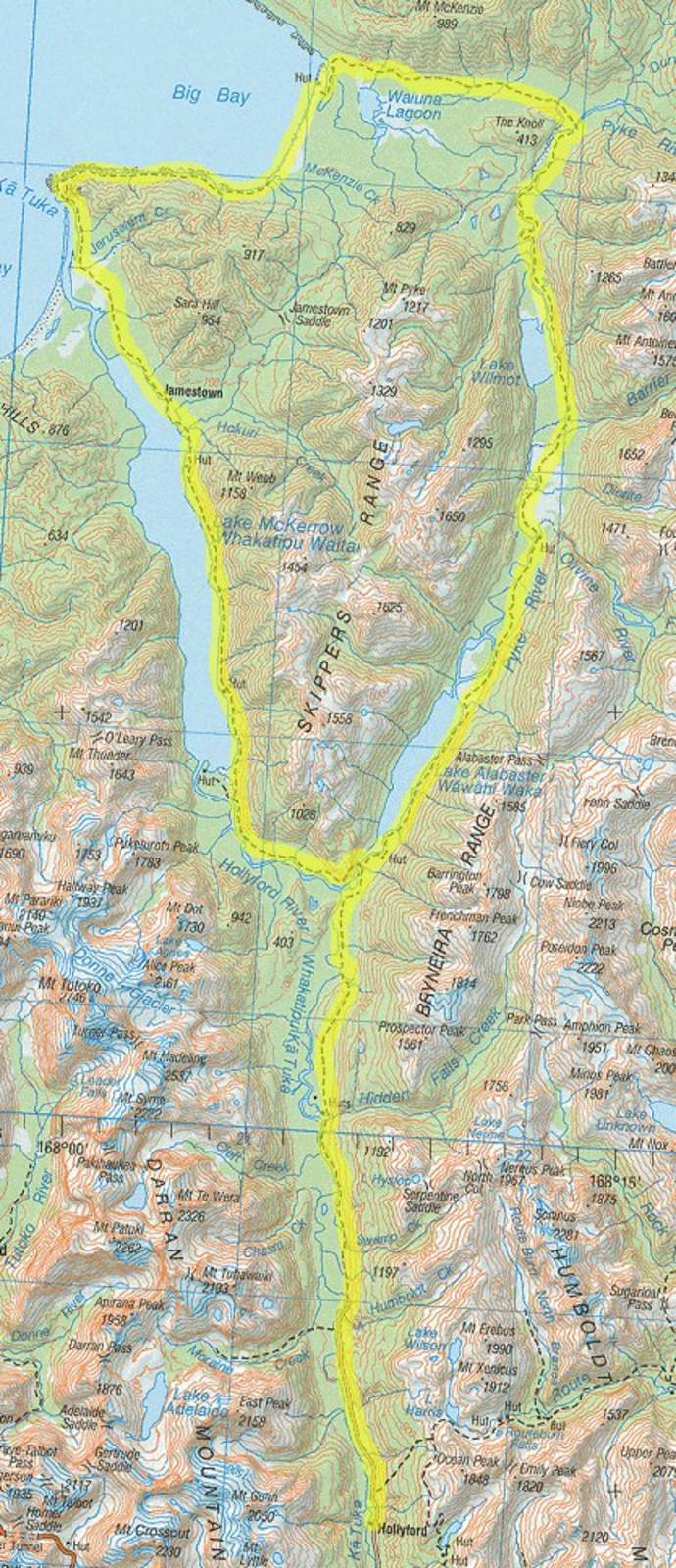
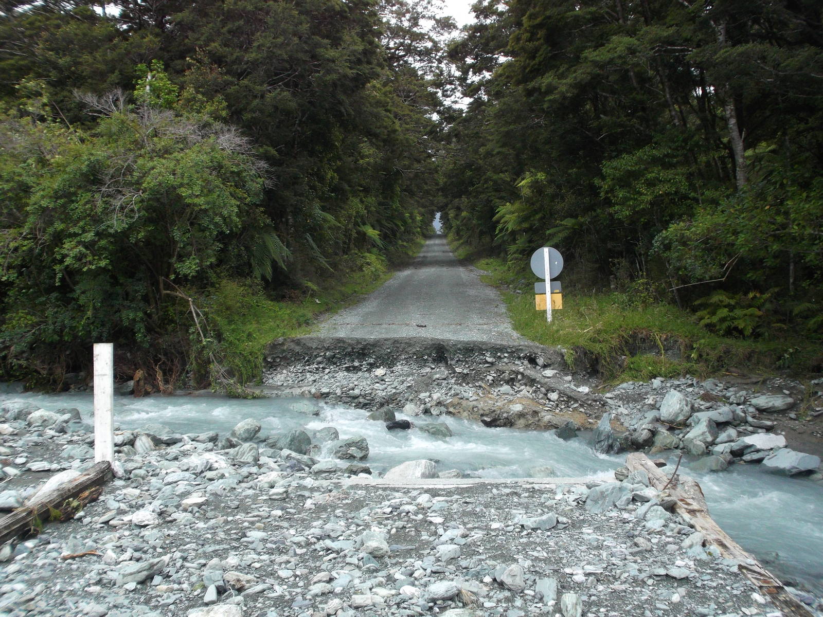
Despite the rain that had inundated the park, I tramped the Hollyford Track and tacked on the Pyke-Big Bay route as a return loop. Even for an area that normally received a lot of rain, this spell was high. Several days prior even the lower reaches of the Hollyford Track would have been impassable, with the lakes several meters higher and roaring streams. Although it rained on me (it is Fiordland after all), by the time I came through the flood had mostly receded, leaving only downfalls and washouts — including one along the Lower Hollyford Road, meaning I had to walk an extra 10K for Gunn’s Camp instead of starting at the road end.
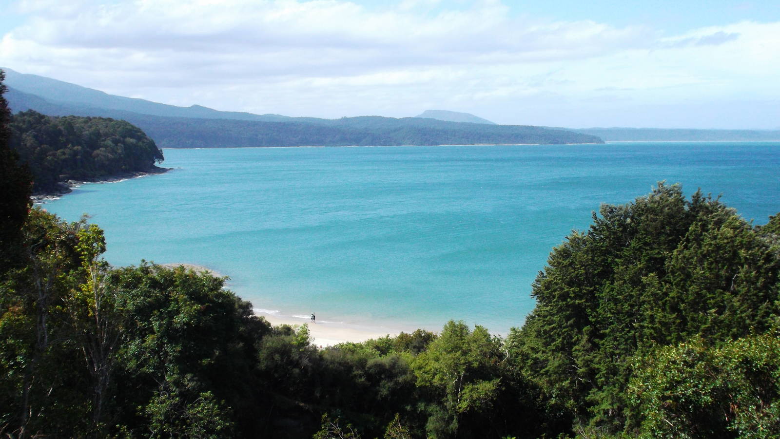
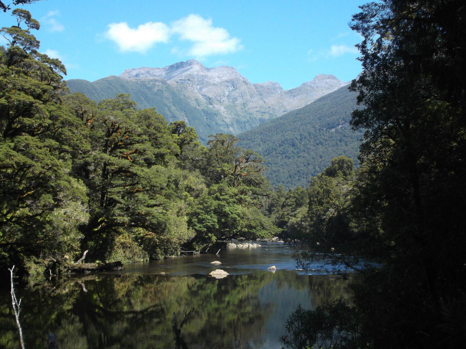
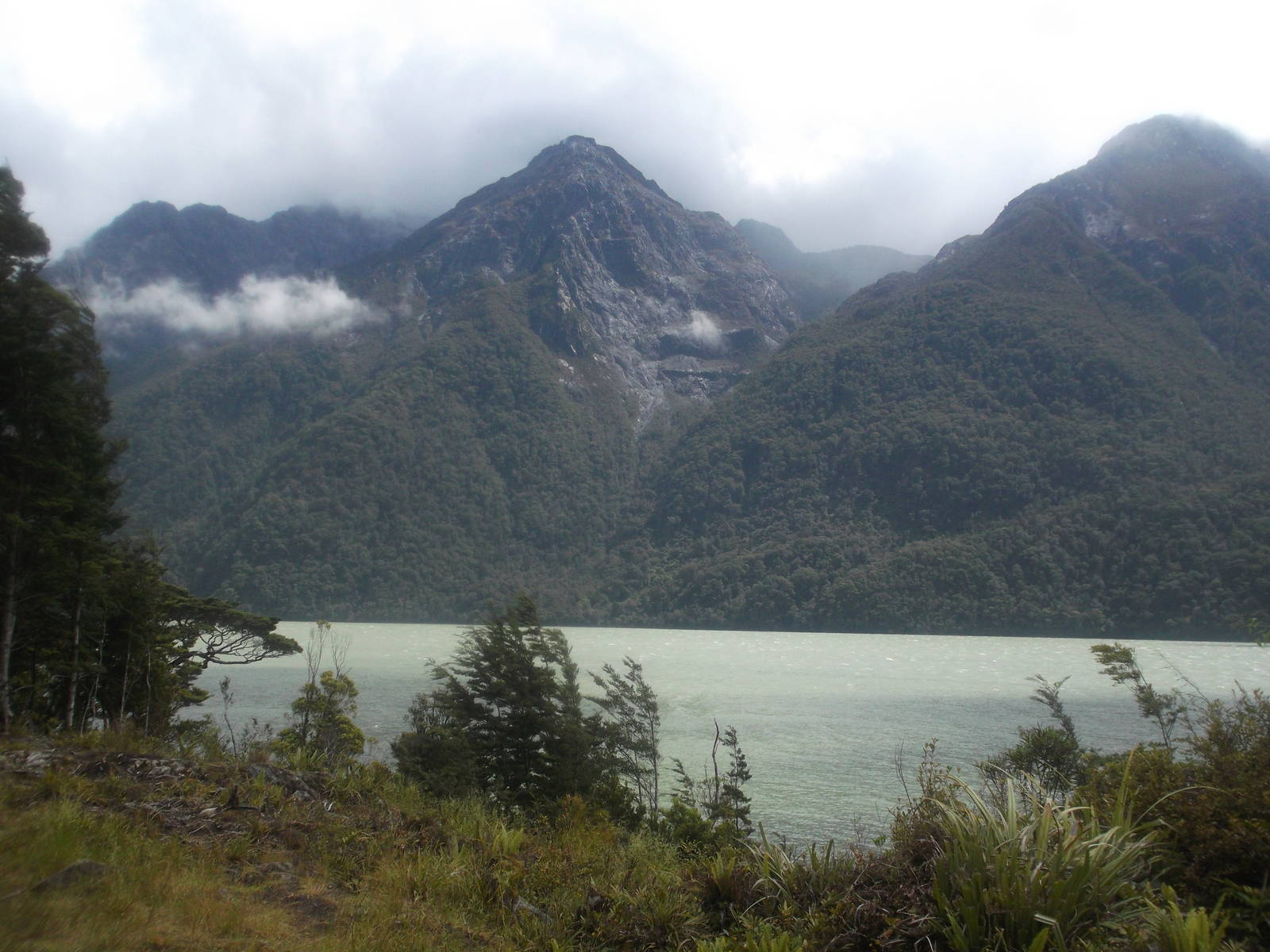
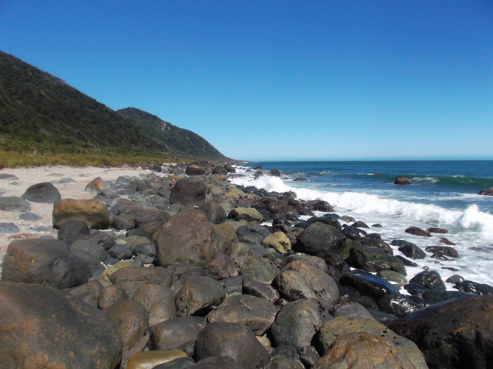
The Hollyford Track itself was nice, staying low through much of the forest, but also providing many views of the surrounding mountains. The Demon Trail was not as bad as advertised, although it was dry when I went through. The track had great views of Lake McKerrow as it neared the coast, and eventually the ocean emerged. The coastal walk to Big Bay was pleasant, where for the first time since perhaps I was a teenager I played in the ocean’s surf.
The hike along the Pyke River was quite rough. Although mostly well marked with orange triangles, the route was very overgrown with plants, difficult underfoot, and very wet. Progress was excruciatingly slow, although finally crossing the Olivine River in a cable car was a unique experience. Further along, Lake Alabaster was even worse, with no track cut. I just followed the shore line — sometimes scrambling over rocks and roots on shore, other times walking through waist deep water with an uneven bottom. This “path” was captivating for a while, but the drudgery soon got old. At least when I finally reached Lake Alabaster Hut the track returned to nearly Great Walk standard for the rest of the way out.


Route I Walked
60 km
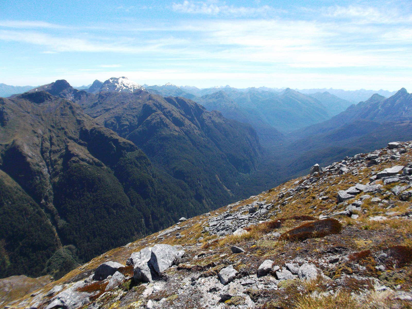
My formal introduction to New Zealand’s Great Walks was on the Kepler Track — after having completed several hundred kilometers of tramping on routes and tracks of lesser standard already. I still could not bring myself to splurge on a Great Walk Hut though, and used my tent for the first time. The tread underfoot was amazingly well groomed — especially after just coming off the Dusky. The lower portions of the track went through luscious beech forests and along water, but the highlight was the Kepler Mountains above bushline. The day was a bit cloudy with a strong wind at times, but I still had gorgeous views of the mountains and surrounding valleys as the track hugged the ridgeline.
I also climbed down into Luxmore Cave, which was fun and had neat rock formations. I eventually turned around after the rock formations became uninteresting, although I still had plenty of headroom left.


Route I Walked
180 km
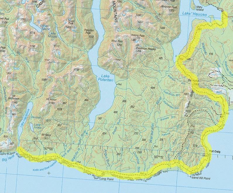
I walked the South Coast Track, but started from Lake Hauroko car park for a few extra days of tramping goodness. I do not think a lot of people go this way, and probably for good reason. It was two long, arduous days to reach the South Coast Track, and without many good views. I saw Lake Hauroko a few times and the top of The Hump could have been spectacular, but both times I crossed it the weather was cloudy with very low visibility. The route was very well marked with orange blazes, so I knew I was on a track, but not particularly well signed, so I did not know if I was on the right track. My map indicated only this track in the area, but trudging through the forest, not entirely convinced I was necessarily going to the right spot, was a little unnerving. Still, I made it through without any wrong turns.
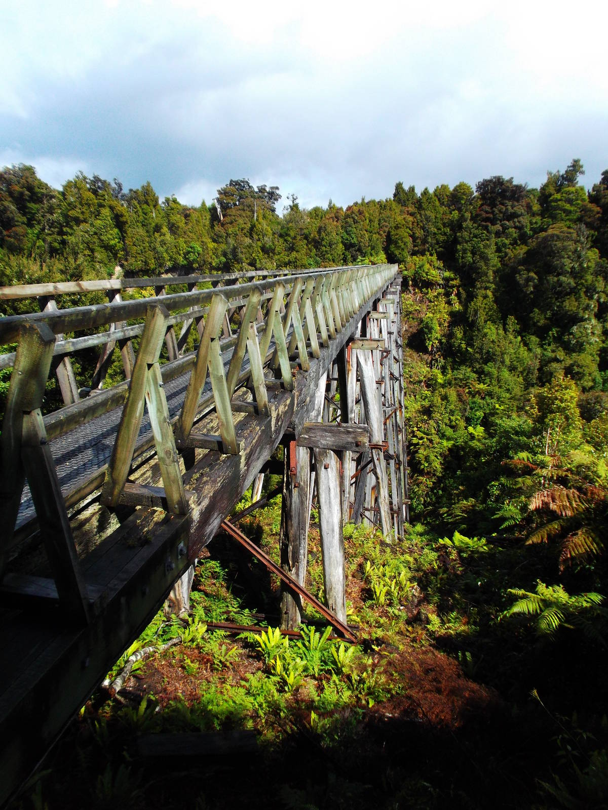
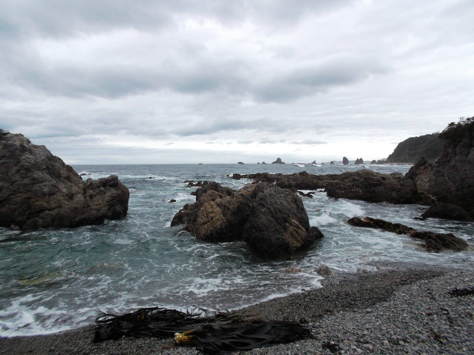
Upon reaching the South Coast Track, the tread greatly improved for a while. Seeing the ruins of the historic Port Craig sawmill, as well as the large viaducts its railroads used was neat and interesting. Unfortunately most of the rest of the track was not so great. Despite being coastal, the tread was entirely in the bush, and I could almost never see the ocean, only sometimes hear it. The exception was a detour to Westies Hut, which was located in a sea cave next to the ocean. The hut felt, smelt, and could have been an old fisherman’s shack, built from cobbled together pieces and spare parts. That section of coast also had interesting beaches and rock formations. I made it all the way to the end at Big River, before turning around and hiking out exactly the same way I came. With a better map and information I may have been able to make a less out and back route along the coast itself or Lake Poteriteri, but as it was I stuck to the marked routes.