Home » Adventures » CDT » Journal » Montana » Glacier National Park
I took the long Amtrak ride from Chicago to Glacier National Park, which was uneventful and relaxing. The train was more crowded and less fun than I remembered but was still an easy, if not always fast, way to travel.

Before starting the CDT, I spent a few nights in East Glacier preparing my first couple weeks on the trail. I slept at Backpacker’s Inn, which had very basic, but adequate accommodations. There I met Henry, another thru hiker. He had been waiting at Glacier several days for a warmer sleeping bag to arrive. We talked about long distance hiking, and I tried to glean as much advice as I could.
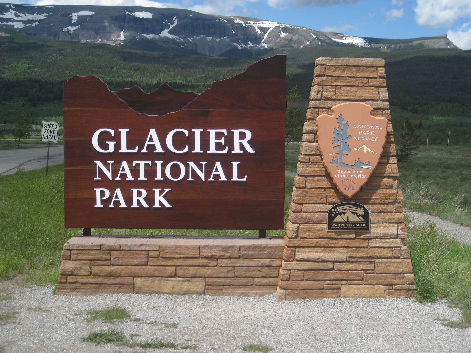
I rode the hiker shuttle to St. Mary’s Visitor Center to obtain my backcountry permit, which was a painless process. I had to start from Chief Mountain, due to excessive snow still on the Highline Trail, but I expected such. Not starting in Canada and missing that stretch of trail was still disappointing though. At the Visitor Center I also met Fuzzy Monkey, a thru hiker I had emailed beforehand. The plush animal mascot attached to his pick gave away his identify.
I rode the shuttle back to town, but later realized that with better planning I could have just stayed at St. Mary’s instead, saving myself two rides. Back in East Glacier though, I still had final preparations to complete and a food drop to mail, all the while still questioning what I was getting myself into with the CDT. Staying at the hostel that night was Tyler, whose has been intentionally hitchhiking across the U.S. and ended up here for a summer job.
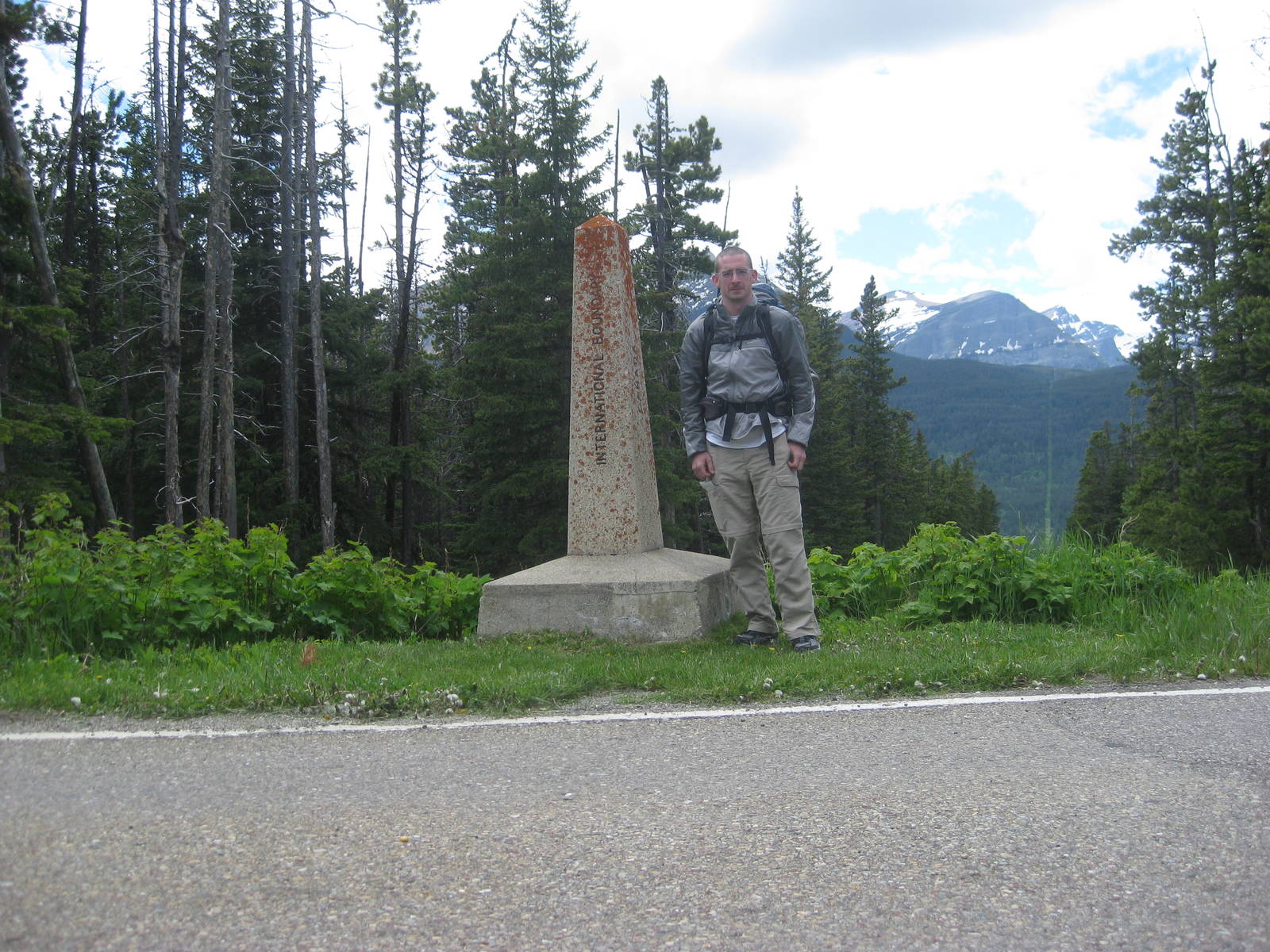
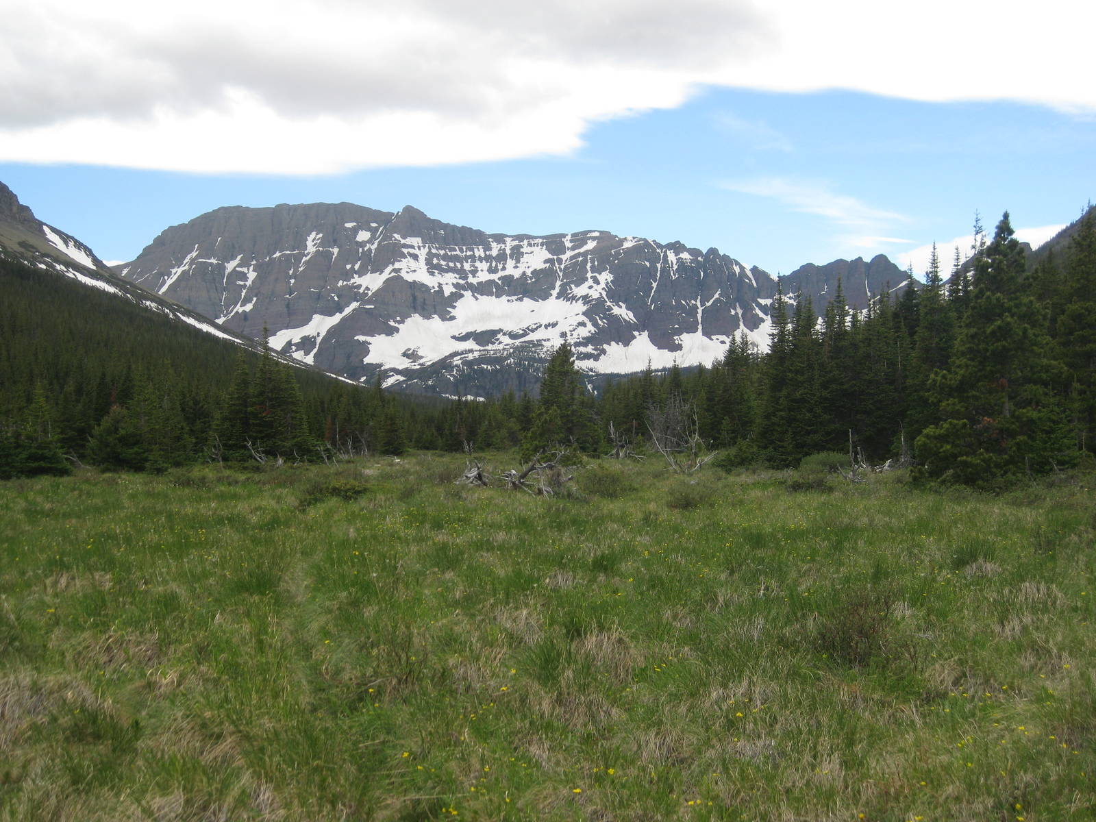
I ate a good breakfast before riding the hiker shuttle to Chief Mountain. I took the requisite pictures at the Canadian border and then started my SOBO CDT hike. My first day was only an easy, ten mile stroll to Elizabeth Lake. Finally having my two feet carry me was a great feeling and pushed away the foreboding omen for my thru hike from my head.
Arriving at camp I met Fuzzy Monkey again, that because of available campsites, had chosen to zero here rather than hike a long day through Glacier so early. Although (or perhaps because) he was going for his Triple Crown, he had done even less logistical preparations than me, which made me feel slightly better and more confident about my less than thorough planning.

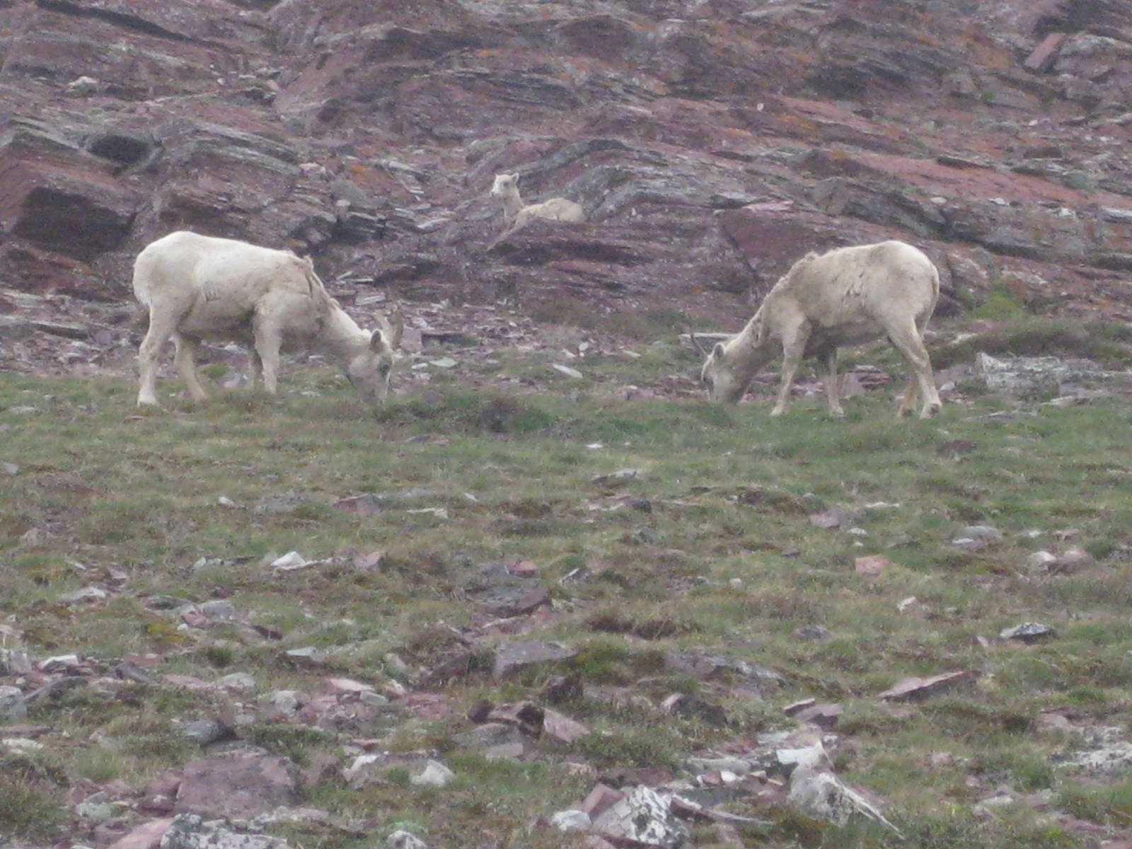
Fuzzy Monkey and I hiked together in the morning, both of us having to cross Redgap Pass since Ptarmigan Tunnel was still closed. We crossed a few snow patches on the way up, but the top of the pass was clear. The descent had more snow and for my first time I glissaded down a few slopes. Sliding was the safest way down the snow sheets, along with being quick and fun.
The wind blew strong all day, but mostly from behind. Still, the gale made crossing a few spots tricky. Fuzzy Monkey had the campsite at Poi Lake reserved, so I continued towards Many Glacier. The trail was well defined and easy, but the miles still added up. The day totaled close to nineteen miles, including a road walk at the end from the trailhead to the Many Glacier Campground. For my second day on the trail that was a little doozy. As a reward I had a good dinner at the nearby restaurant.
I met Transient in the campground, who was also hiking the CDT, which will earn him a Triple Crown. He spewed much unasked for advice on long distance hiking, which I tried to absorb. His style was very direct, which rubbed me the wrong way a few times, but I will still try to learn from him. Anyway, our campsites coincide through the rest of Glacier, so we better get along.

While hiking from Many Glacier towards Pigeon Pass I started through great weather and terrain, which after a couple miles became patchy snow. I could still mostly follow the trail through the intermittent powder, but soon the snow became constant and the tread disappeared entirely. I navigated through the valley, staying on river right the entire time since the bridges across Cataract Creek were not in for the season yet.
The very firm snow was fairly easy to cross as I mostly stayed on top of it. I reached Morning Eagle Falls and realized the switchbacks up the mountainside should have already began, but I missed them buried hidden beneath the snow. I made my own way up the hillside, directly attacking the incline.
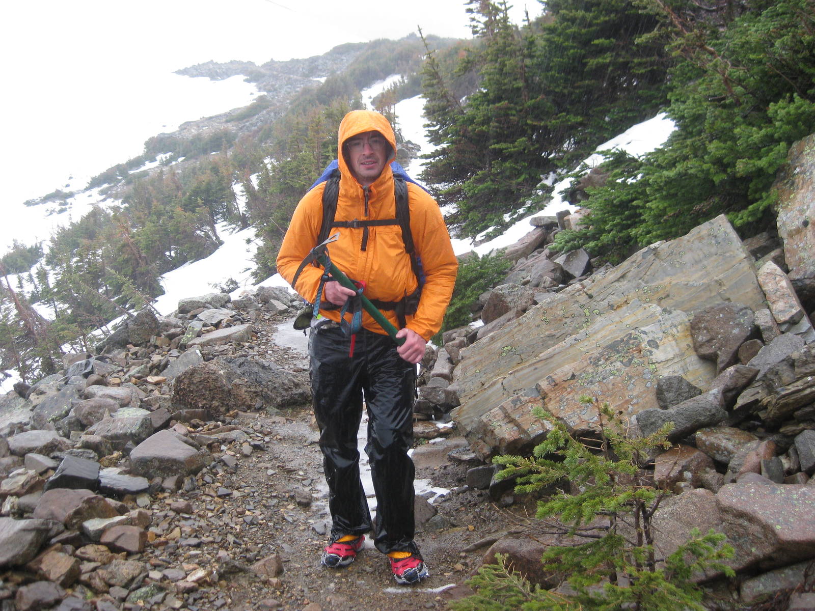
As I climbed the weather began to turn worse, with wind and rain arriving. I tucked in behind trees for protection from the elements. The situation was manageable where I sat, but I did not want to risk climbing higher in those conditions. I hid there hoping for the weather to pass, not wanting to have to turn back.
The weather abated slightly, and I crawled out from cover to make minor progress forward. I crossed a stream on a snow bridge, after which the snow cover abruptly stopped. Magically when I saw dirt for the first time in miles, I popped out near the trail. I continued on it through the weather and stumbled upon Transient. He had left camp earlier than me, but was now taking shelter on the mountainside. I rode out the weather with him for a while before we continued on.
Above the snow the trail was easy to follow, but it crossed several snow patches on steep slopes. These snow conditions were harder than any I had experienced before, and I was glad to be hiking with someone who had more time on snow. I probably would not have pushed forward without him.
Rained continued the rest of the way up the pass, accompanied by a few thunderclaps, and occasionally turning to hail. A 40 m.p.h. wind also assaulted us. Transient said this was the worst weather in which he had hiked — even after two thru hikes.
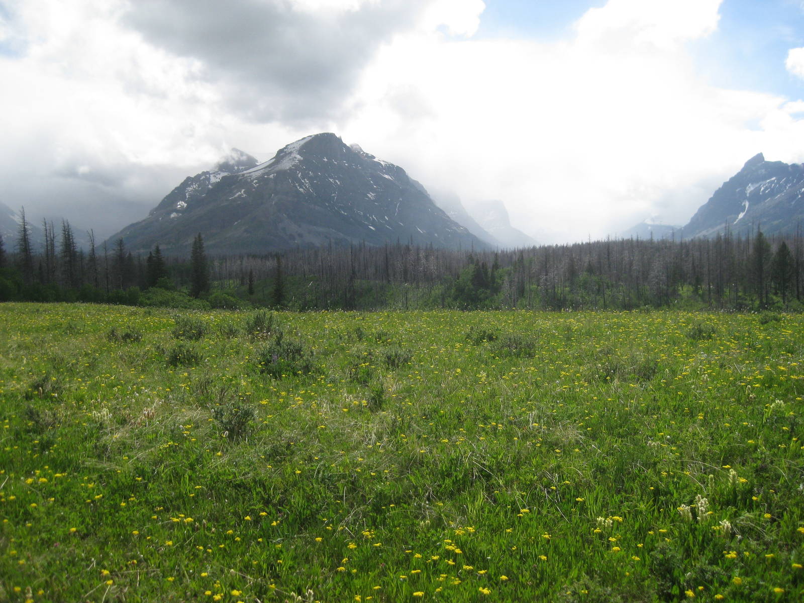
We made our way slowly up and a final climb over snow brought us to the top of Pigeon Pass. Thankfully the other side was traversable, crossing only a few snow patches along the slopes. When the trail reached tree line it completely disappeared under the snow, and we made our way through the woods trying to follow its general path to the Going to the Sun Road. Our slide down ended a little premature though, and we had the exhausting task of bushwhacking through avalanche debris to reach the road. We intersected the road early and had a couple mile walk along it until reaching Reynolds Creek Trailhead.
The snow and the ever more frequent rain as the afternoon wore on left me soaked. Even with Gortex water seeped through any gaps to reach my skin. I did not use enough garbage bags either, so my gear also got wet. I setup camp in the drizzle, and the rain continued most of the night. I hoped for better weather so I could dry out — being damp in the backcountry was not fun.
The sky still drizzled in the morning as Transient and I made our way along St. Mary’s Lake like drowned rats. The rain was only spotty, but never completely abated. The bridges were installed to Red Eagle Lake, our scheduled destination, but Transient and I elected instead for St. Mary’s, miraculously arriving just as the hiker shuttle left for East Glacier. The lingering bad weather and conditions led us to skip Triple Divide and Pitamakan Pass. I had wanted to camp in the backcountry and see what tomorrow’s weather brought, but followed Transient to St. Mary’s anyways.
We stayed at Brownies and met Roaring Lion, another CDT hiker that just crossed the passes we skipped. After hearing his reports, I was glad to have bailed. Their snow conditions were more technically challenging than Pigeon Pass, which probably would not have been safe for me. The climb would have been dangerous, nerve racking, and miserable. I do not feel compelled to do that just to make my footsteps connect. If I make it to Mexico, I will not feel too bad about skipping a few miles in Glacier. I had previously crossed Triple Divide Pass, and I know I will be back to Glacier someday to hike the full Highline Trail and other passes, but at a more seasonally appropriate time. (Ed. note: that ended up being about two years later)

I had an easy morning and a hot cooked meal in a restaurant. In town Transient taught me some thru hiker grocery shopping lessons for a high calorie diet. I already mailed a supply box to Benchmark Wilderness Ranch though, which might be lacking in food. I will have to see when I get there.
After cramming everything into my now much heavier pack, we took off on the trail around four in the afternoon. We hiked through the woods south of East Glacier, stopping several miles before Summit Trailhead, as it was getting late.