Home » Adventures » British Columbia » Cathedral Provincial Park » Lakeview Mountain
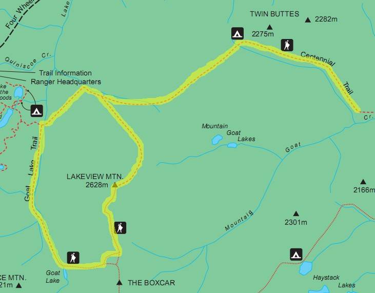
Route I Hiked This Day
A few raindrops that pestered me as I fell asleep the prior evening thankfully did not change to snow, but the wind blew forcefully overnight, making sleep fleeting. Trees mostly blocked the wind’s assault (thankfully no burned, dead ones were nearby), but gusts still penetrated my tent and sleeping bag, chilling me to the bone.
My final full day in Cathedral Provincial Park would include hiking a loop to the park’s highest point (Lake View Mountain), after which I would start my exodus along the eastern Centennial Trail, camping at Twin Buttes.
My day began with an invigorating climb up Lake View Mountain. The trail approaching from the northwest was a steady obstacle, never overly challenging, but never relenting either. A constant elevated heart rate accompanied my ascent. An extended stretch of the trail lay above the tree line, and I could see the it snaking far in front of me, always rising.
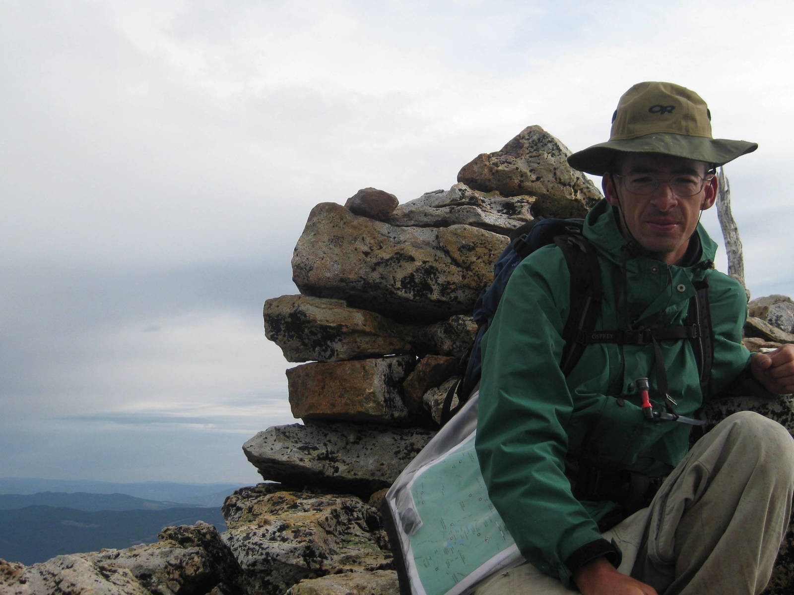
Myself huddled atop Lake View Mountain’s summit
Cairns were installed for navigational assistance, but their population density decreased closer to the summit. The trail’s path was usually obvious though, and within a couple wandering steps another pile of rocks marking the way appeared. Although with the infrequent navigational buoys and the rounded, flatter mountaintop, I had some difficulty locating the exact peak. I accidentally circled around it once before noticing my mistake and turning back towards the actual summit. I made the last push up some rocks to become highest thing for many miles kilometers around.
Of course this high vantage point also meant nothing else was taller to obstruct the elements. Blasts buffeted the small peak, and I tightly held on to everything to keep the thieving wind from stealing my supplies. I quickly became cold atop my perch from the attacking gusts on this cloudy day. This lookout revealed that clouds and storms obstructed many of the mountains upwind. My current location atop an exposed, rocky peak was not an ideal place if precipitation arrived. With that impending weather and current chill, I stayed on the summit barely long enough to grab the requisite picture before fleeing. Staying longer would have been nice, but you visit mountains on their terms, not your own.
Despite my short hiatus there, being king of the highest mountain was instinctively empowering. Even if only requiring a nontechnical climb that topped out below 9,000 feet 3,000 meters, to gaze all around and see nothing taller was an awesome feeling. Ironically, despite being the highest point in the park and being named Lake View Mountain, the Rim Trail provided better views of the core’s lakes.
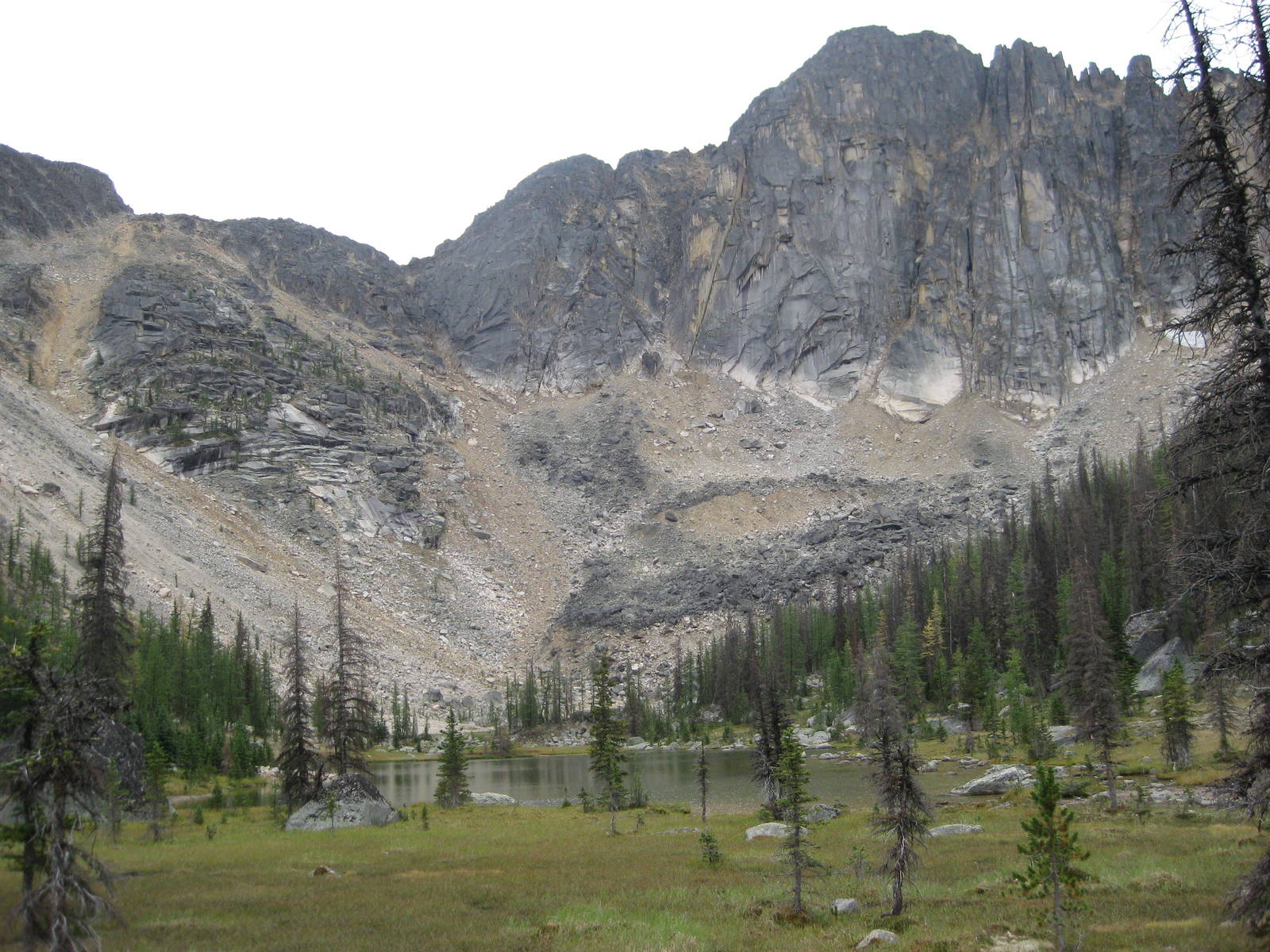
Mountain Goat Lake
Continuing the loop with a descent from Lake View Mountain, I considered visiting the Box Car, but between approaching storms, my cold hands (gloves failed to make my gear checklist), and missing the junction for that landmark, I elected not to visit another mountain. Instead, I negotiated the extremely steep descent to Goat Lake, knowing I would have to regain most of this elevation on my way to Twin Buttes.
The relative protection of the tree line made me feel slightly better should adverse whether arrive. I continued past Goat Lake and followed the stream down the valley. During this stretch the rain finally arrived. Normally this event would have been of little consequence, but unfortunately my pack cover was at camp protecting other gear, leaving me vulnerable on the trail. I ducked under trees for shelter, since a wet pack with another night in the woods would be extremely bad. It never poured while waiting in the valley, but a steady rain saturated the earth.
Patience was not my greatest virtue, and I quickly get fidgety standing still (ironically though, I can sit on a bike for hours on end). In the woods with nothing to occupy my mind, standing under the same tree became old very quickly. Adding to my frustration was remembering that with a pack cover this weather would have been little more than a slight inconvenience. I continually reminded myself that my options were to either wait there and have a dry camp that night, or hike now in the rain and wait around a wet camp that evening.
While stopped in the valley, the rain’s intensity cycled, allowing me to occasionally make forward progress during the lulls, before inevitably having to seek shelter again. My daybreak start made my earlier ascent to Lake View Mountain possible, as some of its peaks were now covered in clouds. The valley was a much safer place to be. In that depression though, between the cliffs, trees, and swirling wind, predicting the weather was next to impossible. I had no choice but to wait in the woods for things to clear.
After a boring wait, eventually the rain stopped, and the sun even tried to poke through. I took advantage of the gap to scamper along Lakeview Stream before turning out of the valley.
From Goat Lake Trail I now had a long climb on the Centennial Trail over the north end of Lake View Mountain. The stretch below the tree line went smoothly (having hiked it several times already), but above the bush conditions became significantly more difficult. In the open, inclined meadow, the faraway ridgeline was continually visible, a constant reminder of how far away it was. As I kept climbing through the steep grass, the peak never seemed to get closer. How disheartening to battle the mountainside, only to look up and see almost no progress accomplished. Towards the end of my expedition, this last arduous climb was more than I expected, difficult both mentally and physically. Frequent rest breaks were needed, where I tried not to remind myself how far below the top I still stood. I was, however, even now more glad for not having attempted this section during my poorly planned arrival in Cathedral several days earlier.

Spectacular panoramic view of Quiniscoe Mountain from the eastern Centennial Trail
Eventually though, my steadfast plodding and a pair of very weary legs brought me over the undulation after which only downhills led to camp at Twin Buttes. Somewhere in the alpine meadow on the backside of Lakeview Mountain though, I lost the piles of cairns marking the trail. This navigation snafu did not overly concern me as I was in a large, open area and could see Twin Buttes in the distance. So I just continued forward on presumably the correct vector (of course without checking my compass first).
During these wanderings the wind returned, and a light rain pelted the country side. With the extra propulsion from the weather, the precipitation felt more like hail as it continually smacked against me. After enduring these conditions for a while, my topo map told me my assumed “correct vector” was indeed incredibly wrong, and I was no longer near the trail. It was nearer the treeline, so I turned across the meadow in that more correct direction.
In short order I miraculously happened upon an established trail marked with small ribbons. My relief from finding that path was short lived though as in either direction it quickly dissolved. Fifty yards meters of known trail were obvious, but after that it evaporated. The plethora of horse and cattle tracks in the area compounded the difficulty of following the trail. I began to question whether this path was indeed the Centennial Trail or just a rancher’s path in his “historic grazing rights.” With no way to know for sure, I continued wandering through the valley, constantly finding and loosing paths, never quite certain if they were just a cow’s favorite route to water.
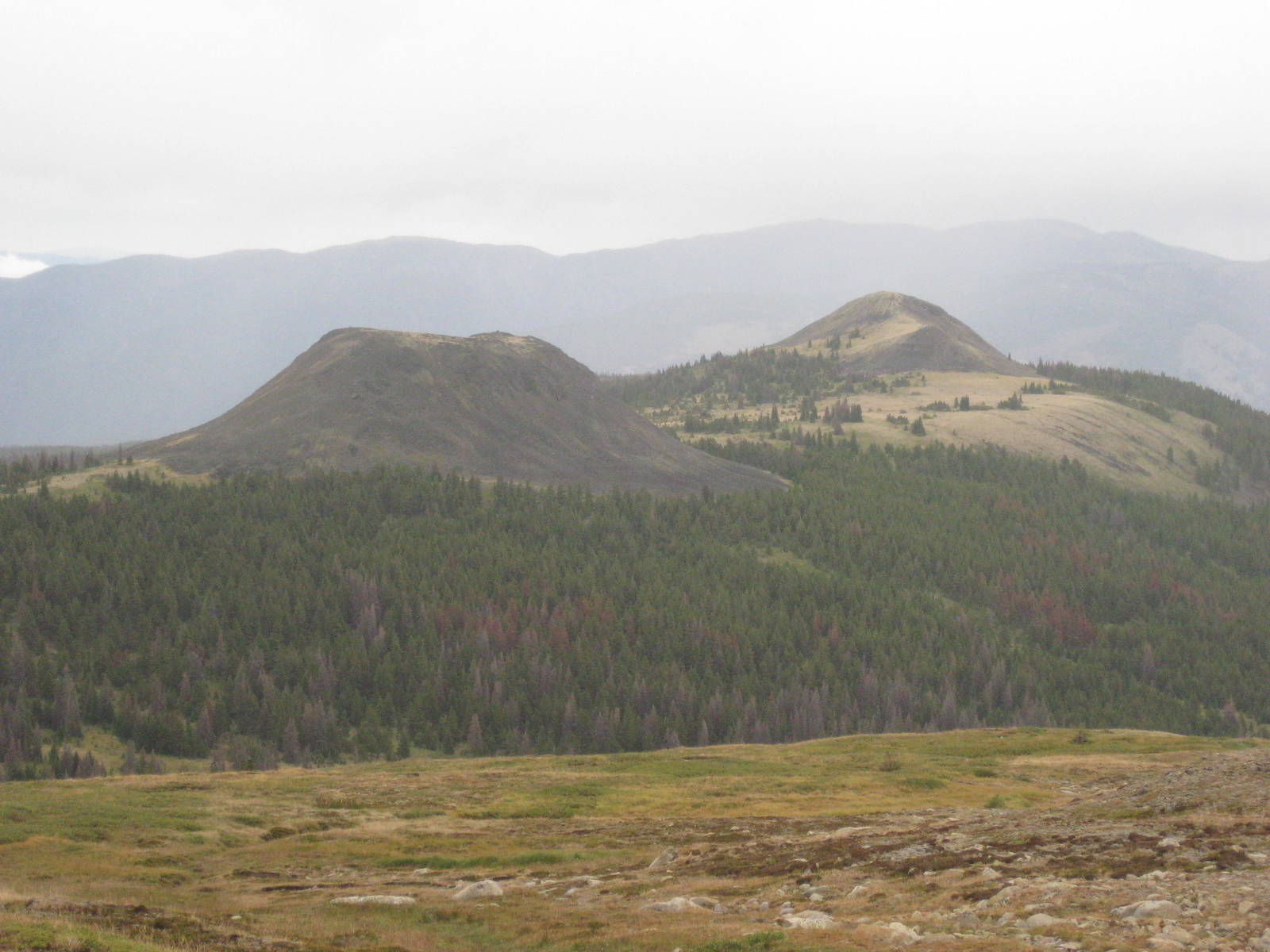
Twin Buttes
While exploring one promising lead, I actually correctly used my navigational skills to deduce that route could not be possibly be the one marked on the map. While keeping an open mind and objectively comparing my location to the map’s details, it showed me to be on the wrong side of the river. From north to south the geography should have lined up as: Twin Buttes⇒trail (me)⇒river, but it was: Twin Buttes⇒river⇒me. So for about the third time in my life, I correctly used a topo map in the wilderness.
Although I now knew this spot was wrong, that only marginally improved the situation. Crossing over the headwaters of a tributary of Mountain Goat Creek did not bring much success in locating the path. Being in the less used portion of the park, the Centennial Trail might not have even been maintained or marked very well. This route could have been barely more than an overgrown scratch in the ground.
Rather than continue searching for something which might not exist, I blazed my own trail by following Mountain Goat Creek through its valley. This depression eventually intersected Goat River, which would be impossible to accidentally cross. At that point I would know my exact position and could then either relocate the trail or continue navigating from a fixed location.
My bushwhacking skills were not needed long though as partially down the valley I stumbled upon a well groomed trail. This cleared route was unequivocally the Centennial Trail, with ample markings and wide right of way. How this worn trail deteriorated so quickly as to prevent me from locating it just several hundred yards meters up the valley was a mystery, but not one I much cared to solve then. Being back on the right path was enough.
I was now well past Twin Buttes campground, my planned accommodations. Backtracking uphill into the area where I just got lost to find a basic campsite did not sound appealing. Since the afternoon was still young, and now being outside the core area camping in the open was legitimate, I elected to push onward and shave a few miles kilometers from the next day. The extra distance would also drop a couple feet meters in elevation and hopefully gain a few resulting degrees in temperature.
The trail continued down the valley though lush forests. Ominous warning from forest peoples cautioned this less frequented side of the park was not well maintained, but these reports proved fictitious. The eastern section of the Centennial Trail through Cathedral Provincial Park was very easy to follow, with a noticeably worn path and many blazes on the trees. Although through this stretch I passed a small herd of cattle — who I blamed for my earlier navigational difficulties — hiding in the forest, but they were oblivious to my ramblings.

I made camp near the confluence of Ewart and Mountain Goat Creek, which non-coincidently was when hunger set in and my map required refolding to reveal the park’s next quadrant. Erecting my tent was slow and awkward, as between the wind, cool temperatures, and no gloves, my hands were frigid. Their condition was not near dangerous, but finally crawling in my sleeping bad and sticking my hands under my armpits was a great relief.
Despite my Gortex boots, their insides became soaked throughout the day. The water must have infiltrated via wet underbrush striking my ankles and penetrating the small gap between the top of my boots and the bottom of my rain pants. The water then wicked down my socks. This weakness in my outer layer will need to be fixed.