Home » Adventures » Black Hills » Centennial Trail » To Pilot Knob

Route I hiked this day
After a hard prior day, I did not feel like getting out of my tent and even the prospect of a hot cooked meal that night was little impetus. Eventually I started hiking, and the trail mainly followed a forest road downhill for the first couple of miles. In a few spots the trail veered from the road, but stayed parallel and rejoined a little ways later. It eventually emerged into a clearing and continued along cattle rancher paths.
I missed a turn in this section. I actually saw the “89” marker, but thought it indicated straight. I begin thinking I made a mistake not too much later, but not until after I climbed a big hill did I convince myself to turn around.
The trail continued toward Brush Creek, passing several herds of cows that gave me the evil eye. Brush Creek was also approximately the halfway point on the CT.
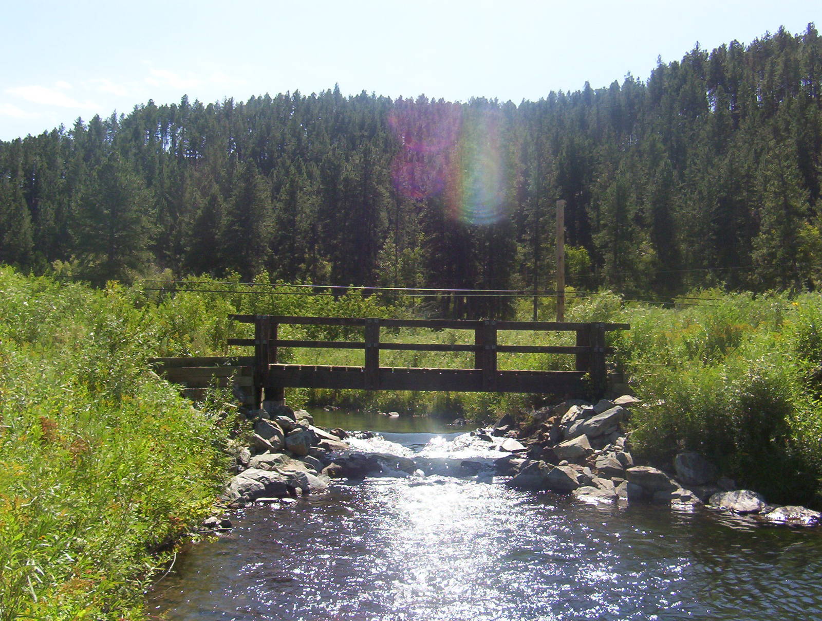
Afterwards the trail began climbing gently up Gold Standard Gulch. Logging operations were ongoing as I made my way down to Rapid Creek, with the forest service clearing trees out. Weeds encroached the trail along the creek, but several large bridges also crossed it. A few people fly fished in the river.
I had lunch at the base of a huge spillway on Pactola Reservoir, which would be an awesome sight to watch overflow. The easy downhill morning ended abruptly with a steep climb from Rapid Creek to above lake level. This transitioned into a series of steep up and downs.
After crossing the Highway 385 the trail did a seemingly endless series of switchbacks following the many valleys descending into the reservoir. The path remained at the same elevation, but constantly ebbed and flowed from the lake as it followed the hillside. I walked a long way, but made little meaningful progress on the map.

The trail eventually reached a forest road and became easier. It made the final descent to Pilot Knob after crossing Highway 385 near a tacky “Wonderland Cave” sign. Pilot Knob was not the ideal place to camp, but I found an adequate spot in the hills away from the trail. Even if the terrain was not ideal, the location was. A 15 minute walk away was the hamlet of Merritt, which supposedly contained a restaurant. I was paranoid a dinner would not be there, but Sugar Shack lay on Highway 385. I devoured a delicious, greasy, artery-clogging mushroom-Swiss burger made, topped off with a piece of pie. The meal was a great treat midway trough the trail.
Pilot Knob
After dinner I walked back to camp through the now falling rain. My Gortex coat protected me, and with some maneuvers I slid into my tent while keeping the rain and wet clothes I was wearing mostly out. I relaxed in my tent after the hearty meal with the pitter patter of rain serenading me to sleep.
Although tired, I was in much better shape than prior day. My legs were sore, but I was together mentally. The bottom of my feet hurt the most. Not having broken in my boots beforehand did not help either.