Home » Adventures » Australia » Frenchmans Cap
Route I Walked
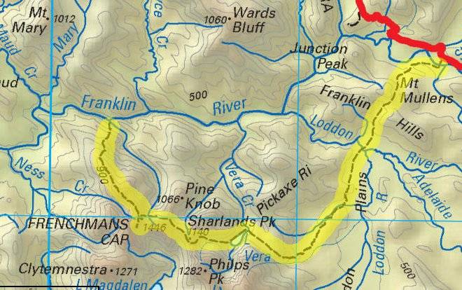
60 km
To grab a taste of Franklin-Gordon Wild Rivers National Park without undertaking an amazing (but also long and expensive) river trip, I climbed up to Frenchmans Cap. Although I walked in through a steady rain, the track was in excellent condition and easily passable. Much labor had been invested in this track to enable such easy going. The infamous mud of Loddon Plains had been completely bypassed with hardened track up the hillside, much of it board walked. Only occasionally did I have to trudge through at most shoe deep mud. The track still lacked escalators so Barron Pass required some effort to reach. The track here was quite steep, but was mostly just a matter of putting in the time to get to the top.
The pass did not provide any views due to the storm so I motored on to Lake Tahune Hut, with much welcome shelter from the weather as well as a stove for heating. If a hut had not been available and tenting was the only option, I would not have even attempted the hike in these conditions. Wet camping did not sound like any fun.
Frenchmans Cap
I spent the entire next day in the hut, as the poor weather hung around. A couple people that had to leave that day reached the summit, but they climbed small waterfalls to do so and encountered snow on the top. Remaining dry and warm inside sounded much better, especially with improved weather predicted for the next day. One day was not long enough to catch cabin fever either, as a couple books and music kept me entertained. Forced relaxation and rest was also a nice change of pace from my normal hard marches.
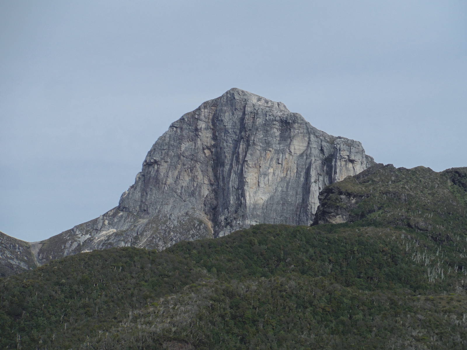
The weather cleared the next day, and I tackled the final stretch to the peak of Frenchmans Cap. This last push had steep sections of scrambling, but in good weather the route gave me no problems. At the top the broad summit had mostly good views of the lakes and valleys below, with only occasional low clouds obstructing the view. I spent some time on top enjoying the tranquil summit, where just twenty-four hours prior it had snow.
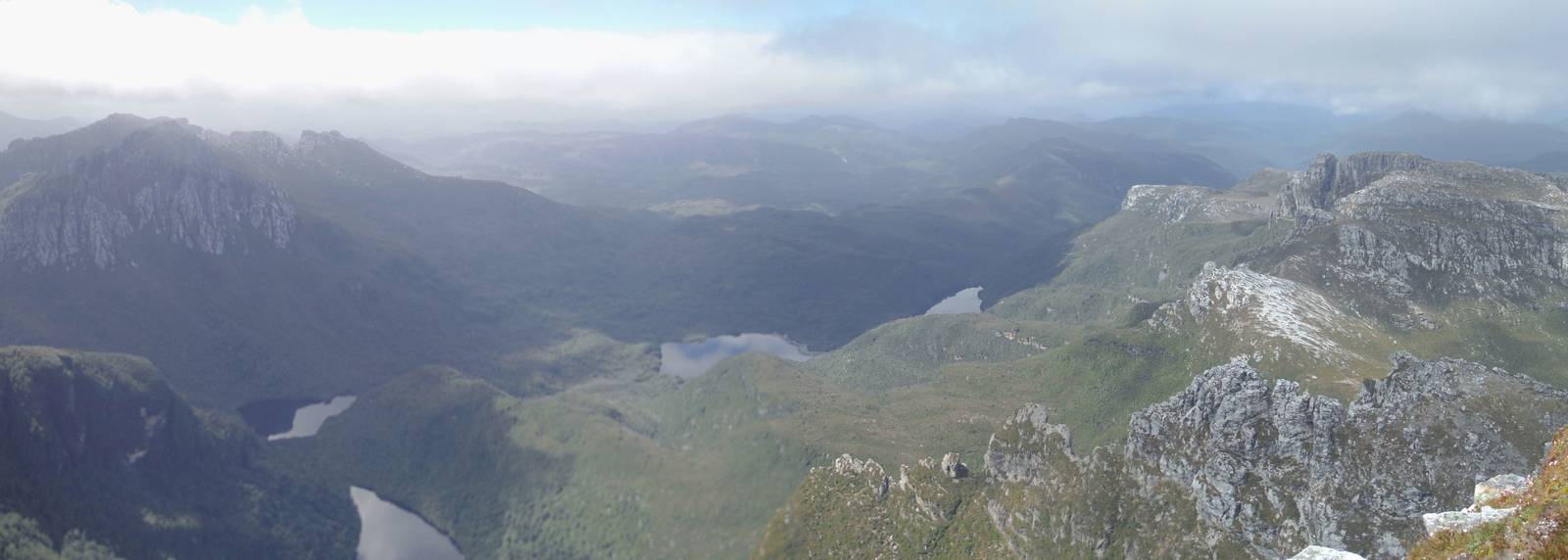
After crawling down from Frenchmans Cap I headed further into the park towards Irenabyss. A climb over North Col was followed by a ridge walk with fine views of the valleys, lakes, surrounding mountains, and backside of Frenchmans Cap. The track eventually fell off the ridge and steeply plummeted to the Franklin River at Irenabyss. The river was smaller than I expected, given its legendary status and large struggle to save it. The view into the canyon of Irenabyss from my perch on the riverbank was not ideal, and did not give a clear sense of what paddling the river might be like. Still, some steep rock walls I could see indicated the river would be fun.
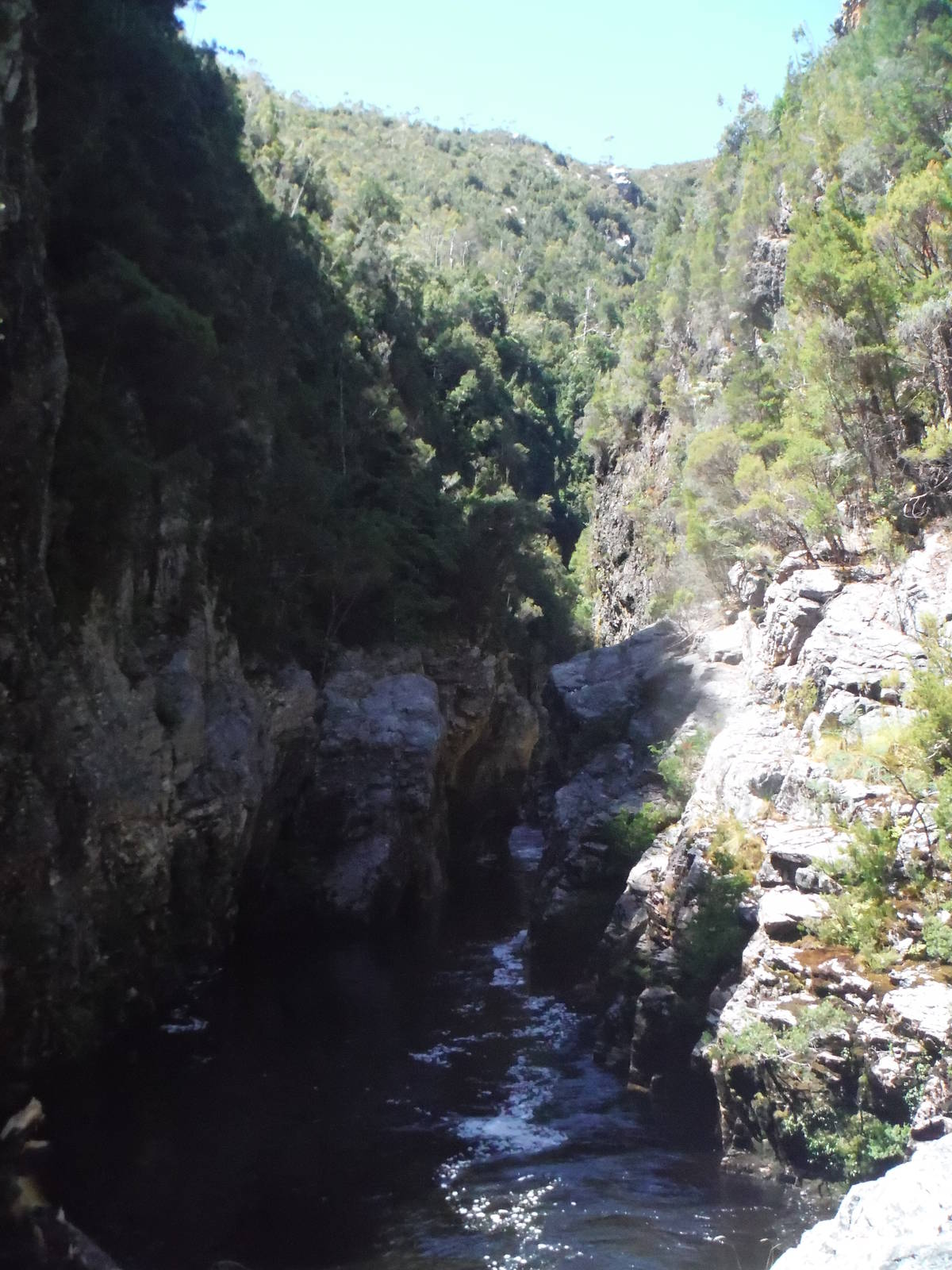
Irenabyss
The day had cleared nicely and a cloud free blue sky allowed a nice afternoon stay on the riverside. Eventually though I had to climb back up from the gorge to my shelter at Lake Tahune Hut.
The next day I retraced my steps back to the carpark, and in still nice weather finally clearly saw the face of Frenchmans Cap from Barron Pass. I was again thankful for all the track work that had been done as I made good time back to my car.